California Lighthouse
The name is a trick. Visitors assume it has something to do with the Golden State, but the California Lighthouse on Aruba's northwestern tip owes its name to a shipwreck, not a coastline. On September 23, 1891, the S.S. California -- a wooden British steamship of the West India and Pacific Steamship Company, sailing from Liverpool to the Americas -- went down in the strong currents off Hudishibana. The wreck still sits at a depth of 14 meters, a popular dive site where currents tug at swimmers the way they once pulled a sailing ship under. The lighthouse was built to make sure it never happened again.
A Shipwreck's Ghost and a Famous Namesake
The S.S. California is routinely confused with a far more infamous vessel: the S.S. Californian, the ship that failed to respond to the Titanic's distress calls during its sinking in 1912. The two names differ by a single letter, but the Aruban California met its end 21 years before the Titanic disaster, in entirely different waters. The wreck became part of the island's lore, a submerged reminder that the Caribbean's beauty conceals real danger. When colonial authorities finally decided to erect a lighthouse on the rocky plateau above, they named it for the ship that made the case.
French Elegance on a Limestone Plateau
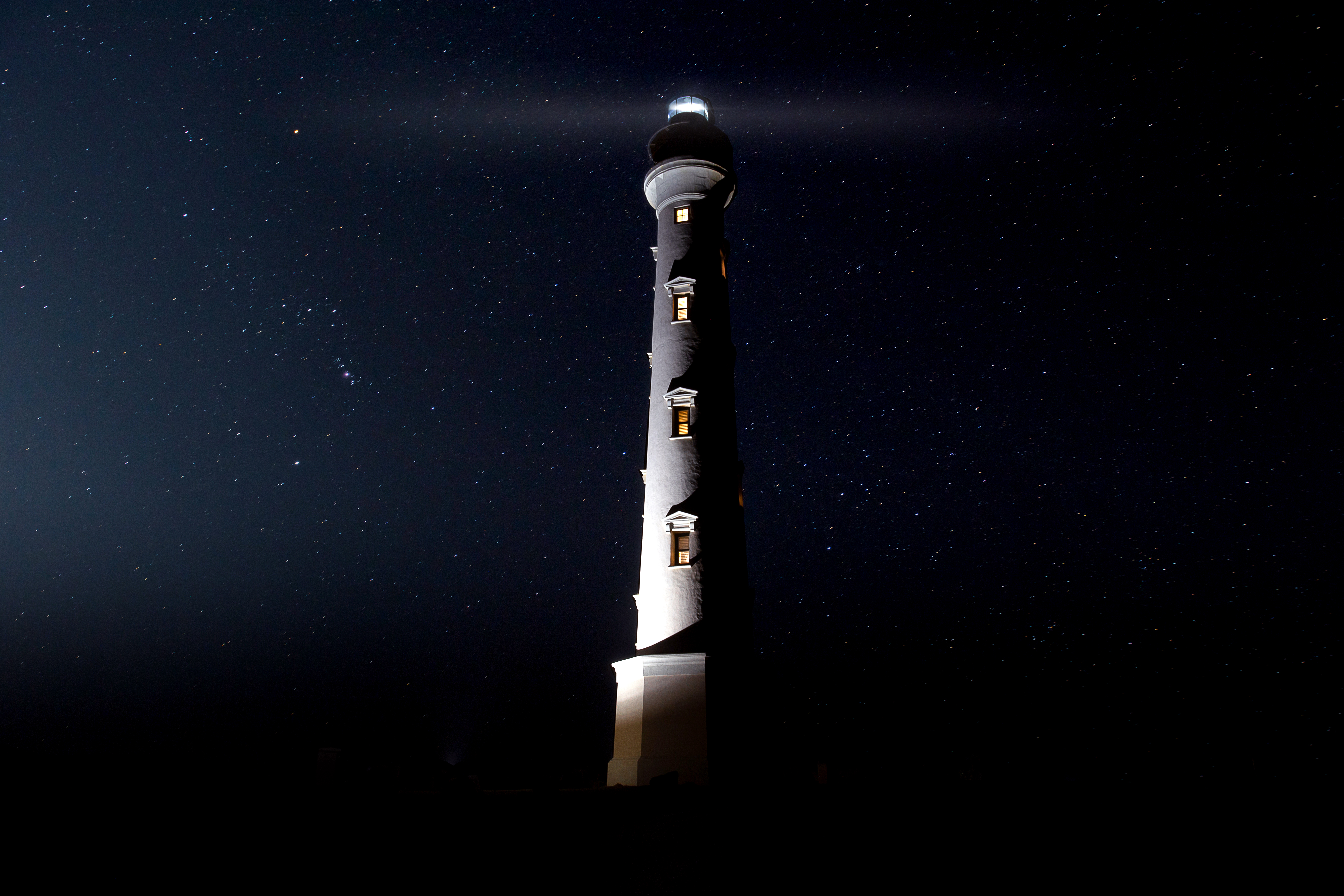
Designing a lighthouse for a remote colonial island during a world war required both ambition and patience. In 1913, with Aruba still administered through the Colony of Curacao and Dependencies, French architect Leon Jean Marie Bourgeois drew up plans for a structure that would echo two of France's iconic landmarks. The tapered cylindrical lines recall the Eiffel Tower's clean geometry, while the overall form pays homage to Cordouan, France's oldest lighthouse. The design sits on an octagonal stone base topped by a lantern with a double gallery, the metal crown spanning 25 feet in diameter. Construction ran from 1914 to 1916, complicated by World War I, which made shipping the light mechanism from the French manufacturer Barbier, Benard, et Turenne a logistical ordeal. The result was worth the trouble -- a 30-meter tower, the tallest structure in Aruba, rising from terrain so jagged and barren it resembles a lunar surface.
Kerosene, Pendulums, and Twelve-Hour Cycles
In an era before Aruba had electricity, keeping a lighthouse burning required mechanical ingenuity. The light ran on farol, a type of kerosene, illuminating from six in the evening to six in the morning. A weighted pendulum descending 24 meters regulated the mechanism, completing its full cycle every twelve hours. Over that span, the light would cycle 4,320 times on a single gallon of fuel. Lighthouse keepers worked weekly rotating shifts, living in a double service house beside the tower. The surrounding area was so isolated -- no other buildings nearby -- that locals whispered the place was haunted after dark. The kerosene gave way to acetylene gas in 1965, and electricity finally arrived in 1970, ending a half-century of keepers tending flame through Caribbean nights.
The Arawak Name and the View
The plateau where the lighthouse stands carries the Arawak name Hudishibana, a word whose components suggest something like "Great Spirit" -- hu meaning spirit or almighty, bana meaning big. The Arawak people named this windswept point long before any European ship ran aground here, recognizing its power as a place where land surrenders to open ocean. Today, 123 spiraling steps lead visitors to the top of the restored tower. In May 2016, the lighthouse completed a full renovation marking its centennial, and the old keepers' service house has been absorbed into a restaurant, La Trattoria el Faro Blanco -- The White Lighthouse. The dunes of Sasariwichi roll nearby, and Arashi Beach stretches below. From the gallery at the top, the view reaches across the full sweep of Aruba's northwestern coast, the same water that swallowed the California glittering in the sun.
From the Air
The California Lighthouse (12.613N, 70.052W) sits on Aruba's northwestern tip at Hudishibana, making it an excellent visual waypoint when approaching from the north or west. At 30 meters, it is the tallest structure on the island and visible from considerable distance in clear conditions. The lighthouse sits near Arashi Beach and the Tierra del Sol golf course. Nearby airport: Queen Beatrix International (TNCA), approximately 12 km southeast. Best viewed at 1,500-3,000 ft AGL for detail of the coastline and surrounding dune landscape.