Calle Real, Iloilo
Jose Rizal, the national hero of the Philippines, was impressed when he arrived in Iloilo. The city's main commercial street, Calle Real, was already famous by the time Rizal walked it in the late 19th century, lined with shops and trading houses that made Iloilo one of the wealthiest ports in the archipelago. Today the street is officially named J.M. Basa Street, after Jose Maria Basa, a Filipino businessman, propagandist, and close associate of Rizal. But nobody in Iloilo calls it that. It is Calle Real, the Royal Street, and the buildings along it still carry the ambitions of the people who built them.
Where the Money Lived
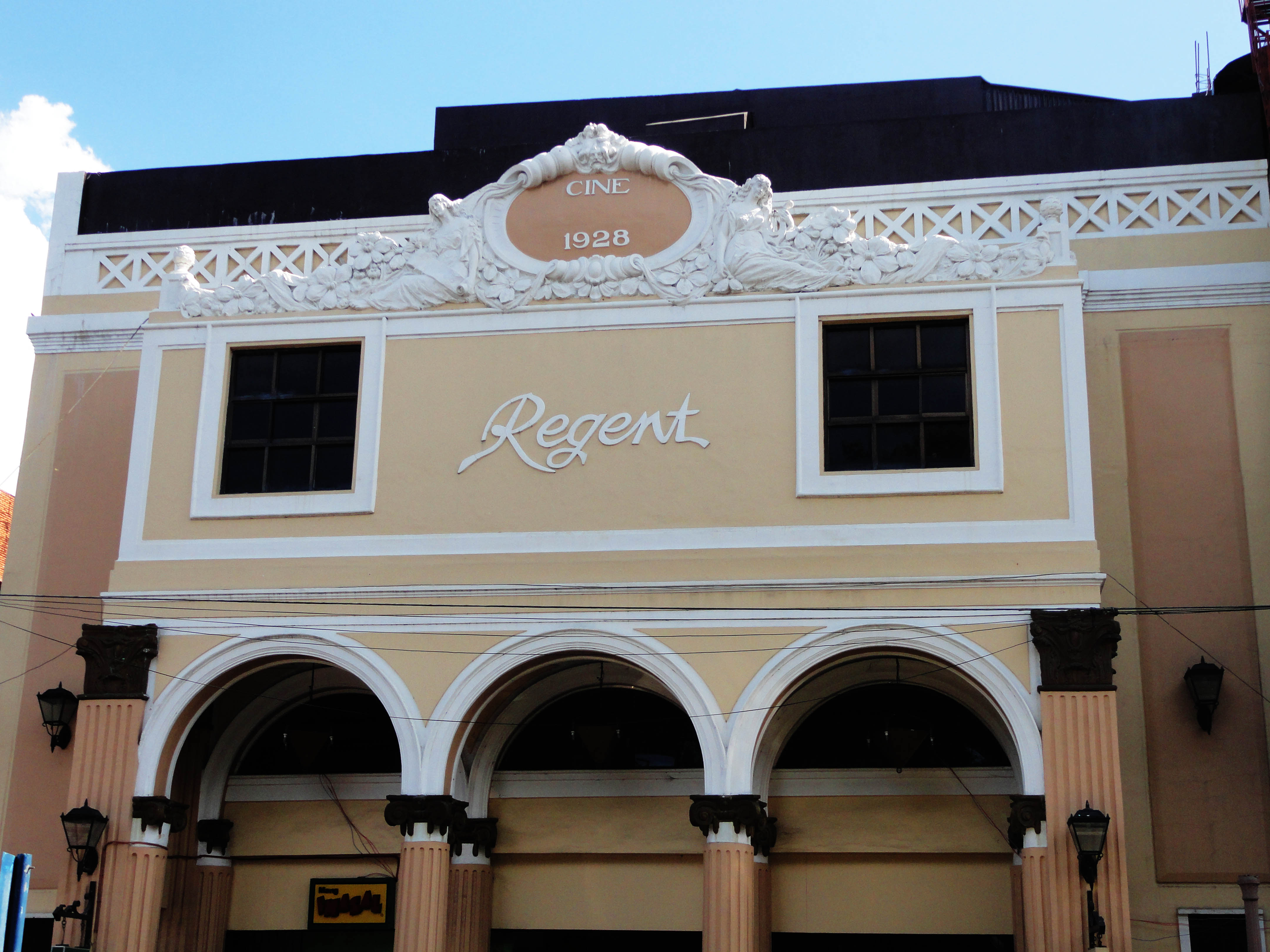
During the Spanish colonial era, Calle Real was the main artery of commerce for Iloilo, a city whose port connected the sugar and textile wealth of the Visayas to the global market. When the Americans arrived at the turn of the 20th century, the street became a hub for high-end shopping outlets selling European imports. The wealthy families of Iloilo built their commercial buildings along this stretch in the architectural styles of the day: neoclassical facades with formal columns, beaux-arts ornament with its disciplined exuberance, and later the sleek geometric lines of art deco. The Eusebio Villanueva Building, once known as the International Hotel, rises along the street's length. The Javellana Building, the Elizalde Building, the Celso Ledesma Building, and the Divinagracia-Alba Building each represent a different decade's vision of prosperity expressed in stone and plaster.
The Last Capital of Spain in Asia
At one end of Calle Real stands Plaza Libertad, formerly known as Plaza Alfonso XII. It was here that the flag of the first Philippine Republic was raised after Spain surrendered Iloilo, a moment that marked the city as the last capital of the Spanish Empire in Asia and the Pacific. Facing the plaza is the Iloilo Masonic Temple, completed in 1928 and serving as the headquarters of Iloilo-Acacia Lodge No. 11, chartered in 1917. During World War II, the Japanese Imperial Army commandeered it as their headquarters. In 2018, it was declared a National Historical Landmark. The plaza and the temple anchor the western end of the heritage zone, connecting the street's commercial history to the political upheavals that shaped the nation.
Heritage by Ordinance
The local government designated Calle Real as a heritage zone through Ordinance No. 00-054, the Local Cultural Heritage Conservation Ordinance, which also established the Iloilo City Cultural Heritage Conservation Council. The heritage designation expanded beyond J.M. Basa Street itself to encompass the surrounding streets of Aldeguer, Mapa, Ortiz, Muelle Loney, Solis, Rizal, and Iznart, stretching from Plazoleta Gay to the Iloilo Central Market. This entire area, commonly referred to as old downtown Iloilo, forms the Calle Real Heritage Zone. Cultural performances are staged regularly to promote Ilonggo heritage and attract both domestic and international tourists. The zone represents one of the most concentrated collections of turn-of-the-century commercial architecture in the Philippines, a streetscape that survived war, neglect, and the relentless pressure of modernization.
Wires Down, Walls Revealed
For decades, the architectural details of Calle Real's buildings hid behind a web of overhead power lines and cables. In 2023, underground cabling began along the downtown area, financed by MORE Power, the city's sole power distributor. The project covered the entire length of Calle Real from Plazoleta Gay to Plaza Libertad. By January 2025, the removal of overhead wires was complete. The effect was immediate: facades that had been partially obscured for years were suddenly visible in their entirety, ornamental details emerging from behind the cables like text cleared of redactions. The underground cabling project was not strictly a heritage initiative. It was an infrastructure upgrade. But its most visible result was aesthetic, and for the first time in a generation, visitors walking Calle Real can see the buildings as their architects intended them to be seen.
From the Air
Coordinates: 10.694N, 122.571E, in the downtown district of Iloilo City Proper on the southeastern coast of Panay Island. Calle Real runs through the old commercial center near the waterfront. Nearest major airport: RPVI (Iloilo International Airport) in Santa Barbara, approximately 19 km north. From altitude, the downtown area is visible along the Iloilo River near its mouth at the Iloilo Strait. Plaza Libertad and the dense grid of colonial-era streets are distinguishable at lower zoom levels.