Camp Peary
The towns of Magruder and Bigler's Mill no longer appear on any Virginia map, but their roads and buildings are still there - behind a perimeter fence that has been closed to the public since 1951. In 1942, the U.S. Navy needed land for a Seabee training base and took roughly 9,000 acres on the north side of the Virginia Peninsula in York County. Every resident of both towns had to leave. Magruder was a traditionally African-American community, established for freedmen after the Civil War and named, with bitter irony, for Confederate General John B. Magruder. Many displaced families relocated to the Grove community on U.S. Route 60 in James City County, where residents from another area had already been uprooted during World War I to create what is now Naval Weapons Station Yorktown. The Navy named its new base for Arctic explorer Rear Admiral Robert E. Peary. What happened inside would transform the property into one of America's most famous open secrets.
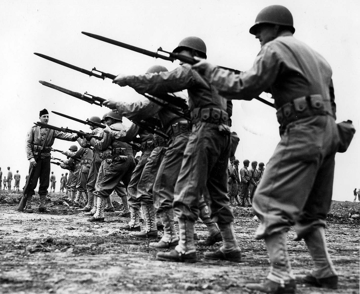
The Men Who Built Everything
The initial Seabee recruits of World War II were not ordinary soldiers. They were the men who had built Boulder Dam, America's highways, and New York City skyscrapers - civilian construction workers joining the Navy's new construction battalions. Camp Peary opened on November 3, 1942, with the 36th Construction Battalion the first to train there. At Naval Construction Training Center Peary, Seabees learned basic military order, discipline, weaponry, stevedoring, and construction trades. Over 60 trade schools operated on the base during its peak. In June 1943, a dynamite and demolition school opened, and its first graduates included the inaugural six classes of Seabee volunteers for the Naval Combat Demolition Units - the forerunners of today's Navy SEALs. By the time Seabee boot camp relocated to Camp Endicott at Quonset Point, Rhode Island in June 1944, another 100,000 men had passed through Camp Peary's gates. The Chesapeake and Ohio Railway had even extended a spur track from its Richmond-Newport News main line to service the massive operation.
Ghosts from Lost U-Boats
When the Seabees departed, a different kind of resident arrived. A portion of Camp Peary became a detention center for German prisoners of war, and these were not ordinary POWs. Many were Kriegsmarine crewmen pulled from captured U-boats and ships that the German high command believed lost at sea with all hands. The secrecy was critical: if Berlin learned these men had survived, the Germans would know that Enigma machines and codebooks thought destroyed could have been captured and compromised. That knowledge would have prompted an immediate change to the codes that Allied codebreakers had already broken, undermining one of the war's most consequential intelligence operations. So the prisoners were kept hidden, their existence unacknowledged. Letters from Herman Recht, a clerk at the camp, now held by the College of William and Mary, offer a rare window into daily life at this secret facility. After the war, many of the former POWs chose to stay in Virginia and the United States, becoming naturalized American citizens.
Five Quiet Years, Then the Fence Went Up
The Navy vacated Camp Peary in 1946, and for five years it served as a Virginia state forestry and game reserve. A reservoir built on the upper reaches of Queen's Creek to supply the base's water needs was handed over to the City of Williamsburg, becoming Waller Mill Reservoir and the foundation for Waller Mill Park. A section of the abandoned C&O Railway spur was converted into a recreational rail trail. Then, in 1951, the Navy returned. The portion north of the highway was secured and closed to the public - permanently. On the grounds sits Porto Bello, the historic hunting lodge of Lord Dunmore, the last royal governor of Virginia, listed on the National Register of Historic Places. It remains inside the restricted zone. Two months after the Bay of Pigs Invasion in June 1961, the Navy announced it was opening a sister facility at Harvey Point base in Hertford, North Carolina, noting that some training at Camp Peary would transfer there.
The Farm
Camp Peary is widely known as 'The Farm,' a training facility operated by the Central Intelligence Agency for the purpose of training clandestine officers from the CIA's Directorate of Operations, the Defense Intelligence Agency's Defense Clandestine Service, and other intelligence bodies. The U.S. government has never formally acknowledged this function, even as it has become one of the most referenced locations in espionage literature and film. Access is strictly controlled, and all visitors are escorted at all times. An airport with a runway was added near the old site of Bigler's Mill, and flight records indicate that at least 11 aircraft believed to be owned by CIA front companies have landed there. Former CIA officer Bill Wagner described attending a three-week interrogation course at The Farm in 1970, calling it the agency's 'premier course.' According to Wagner, the course was dropped from the CIA training curriculum after the Watergate scandal brought increased scrutiny to CIA practices. Today, the displaced communities of Magruder and Bigler's Mill exist in a strange limbo - their roads and structures still present, some still occupied, all behind a fence that the public has not crossed in over seven decades.
From the Air
Located at 37.33°N, 76.67°W in York County, Virginia, adjacent to the York River and just north of Interstate 64 near Williamsburg. The reservation covers approximately 9,000 acres of mostly wooded land with a runway visible on satellite imagery near the old Bigler's Mill site. Biglers Millpond is adjacent to the York River along the northern perimeter. CAUTION: This is restricted airspace - do not overfly at low altitude. Newport News/Williamsburg International Airport (KPHF) is approximately 15nm southeast. Williamsburg-Jamestown Airport (KJGG) is about 8nm southwest. The York River provides a strong visual reference along the northern boundary.