Canadian Forces Maritime Experimental and Test Ranges
Torpedoes do not explode at Nanoose Bay. They never have. The Canadian Forces Maritime Experimental and Test Ranges, known as CFMETR, tests weapons and detection systems in the Strait of Georgia without ever detonating anything. What makes this stretch of water valuable is not firepower but geography: a seabed several hundred metres deep, composed of soft mud, free of underwater obstacles, running several dozen kilometres long and several kilometres wide. It is, in effect, a natural laboratory for tracking anything that moves through water.
The Deep Range
The testing area, designated Area WG, occupies a deep channel in the Strait of Georgia off the east coast of Vancouver Island. CFMETR operates a three-dimensional sonar tracking system capable of monitoring the real-time position and performance of objects moving through the water column. When trials are underway, the entire range area is closed to civilian maritime traffic as a safety precaution. The equipment under evaluation includes sonobuoys, ship-mounted and aircraft-deployed sonar systems, and torpedoes. The facility also handles repair and overhaul of dipping sonar units used on Canada's Sikorsky CH-148 Cyclone helicopter fleet, the maritime patrol helicopters that operate from Royal Canadian Navy frigates.
Two Flags on One Base
CFMETR holds a distinction unique within the Canadian Forces: it is jointly staffed by personnel from two nations. Active military from the Royal Canadian Navy work alongside Department of National Defence civilian employees and a small number of United States Navy civilian employees from Naval Base Kitsap, across the border in Washington state. This binational arrangement reflects the close defense cooperation between Canada and the United States, particularly in undersea warfare technology. The facility's location on Vancouver Island, facing American naval installations across the strait and Puget Sound, makes the partnership a matter of practical geography as much as diplomatic alliance.
A Salmon War's Unlikely Target
In the late 1990s, CFMETR found itself at the center of an unexpected political storm. During the Pacific salmon dispute between Canada and the United States, British Columbia Premier Glen Clark threatened to cancel the American lease at Nanoose Bay as leverage in the fishing negotiations. The Seattle Times reported in August 1997 that Clark was considering using the torpedo testing facility as a bargaining chip, a move that would have disrupted a defense arrangement both nations relied on. The threat underscored how deeply the salmon wars had cut into Canada-U.S. relations, turning even a quiet weapons testing range into a diplomatic flashpoint. The lease ultimately survived, and CFMETR continues to operate as a binational facility.
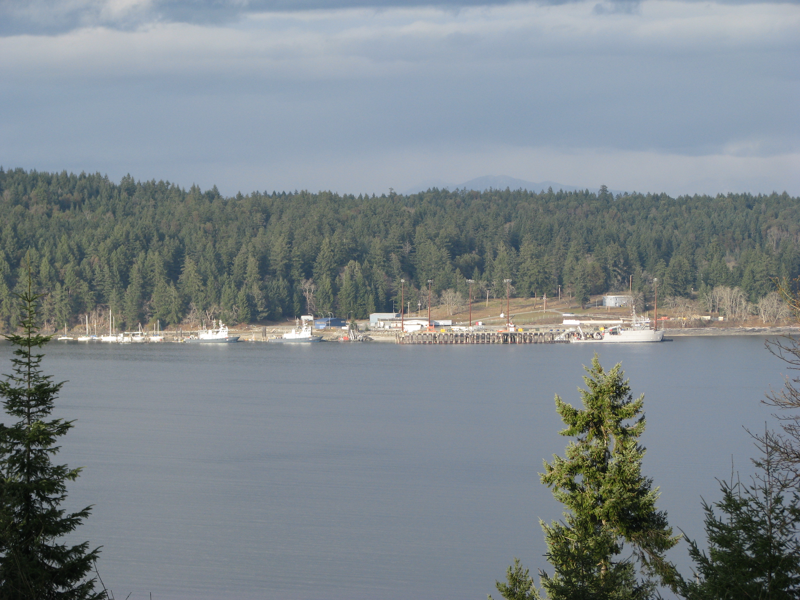
Hidden in Plain Sight
From shore, CFMETR looks unremarkable: a cluster of docks and buildings at the edge of Nanoose Bay, with Canadian Maritime Command vessels and the occasional U.S. Navy yard tug tied up alongside. The real work happens underwater and out of sight, tracked by sonar arrays that map every movement in three dimensions. For boaters transiting the Strait of Georgia, the only visible sign of activity is the occasional notice closing Area WG to civilian traffic. The facility represents a side of Vancouver Island most visitors never consider: beneath the surface of these scenic waters, some of the most advanced submarine detection and torpedo guidance technology in North America is being tested, refined, and validated.
From the Air
Located at 49.30N, 123.98W at Nanoose Bay on the east coast of Vancouver Island. The facility's docks and buildings are visible on the eastern shore of Nanoose Bay. Area WG, the testing range, extends into the Strait of Georgia and may show restricted-area markers during active testing periods. Nearest major airport is Nanaimo Airport (CYCD) approximately 20 km to the southeast. Qualicum Beach Airport (CAT4) is closer to the north. Exercise caution: military testing may result in temporary airspace restrictions. Best viewed at 3,000-5,000 feet.