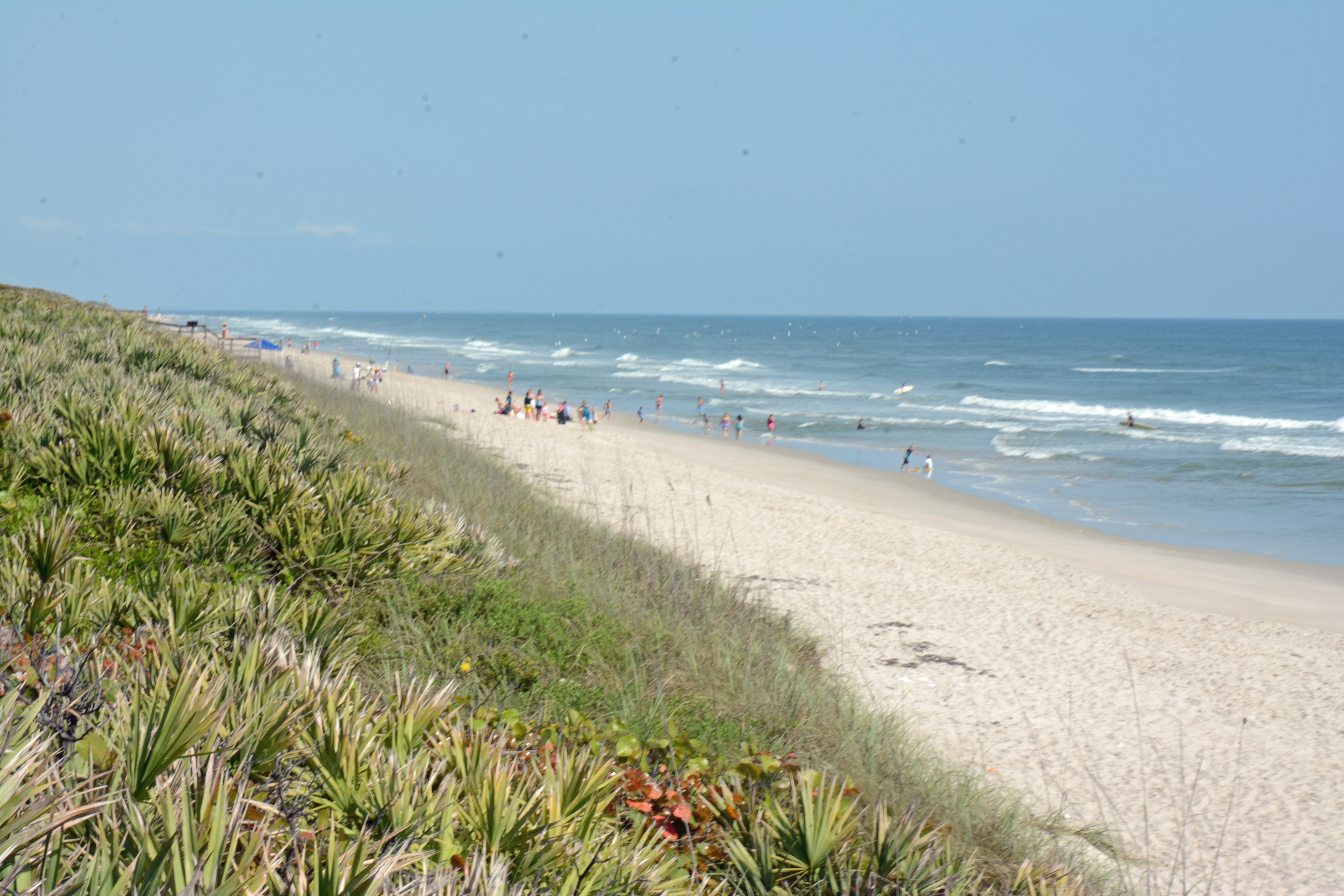
Canaveral National Seashore
The names are among the oldest in North America. Spanish explorers in the sixteenth century charted this stretch of Florida coast as Canaveral and Los Moquitos, and both names stuck, morphing slightly into Cape Canaveral and Mosquito Lagoon over the centuries. Today, Canaveral National Seashore preserves 24 miles of barrier island between New Smyrna Beach and Titusville, making it the longest undeveloped stretch of coastline on Florida's Atlantic side. It is a place of jarring contrasts: sea turtles crawl ashore to nest on the same beaches where SpaceX rockets arc into orbit, and more than 1,000 plant species and 310 bird species thrive within earshot of launch pad sirens.
The Artist Who Saved a Shoreline
By the late 1960s, developers had plans to build on the barrier island. Artist and environmentalist Doris Leeper led the fight to stop them. On April 26, 1968, the Volusia County Board of Commissioners passed a resolution requesting the Department of the Interior establish a national seashore. Congressmen Bill Chappell and Lou Frey introduced legislation, and in 1974 a congressional party toured the proposed site. Florida State Parks transferred roughly 4,000 acres of land they had already purchased. The Department of Interior initially objected, worried about conflicts with rocket launches from nearby Cape Canaveral. The House passed the Seashore Act on December 3, the Senate followed on December 17, and despite the Interior Department urging a veto, President Gerald Ford signed the bill into law on January 3, 1975. For years afterward, Representative Frey credited Doris Leeper as the driving force behind the park's creation.
Rocket Pad Neighbors
The John F. Kennedy Space Center occupies the southern end of the same barrier island. NASA's Launch Complex 39B and SpaceX's Launch Complex 39A are visible from Playalinda Beach, where 13 parking lots line the shore. During launch-related activities, the entire seashore can be closed to the public, a reminder that this is still an active spaceport. When rockets do fly, Playalinda becomes one of the closest public viewing spots, drawing crowds who watch the vehicles climb above the dunes. The relationship between the seashore and the space center is older than the park itself: in 1961, NASA selected Cape Canaveral as its primary launch site and acquired over 100 square miles of surrounding land as a buffer. In 1963, 25,000 acres of that buffer became the Merritt Island National Wildlife Refuge, which eventually expanded to 140,000 acres.
The Lagoon's Edge
More than two-thirds of Canaveral National Seashore is not beach at all but Mosquito Lagoon, a shallow estuary that teems with life. Shoreline anglers wade for speckled trout, redfish, sheepshead, and mangrove snapper. Kayakers and motorboaters launch from access points within the park to explore winding mangrove channels. On the ocean side, surf fishers cast for pompano, whiting, bluefish, and sharks. Hunters launch from the seashore into the adjacent Merritt Island Wildlife Refuge during season, pursuing waterfowl, deer, and wild pigs. The lagoon's ecological richness makes it one of the most productive estuaries in the Indian River system, a nursery for fish and shellfish that sustains both wildlife and a regional fishing economy.
Ancient Mounds and Living Shores
Long before rockets or park rangers, this coast supported dense human settlement. Turtle Mound, a massive shell midden at the northern end of the seashore, was documented by naturalist William Bartram in 1774 and Andre Michaux in 1788. It rises about 50 feet above sea level, one of the tallest such mounds on the Atlantic coast, built over centuries by indigenous people who harvested oysters from the lagoon. The National Park Service recognized the importance of protecting places like this as early as 1934, when it began surveying coastline for national beach parks. A 1955 report, Our Vanishing Shoreline, catalogued 126 undeveloped coastal areas and flagged Mosquito Lagoon as a priority. It took another two decades of political effort before those words translated into the protected shoreline visitors walk today.
From the Air
Canaveral National Seashore is located at 28.77N, 80.78W, stretching along a barrier island between New Smyrna Beach and the Kennedy Space Center. From the air, the narrow island is unmistakable, separating the Atlantic Ocean from Mosquito Lagoon. The Vehicle Assembly Building and launch complexes at KSC are prominent landmarks at the southern end. Turtle Mound is visible at the northern end as a raised feature along an otherwise flat coastline. Best viewed at 2,000-5,000 feet. Nearest airports: Space Coast Regional Airport (KTIX) 8nm southwest, Massey Ranch Airpark (X50) 5nm northwest, Daytona Beach International (KDAB) 25nm north. Note: airspace may be restricted during launches (TFRs around KSC).