Cancer Alley
In 1976, Coast Guard divers dropped into a bayou along the Mississippi River between Baton Rouge and New Orleans to retrieve sediment samples. They surfaced with second-degree burns on their hands. The water itself had become toxic. By that point, the corridor already had a name whispered by the people who lived there and a nickname that would eventually reach the national vocabulary: Cancer Alley. Stretching roughly 85 miles along the River Parishes of Louisiana, this narrow band of land holds more than 200 petrochemical plants and refineries. As of 2012, it accounted for 25 percent of all petrochemical production in the United States. Environmentalists call it a sacrifice zone -- a place where the rates of cancer caused by air pollution exceed the federal government's own limits of acceptable risk.
The Chemistry of a Corridor
The petrochemical buildup along the Mississippi accelerated through the mid-twentieth century. By the 1970s, plants producing vinyl chloride, nitrogen fertilizers, and chlorine proliferated along the riverbanks between Louisiana's two largest cities. In 1969, DuPont opened a facility in Reserve, Louisiana, to manufacture chloroprene, the key ingredient in neoprene. That plant, sold to the Japanese company Denka in 2015, would become one of the most scrutinized industrial sites in America. The EPA identified the area immediately adjacent to the Denka neoprene facility in St. John the Baptist Parish as having a cancer risk from air pollution over 700 times the national average. According to the agency, the plant emits 99 percent of the nation's chloroprene pollution. The numbers are not abstract here. They translate into diagnoses, funerals, and the slow erosion of communities whose residents can smell the chemicals in the air they breathe.
Voices from the Parishes
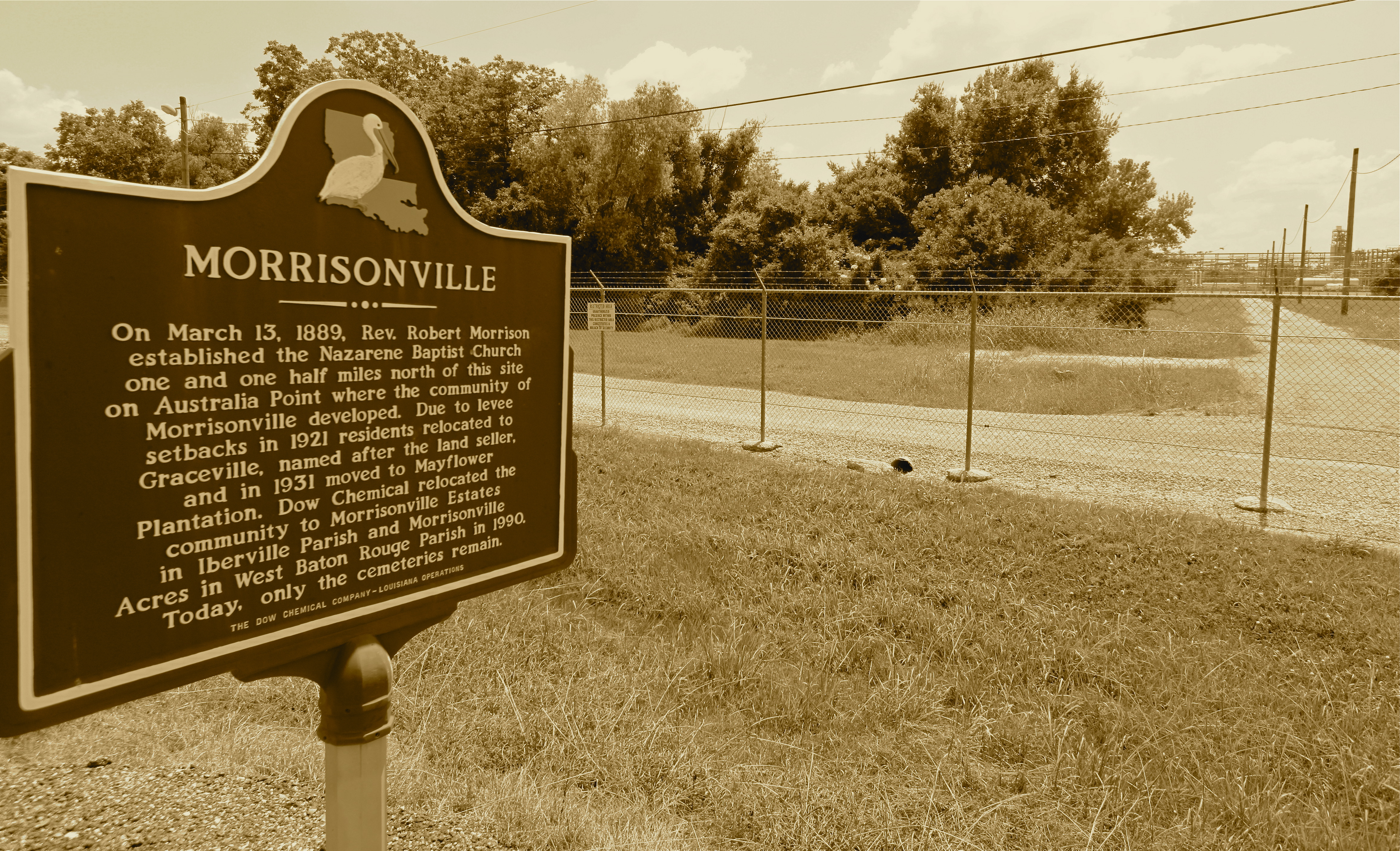
The fight against industrial expansion in Cancer Alley has been led largely by the people who live there. In 1996, Shintech Inc. announced plans for three new polyvinyl chloride plants in Convent, a small majority-Black community of roughly 700 people that serves as the seat of St. James Parish. Louisiana issued permits despite acknowledging the plants would add 623,000 pounds of pollutants to the air annually. After sustained community pressure and lobbying, Shintech withdrew its plans in 1998. Two decades later, the pattern repeated. In 2018, Formosa Plastics proposed the Sunshine Project, a $9.4 billion complex on the west bank of St. James Parish estimated to emit over 13.6 million tons of greenhouse gases per year. The proposed site sat one mile from an elementary school. Archaeologists hired by Formosa discovered unmarked graves of enslaved people beneath the 2,300-acre site. Community leader Sharon Lavigne and the grassroots organization RISE St. James spearheaded a lawsuit, and in November 2020, the Army Corps of Engineers suspended its permit.
The Numbers That Don't Add Up
The EPA reported in both 2016 and 2020 that Cancer Alley residents face more than ten times the health risk from hazardous air pollutants compared to other Louisiana residents. A Human Rights Watch review of 12 fossil fuel and petrochemical plants operating between October 2020 and November 2023 found that only one was in full compliance with federal environmental laws during that three-year period. Only two complied with the Clean Water Act. The Louisiana Chemical Association has disputed the Cancer Alley designation, citing Louisiana Tumor Registry data that it says shows no increase in cancer deaths connected to industrial pollution. Activists and researchers counter that the registry's census tracts are too large to capture conditions adjacent to specific plants, and that the data may be incomplete, particularly for deaths during the COVID-19 pandemic. Louisiana health officials have been unable to release case-level data, citing medical privacy laws -- a legal barrier that leaves the question statistically unresolved while the human evidence accumulates.
Buried History, Living Injustice
Cancer Alley sits at the intersection of environmental and racial injustice. The corridor follows the same Mississippi riverbank where antebellum sugar plantations once stood, and many petrochemical plants now occupy former plantation land. The discovery of enslaved people's graves beneath the proposed Formosa Plastics site underscored a grim continuity: Black communities have borne the burden of this land for centuries, first through forced labor and now through disproportionate exposure to toxic pollution. Scholars and residents describe the region as a frontline example of environmental racism. When wealthier, primarily White neighborhoods organized against petrochemical facilities through NIMBY campaigns in the 1970s, the companies shifted their operations toward low-income communities of color that lacked the political clout to resist. In 2023, the EPA found significant evidence that Louisiana regulators' actions and inactions have resulted in adverse impacts on African American residents throughout the corridor.
A Storm on Every Horizon
The risks compound. Cancer Alley's proximity to the Gulf of Mexico makes it vulnerable to hurricanes that transform industrial infrastructure into environmental catastrophe. Hurricane Katrina in 2005 caused nearly 11 million gallons of oil to spill near New Orleans. Hurricane Harvey in 2017 triggered power outages at a Houston-area plant that caused unrefrigerated chemicals to decompose and ignite into a fireball. In January 2021, President Biden signed an executive order on environmental justice that specifically named Cancer Alley. But enforcement has been inconsistent. Louisiana's attorney general sued the EPA for using civil rights law to challenge industrial permitting, and the agency subsequently dropped its Cancer Alley investigation. The corridor remains what it has been for decades: a place where the promise of industrial prosperity and the reality of toxic exposure exist side by side, separated by little more than a fence line and the question of who gets to decide what acceptable risk means.
From the Air
Located at approximately 30.0N, 90.6W, Cancer Alley stretches roughly 85 miles along the Mississippi River between Baton Rouge (KBTR) and New Orleans (KMSY). From cruising altitude, the corridor is identifiable by the concentration of industrial facilities -- storage tanks, flare stacks, and refinery complexes -- lining both banks of the river. Individual plants are visible at 3,000-5,000 feet AGL. The Baton Rouge ExxonMobil refinery and the Denka facility near Reserve are among the most prominent landmarks. Nearby airports include Baton Rouge Metropolitan (KBTR) and Louis Armstrong New Orleans International (KMSY).