Candlestick Point State Recreation Area
The Navy planned to build a shipyard here during World War II, then walked away when the war ended. Without oversight, the 170-acre landfill at San Francisco's southeastern tip became an unofficial garbage dump for the surrounding neighborhood. It took $10 million from the California State Legislature in 1973 and a legislative vote in 1977 to transform this abandoned industrial ground into something unprecedented: California's first urban state recreation area. Candlestick Point today offers what its neighbors in Bayview-Hunters Point have always deserved and rarely received -- open water views, fishing piers, and unobstructed bay wind.
Three Theories and a Name
How Candlestick Point got its name depends on whom you ask, and the competing theories are all better than anything a naming committee could produce. Some sources point to Candlestick Rock, an eight-foot-tall pinnacle that once stood at the high-tide line before vanishing around 1920. Others credit the long-billed curlew, a shorebird so common here that locals called it the "candlestick bird" for its elongated beak. The most dramatic theory involves the 19th-century practice of burning derelict sailing ships in the bay -- as they sank, their flaming masts looked like lit candlesticks against the water. The name predates the stadium that borrowed it, and unlike the stadium, the point endures.
From Landfill to Landmark
The transformation of Candlestick Point from dump to park required more than money. The reclamation involved capping contaminated fill, establishing drainage systems, and building recreational infrastructure on land that had spent decades absorbing industrial waste and household garbage. The result, California's first urban recreation area, proved that state parks did not have to mean pristine wilderness. Candlestick Point demonstrated that even the most abused urban land could be restored to public use -- a lesson that would influence urban park-making across the state for decades to come.
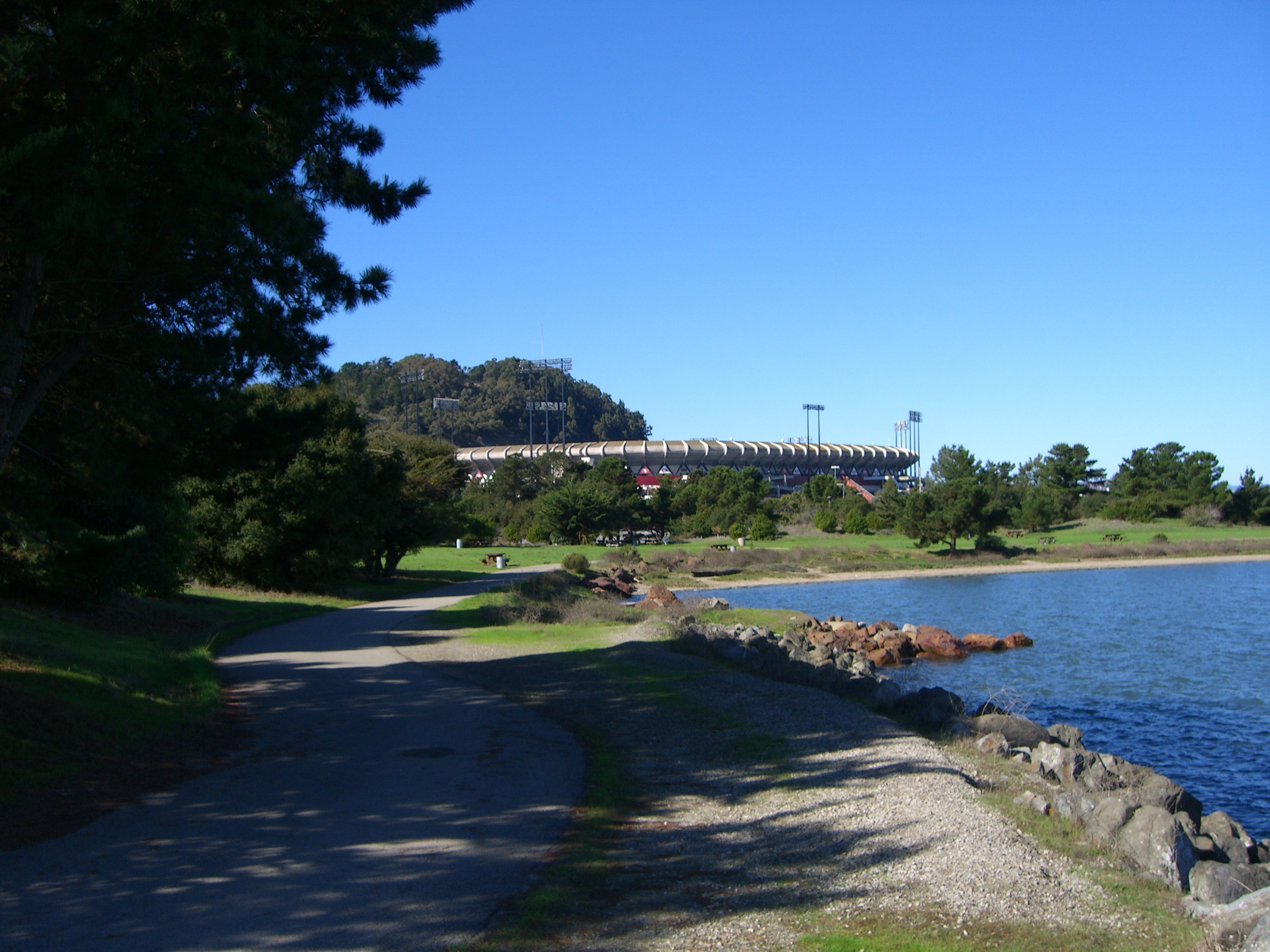
Wind, Water, and Weekend Life
The same winds that made adjacent Candlestick Park stadium notorious among baseball fans make the state recreation area a magnet for windsurfers. Regular, strong gusts sweep across the point from the bay, creating reliable conditions that draw boardsailors year-round. Two fishing piers extend into the water, offering crabbing and shore fishing with views across to Oakland and the East Bay hills. Picnic areas, hiking trails, and fitness courses fill the interior. On weekends, the park serves the Bayview-Hunters Point community as a front yard -- a place to grill, fish, walk, and watch container ships glide through the bay.
A Park at the Edge
Candlestick Point sits at the southeastern tip of San Francisco, two miles north of Sierra Point in Brisbane, immediately south of the Hunters Point neighborhood. Its location puts it at the geographic margin of the city -- far from the tourist corridors of Fisherman's Wharf and Golden Gate Park, closer to the shipyards and industrial zones that have defined this corner of San Francisco since the 1940s. That marginality is precisely what makes the park meaningful. It serves a community that has historically been underserved by the city's park system, offering 170 acres of open space and bay access in a neighborhood that was given a garbage dump instead of a shipyard.
From the Air
Located at 37.7111°N, 122.381°W at the southeastern tip of San Francisco, on the western shore of San Francisco Bay. The park's 170 acres of green space and waterfront are clearly visible from the air, adjacent to the former Candlestick Park stadium site. Best viewed at 1,500-3,000 feet AGL. Nearest airport: KSFO (San Francisco International, 5 nm south). Look for the green peninsula jutting into the bay south of Hunters Point.