Canyonlands National Park
The park exists because of a flight. In 1961, Secretary of the Interior Stewart Udall was traveling to a conference at Grand Canyon National Park when his plane passed over the confluence of the Colorado and Green rivers in southeastern Utah. What he saw from the air -- two great rivers merging in a labyrinth of canyons, mesas, and buttes -- changed federal land policy. Below him, a park superintendent named Bates Wilson had spent a decade exploring this terrain on foot and advocating for its protection. Udall's aerial view gave Wilson's ground-level vision the political momentum it needed. Three years later, on September 12, 1964, President Lyndon B. Johnson signed the legislation creating Canyonlands National Park.
Four Parks in One
The Colorado and Green rivers divide Canyonlands into four distinct districts, each with its own character. The Island in the Sky is a broad mesa between the two rivers in the park's northern section, offering viewpoints that drop away to the White Rim sandstone bench far below, and then further still to the rivers themselves. It draws 76.7 percent of the park's visitors, thanks to its proximity to Moab. The Needles district, named for red and white banded rock pinnacles on the east side of the Colorado, attracts another 20.7 percent. The Maze, west of both rivers, accounts for just 1.5 percent of visitors -- it is one of the most remote and inaccessible areas in the entire United States. The remaining visitors come by river, floating the calm stretches above the confluence before hitting Cataract Canyon's whitewater below, rapids that in heavy snow years produce the largest whitewater in North America.
The Father of Canyonlands
Bates Wilson was superintendent of Arches National Monument in the early 1950s when he began exploring the wild country south and west of Moab. After discovering the Needles, he started campaigning for a new national park. Utah Senator Frank Moss introduced the legislation, attempting to balance preservationist and commercial interests, and over four contentious years the proposal was struck down, debated, revised, and reintroduced before finally passing. Wilson became the first superintendent of the new park and is remembered as the Father of Canyonlands. Edward Abbey, the desert writer and frequent visitor, offered his own assessment: Canyonlands was, he wrote, 'the most weird, wonderful, magical place on earth -- there is nothing else like it anywhere.' Political compromise at the time of creation limited the park to an arbitrary portion of the Canyonlands basin, and conservationists continue to advocate for extending the boundaries to the high sandstone rims that form its natural border.
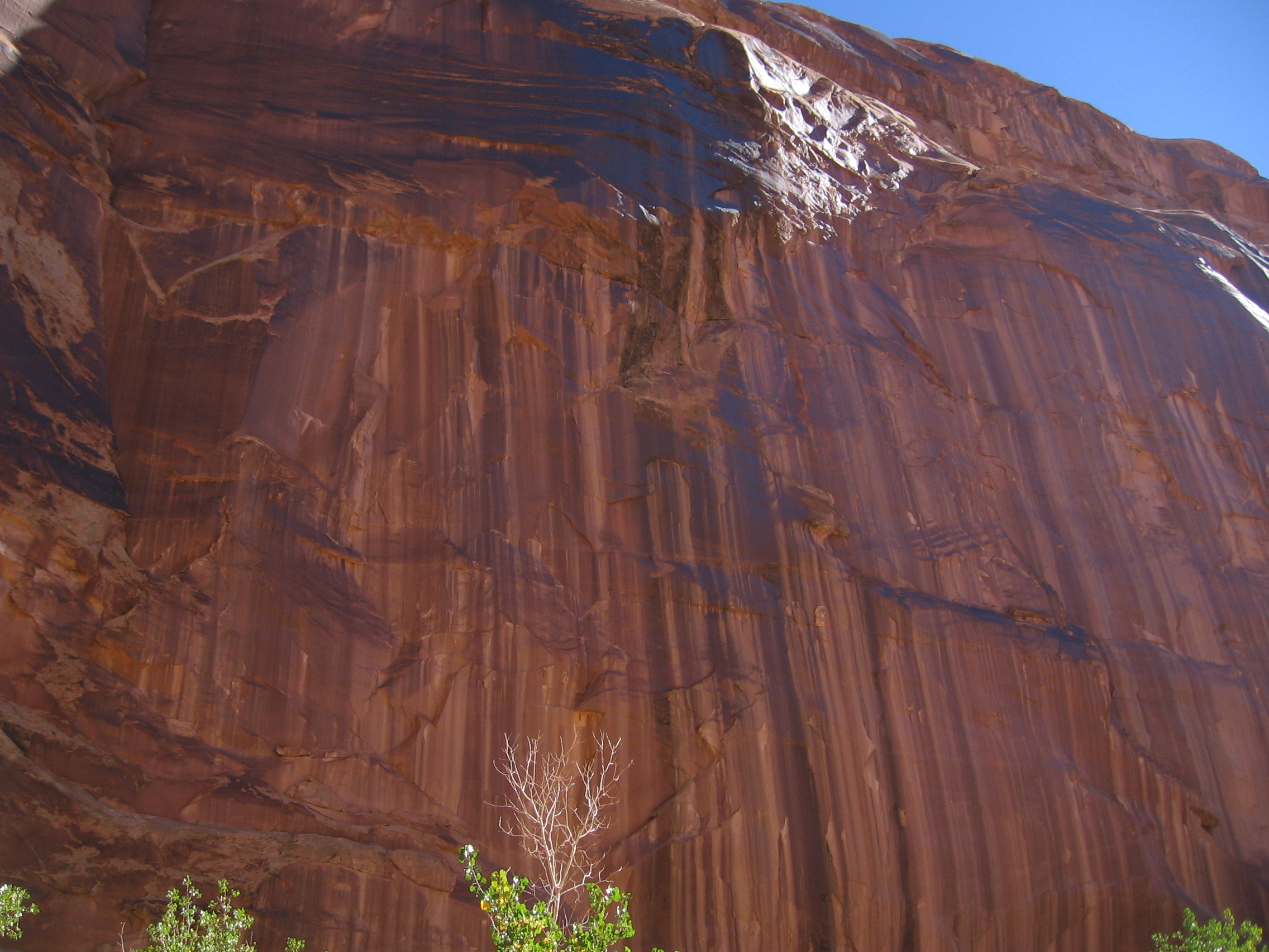
Deep Time Exposed
The geological story of Canyonlands reads like a textbook of Earth's history. The Paradox Formation, a salt bed deposited by an ancient evaporating sea, lies deep beneath the surface. Above it, layers accumulated over hundreds of millions of years: the fossil-rich Honaker Trail Formation from a warm Pennsylvanian sea, the Cedar Mesa Sandstone from coastal dunes, the Organ Rock Shale from oxidized mud, the Wingate Sandstone from Triassic desert dunes, and the Navajo Sandstone from an even vaster desert that once covered much of western North America. The Laramide orogeny began uplifting the Rocky Mountains 70 million years ago, and as the Colorado River canyon cut down to the Paradox salt beds, the overlying rock extended toward the canyon, forming the dramatic grabens visible today. Upheaval Dome, long debated as either a salt dome or a meteorite impact, is now believed by most researchers to be the product of an ancient cosmic collision.
Ancient Hands on Stone
The Ancestral Puebloans left their mark throughout Canyonlands. Their stone and mud dwellings survive in the Needles district, though most portable artifacts were removed by looters long ago. Petroglyphs appear on rock faces throughout the park, most famously on Newspaper Rock along the Needles access road. But the oldest human traces lie in Horseshoe Canyon, a geographically detached section north of the Maze district. Here, hunter-gatherers from the Late Archaic Period, between 2000 and 1000 BC, created panels of rock art -- pictographs, murals, and artifacts -- that predate the Puebloans and rank among the oldest in the Americas. Cryptobiotic soil, a living crust of cyanobacteria, fungi, and mosses, provides the foundation for life across the park's desert floor. A single footprint can destroy decades of this fragile growth, a reminder that even in a landscape measured in geological ages, the present remains astonishingly delicate.
From the Air
Located at 38.17N, 109.76W in southeastern Utah near Moab. The confluence of the Colorado and Green rivers is a spectacular visual landmark from the air, clearly dividing the park into its distinct districts. The Island in the Sky mesa is unmistakable, with the White Rim bench visible below. Best viewed at 6,000-10,000 ft AGL. Canyonlands Field (KCNY) is the nearest airport, approximately 15 nm north near Moab. Grand Junction Regional Airport (KGJT) lies approximately 90 nm northeast. Look for Upheaval Dome's circular crater formation on the western side of the Island in the Sky.