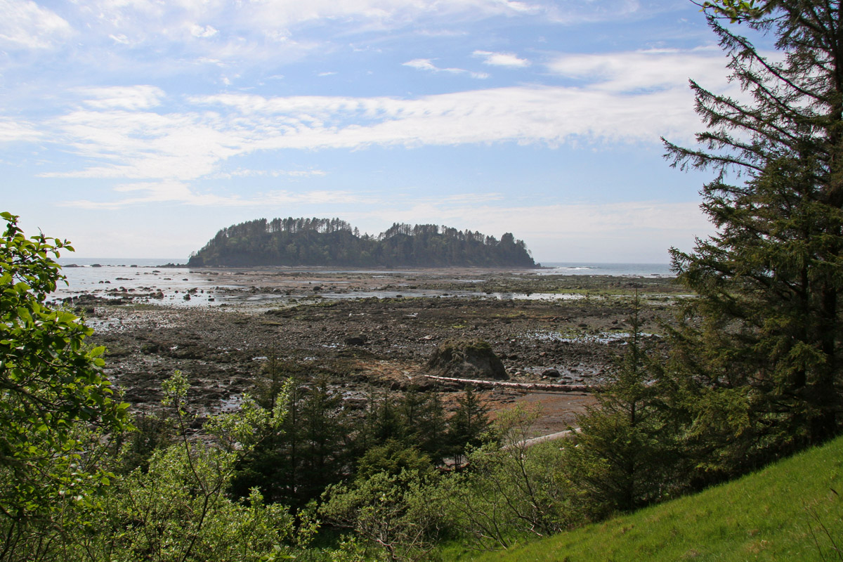
Cape Alava
Walk far enough west in the contiguous United States and you will run out of land at a rocky, wave-battered headland on the Olympic Peninsula. Cape Alava holds that distinction -- the westernmost point in the lower forty-eight, at least at low tide when you can scramble out to the western edge of Tskawahyah Island. The difference between Cape Alava and its rival, Cape Flattery to the north, amounts to roughly five seconds of longitude, about 360 feet. But the arguments over coordinates miss the point. Cape Alava is not remarkable because of where it sits on a map. It is remarkable because of what has washed up here, what has been carved into its rocks, and how difficult it remains to reach.
Three Miles Through the Green
There is no road to Cape Alava. The only way in is a three-mile boardwalk trail from the Lake Ozette Ranger Station, threading through temperate rainforest so dense that the canopy blocks most of the sky. The trail was designated a National Recreation Trail in 1981 and serves as the western terminus of the Pacific Northwest National Scenic Trail, established by the Omnibus Public Land Management Act of 2009. The boardwalk is necessary -- without it, the trail would be an impassable bog for much of the year. The planks are slippery when wet, which is most of the time in a place where precipitation is measured in feet rather than inches. Hikers completing the 9.5-mile Ozette Loop use this trail as one leg, connecting Cape Alava to Sand Point along the coast before looping back through the forest to the ranger station.
A Basque Name on a Makah Shore
The cape carries the name of Don Jose Manuel de Alava, a Basque diplomat born in Vitoria in 1743 who served as commissioner during the resolution of the Nootka Crisis in 1794. It is a European name laid over land the Makah people had inhabited for thousands of years. The Makah village of Ozette, one of five major villages on the northwestern Olympic Peninsula, stood just south of the cape. Petroglyphs at Wedding Rocks, roughly one kilometer south of Cape Alava, attest to centuries of presence -- figures and symbols carved into coastal stone, now accessible to hikers willing to time their visit with the tides. The petroglyphs are not behind glass or roped off. They sit where they were made, weathering at the speed of stone.
The Hojun Maru
In early 1834, a mastless, rudderless Japanese rice transport ship drifted onto the beach near Cape Alava after fourteen months adrift on the Pacific Ocean. The Hojun Maru had been bound for Edo with a cargo of rice when a storm broke the vessel and blew it off course. Of the original crew, only three survived the crossing -- the youngest being a man named Otokichi. The Makah took them in, held them for a time, and eventually the three were taken to Fort Vancouver. They never returned to Japan. An American attempt to repatriate them failed in the Morrison incident of 1837. In 1997, a delegation from Mihama, Japan traveled to Ozette to commemorate the souls of those three sailors, closing a circle that had taken 163 years to complete.
Ice Age Grab Bag
The beaches around Cape Alava are a geologist's puzzle box. The Washington State Department of Natural Resources classifies the sediments here as Unconsolidated Deposition -- Quaternary deposits dating to the end of the last ice age, roughly 10,000 to 14,000 BCE. The technical description is 'Quaternary Sediments, Dominantly Glacial Drift, includes alluvium,' which translates to a geological grab bag of rock types deposited by retreating glaciers and then ground by the relentless force of the open Pacific. Similar deposits are common around Puget Sound, where they sit in relatively protected waters. What makes Cape Alava unusual is that these soft, mixed sediments face the full unshielded power of the ocean. The erosion is constant and dramatic, exposing formations that would remain buried elsewhere and creating a coastline that looks different after every major storm.
From the Air
Cape Alava sits at 48.17°N, 124.74°W on the extreme western edge of the Olympic Peninsula, visible from altitude as the furthest westward point of land on the Washington coastline. The cape is part of Olympic National Park's coastal strip. Tskawahyah Island (Ozette Island) lies just offshore. The nearest airport is Quillayute (KUIL) near Forks, approximately 30 nm to the south. William R. Fairchild International (KCLM) in Port Angeles is about 55 nm to the east. No roads reach the cape -- only the boardwalk trail from Lake Ozette. The coastline here is rugged, with sea stacks and rocky outcrops. Weather is frequently overcast with rain common year-round, especially October through April.