Cape Columbine
The headland takes its name from a disaster. In 1829, the barque Columbine wrecked 1.5 kilometers north of where a lighthouse would eventually rise -- a lighthouse that would bear the ship's name and spend nearly a century trying to prevent what had killed its namesake. Cape Columbine juts into the South Atlantic as the most westerly point of the Western Cape province, a rocky promontory surrounded by submerged rocks and reefs that have made this stretch of coastline one of the most dangerous on the South African seaboard. At least nine ships have gone down in these waters, and the list spans a century and a half of maritime ambition meeting geological indifference.
A Lighthouse of Firsts
The Cape Columbine Lighthouse was commissioned on October 1, 1936, making it the last staffed lighthouse built on the South African coast. But if it was the last of its kind, it was also a pioneer in several respects. It was the first South African lighthouse to receive three navigational aids simultaneously: a light, a fog signal, and a radio beacon. Its lens system was the first designed specifically for use with a 4-kilowatt incandescent electric lamp, a significant technological step in an era when many lighthouses still relied on oil or gas. The lighthouse sits within the Cape Columbine Nature Reserve, 263 hectares of rugged coastal terrain managed by the Saldanha Bay Municipality, where hikers and birdwatchers now walk paths that sailors once watched from their decks with dread.
The Roll Call of Wrecks
The waters around Cape Columbine do not forgive mistakes. The Columbine herself went down in 1829, the event that gave the headland its name. The SS Saint Lawrence followed in 1876, then the SS Lisboa in 1910 and the SS Haddon Hall in 1913. The SS Malmesbury was lost in 1930, the Haleric in 1932. During World War II, the SS Columbine -- sharing a name with the original wreck, though separated by more than a century -- was torpedoed in 1944. The Da Gama went down as recently as 1979. Each wreck added to the local economy of salvage and memory, and each reinforced the lighthouse's purpose. The reefs here are not visible at high tide, and the currents that sweep around the headland can push a vessel off course within minutes. It is a place where the ocean's beauty and its capacity for violence exist in the same frame.
Where the Crayfish Are
On the southern side of the lighthouse lies Tieties Bay, a small, sheltered inlet. Five kilometers inland sits the fishing village of Paternoster, whose economy has revolved around the sea for generations. The coastline between them is renowned for its marine life, particularly the West Coast rock lobster -- known locally as crayfish -- and abalone. The Cape Columbine Nature Reserve wraps around the headland on the stretch between St Helena Bay to the northeast and Saldanha Bay to the south, protecting a landscape that transitions from rocky shore to fynbos scrubland. In spring, wildflowers bloom among the coastal vegetation, adding color to terrain that is otherwise defined by granite, spray, and wind. The Langebaan Lagoon, the West Coast National Park, and a fossil park lie to the south, making Cape Columbine the northwestern anchor of a remarkable concentration of natural and historical sites along this coast.
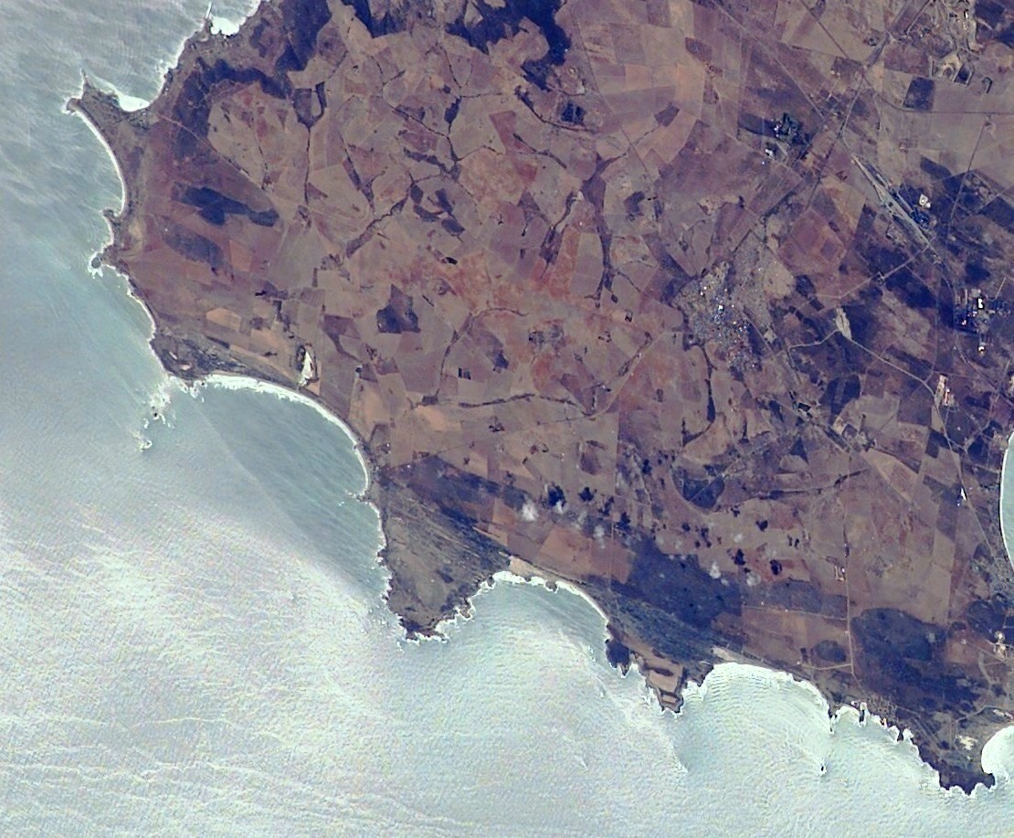
From the Air
Located at 32.83S, 17.86E, the most westerly point of the Western Cape. The white lighthouse is a prominent visual landmark against the dark rocky headland. Best viewed at 1,500-3,000 ft AGL. Approximately 30 km from Vredenburg and 170 km by road from Cape Town. Nearest airports: Saldanha Bay area (military); Cape Town International (FACT) approximately 130 km southeast. The submerged reefs around the cape are sometimes visible as areas of white water and breaking waves.