Cape d'Or
Samuel de Champlain arrived at this headland in 1607 and saw gold in the cliff face. He was wrong, but not by much. The bright deposits glinting from the dark basalt were native copper, not gold, and the French explorer named the place Cap d'Or anyway, because in the right light the distinction hardly mattered. The Mi'kmaq, who had been working these cliffs for at least 2,000 years before Champlain's visit, had a more practical relationship with the cape. They called it L'mu'juiktuk and came for the chert and copper that the volcanic rock yielded, materials hard and dense enough to shape into tools and weapons worth trading across the region.
A Reef Where Currents Collide
Cape d'Or marks the northern entrance to the Minas Basin, the inner arm of the Bay of Fundy where the world's highest tides reach their most extreme expression. The headland is a continuation of the North Mountain tholeiitic basalt formation, an ancient lava flow that runs along the Fundy shore of Nova Scotia. Dramatic cliffs fall away on the western and southern faces, and a basalt reef extends from the cape into the bay, where it meets the Dory Rips. This notorious stretch of water is produced by the collision of three strong tidal currents, a roiling convergence that has menaced mariners for as long as vessels have navigated the upper Bay of Fundy. The currents churn the surface into standing waves and whirlpools that shift with every tide cycle.
Two Thousand Years of Stone and Copper
An archaeological excavation near the lighthouse site in 1980 uncovered extensive Mi'kmaq artifacts dating back roughly two millennia. The cape's volcanic geology produced veins of chert, a hard siliceous rock that fractures into sharp edges ideal for cutting tools. Copper deposits in the basalt provided another tradeable resource. For the Mi'kmaq, Cape d'Or was not scenery but a workshop, a place where the raw materials for survival could be extracted from the rock face. When Champlain explored the copper deposits in 1607, he named the nearby harbour Port of Mines, a name that migrated inland. The Acadian communities around the southern shore of the Minas Basin became known as Les Mines, and the basin itself took its name from the mineral wealth at the cape's doorstep.
The Copper Company's Gamble
Where Champlain saw opportunity and the Duke of Chandos saw frustration, a New York syndicate saw profit. In 1897, the Colonial Copper Company began mining operations at Cape d'Or, investing several million dollars in a site that the cliffs and tides had made inaccessible to every previous attempt. Three shafts were sunk along the cliff face. An ore processor went up, connected to the shafts and to a shipping terminal at nearby Horseshoe Cove by a short narrow-gauge railway. A company town appeared: houses for workers, houses for managers, the infrastructure of industrial ambition planted on a headland above the Fundy tides. The mine went into operation in 1900 and stopped excavation by 1905, when the copper veins proved thinner than the investment required. By 1907 the site was abandoned entirely. The company houses were loaded onto ships and scattered to communities around the bay.
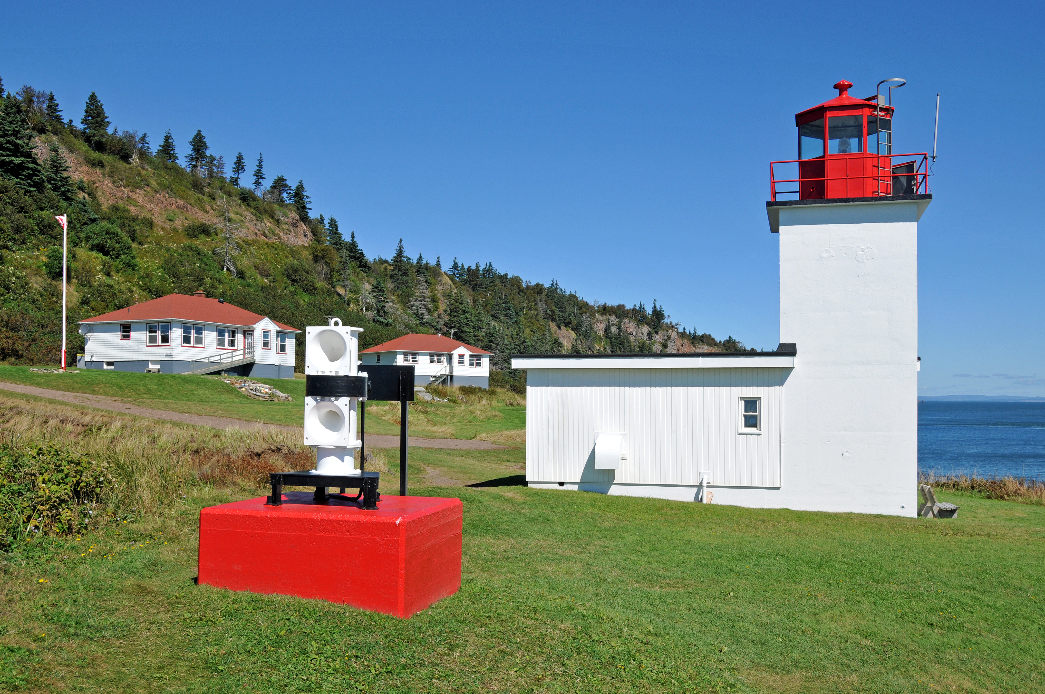
The Lightkeeper's Legacy
A steam-powered foghorn began warning ships away from the Dory Rips in 1875. A lighthouse followed in 1922, recycling a tower that had originally stood at Apple River farther up the coast. New bungalows for the lightkeeper and assistant went up in 1958, and a concrete lighthouse replaced the wooden tower in 1965. The last keeper, Ernie Morris, served until the light was automated in 1989. Six years later, the Advocate District Development Association secured a lease to preserve the site. Today, one of the lightkeeper's houses operates as the Lightkeeper's Kitchen restaurant and the other as a guesthouse, giving visitors a reason to linger on a headland where the basalt still yields beautifully crystallized minerals: cuprite, calcite, apophyllite, and a constellation of zeolites that collectors prize. The copper that fooled Champlain still glints in the cliff face when the light hits right.
From the Air
Located at 45.29N, 64.77W at the northern entrance to the Minas Basin on the Bay of Fundy coast of Nova Scotia. The cape's dramatic basalt cliffs and the lighthouse are visible from moderate altitude. The Dory Rips turbulence in the water offshore is often visible as disturbed surface patterns. Nearest airports are Greater Moncton Romeo LeBlanc International Airport (CYQM), approximately 140 km northeast, and CFB Greenwood (CYGD), approximately 110 km southeast. The headland is reached by road from Advocate Harbour.