Cape Flattery
Captain James Cook was looking for shelter. Sailing along the Washington coast on March 22, 1778, he spotted what appeared to be a small opening in the shoreline and allowed himself to hope it might be a harbor. It was not. But the hope was enough to name the place. 'There appeared to be a small opening which flattered us with the hopes of finding an harbour,' Cook wrote in his log. 'On this account I called the point of land to the north of it Cape Flattery.' It is the oldest non-Native permanently named feature in Washington state, and it was named for a disappointment. The cape itself, though, is anything but. This jagged headland at the extreme northwestern tip of the Olympic Peninsula -- where the Strait of Juan de Fuca crashes into the Pacific Ocean -- is a place of collisions, both literal and metaphorical.
The Corner of the Country
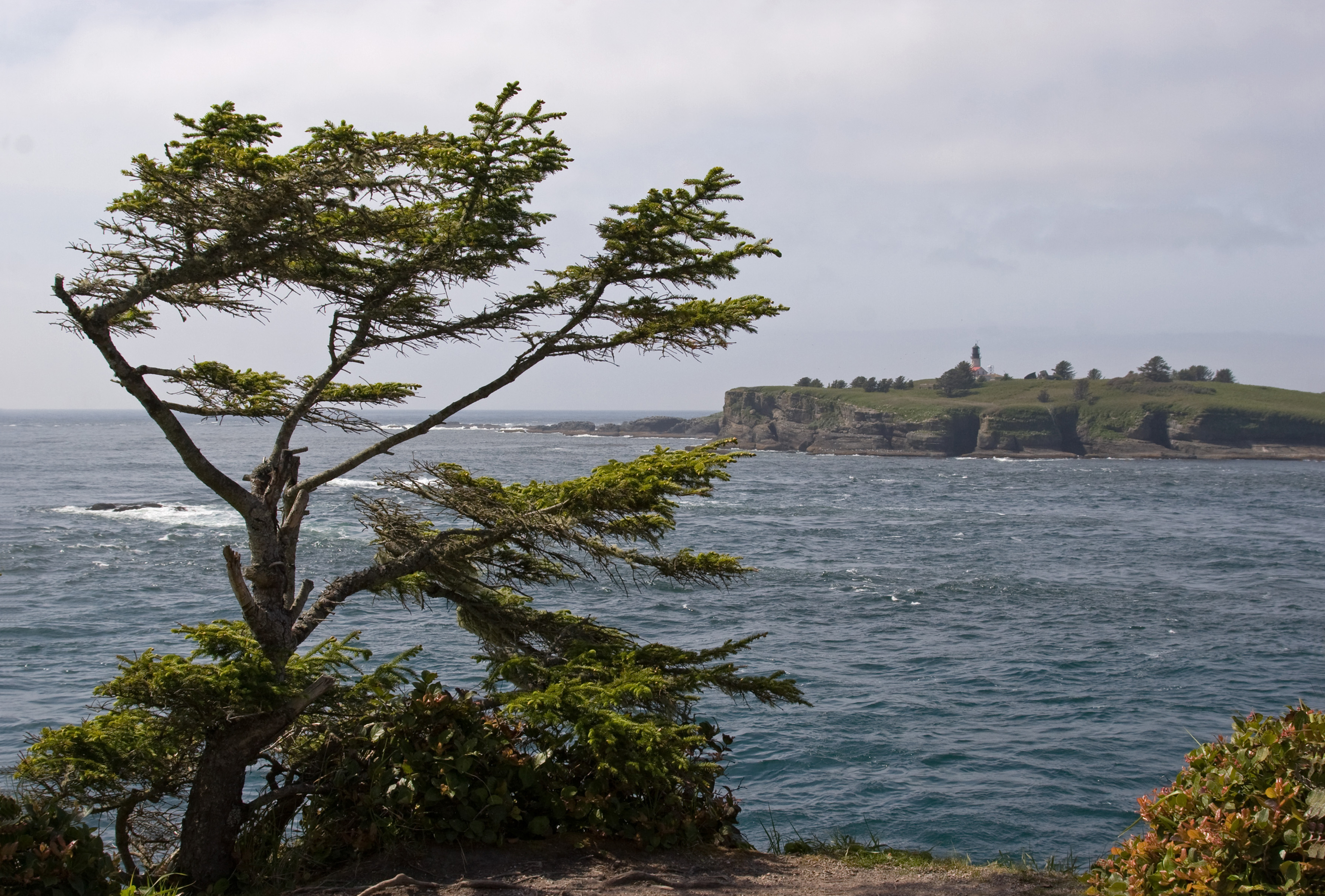
Cape Flattery marks the northwesternmost point of the contiguous United States. It sits on the Makah Reservation in Clallam County, Washington, at the junction of three bodies of water: the Strait of Juan de Fuca to the north, the Pacific Ocean to the west, and Makah Bay to the south. The cape is also the northern boundary of the Olympic Coast National Marine Sanctuary. Cape Alava, roughly fifteen miles to the south, holds the separate distinction of being the westernmost point in the lower forty-eight -- but the two capes compete for that title within about 360 feet of longitude, depending on tides. A short, mostly boardwalked trail leads from the road to observation platforms at the cape's tip, offering views of Tatoosh Island and the Cape Flattery Lighthouse just offshore. Neah Bay, the nearest community, sits along the strait a few miles to the east.
The Three Kichis
In 1834, a broken ship from Japan drifted onto the coast near Cape Flattery. The Hojun Maru had been carrying rice to Edo when a storm dismasted and disabled the vessel, setting it adrift across the entire Pacific Ocean. Of the original crew, three survived the crossing: Iwakichi, Kyukichi, and the youngest, Otokichi. They became the first Japanese people known to have set foot in what is now Washington state. The Makah took the three men in and held them for several months before they were taken to Fort Vancouver by William H. McNeill, acting under orders from John McLoughlin of the Hudson's Bay Company. An American attempt to repatriate the men to Japan failed in the Morrison incident of 1837 -- the ship carrying them was fired upon by Japanese coastal batteries. A Monument to the Three Kichis was erected in Vancouver in 1989, 155 years after the castaways' arrival.
Fuca Pillar
On the west side of Cape Flattery, a tall, nearly rectangular rock column rises from the surf. Fuca Pillar is named for Juan de Fuca, the Greek navigator who sailed under the Spanish flag and whose claim to have explored the strait that bears his name remains contested by historians. The first generally accepted European mention of the pillar came from John Meares in 1788, the same British trader who made first contact with the Makah that June. Meares found a people who were not interested in trading with the British -- one of the few early encounters on the Northwest Coast where the Indigenous side simply declined to engage. The pillar itself has no such diplomatic complexity. It stands where it has stood for centuries, indifferent to the naming rights of European navigators, its rectangular face carved by the same waves that have been shaping this headland since the last ice age.
Where Three Waters Meet
From the observation platforms at Cape Flattery, you can watch the Pacific Ocean collide with the Strait of Juan de Fuca. The meeting is not gentle. Currents from the open ocean push against tidal flows moving in and out of the strait, creating confused seas, standing waves, and conditions that have wrecked ships for centuries. Tatoosh Island, just offshore, hosted a lighthouse beginning in 1857 to warn vessels away from the rocks. The light still operates. Below the platforms, Sitka spruce cling to the cliffs, their roots gripping rock in a place where wind and salt spray are constants. On clear days, the view extends north across the strait to the mountains of Vancouver Island. On most days, fog obscures everything beyond the immediate coastline, and the sound of the cape is just water hitting stone -- the same sound Cook heard in 1778 when he mistook a rocky shore for a harbor and named a place for an illusion.
From the Air
Cape Flattery is at 48.38°N, 124.71°W, the northwesternmost point of the contiguous United States. From altitude, it is the prominent headland at the tip of the Olympic Peninsula where the coastline turns from facing west to facing north. Tatoosh Island and the Cape Flattery Lighthouse are visible just offshore. The Strait of Juan de Fuca stretches north toward Vancouver Island. Neah Bay is the small harbor community a few miles to the east along the strait. The cape is on the Makah Reservation. Nearest airports: William R. Fairchild International (KCLM) in Port Angeles, approximately 65 nm east; Quillayute Airport (KUIL) near Forks, approximately 50 nm south. Weather is maritime -- fog, rain, and overcast conditions are the norm. Wind can be significant, especially where the strait meets the open ocean.