Cape Fold Belt
Table Mountain is a valley floor. That fact, startling enough on its own, reveals the scale of what has been lost. The iconic flat-topped peak that defines Cape Town's skyline sits in a syncline, a geological trough that was once the bottom of a fold. The anticline that towered above it, the original mountaintop, has been entirely eroded away. What remains of the Cape Fold Belt is the skeleton of a mountain system that was once immeasurably larger, a chain stretching 1,300 kilometres along South Africa's western and southern coasts, the remnant of an even vaster belt that once connected Argentina, Africa, Antarctica, and Australia.
Gondwana's Crumple Zone
The story begins about 510 million years ago, when a rift opened in the supercontinent Gondwana, just south of what would become southern Africa. The rift flooded, forming the Agulhas Sea, and over the next 180 million years, an 8-kilometre-thick layer of sediment accumulated on its floor. This became the Cape Supergroup, the raw material from which the mountains would be built. Then, during the Permian period, roughly 300 to 250 million years ago, the Falkland Plateau drifted northward and collided with the southern edge of the African landmass. The collision crumpled the Cape Supergroup sediments into a series of parallel folds running predominantly east to west. The same tectonic event raised mountains in what are now the Ventana range near Bahia Blanca in Argentina, the Pensacola and Ellsworth Mountains in Antarctica, and ranges in eastern Australia created by the Hunter-Bowen orogeny.
Written in Sandstone and Shale
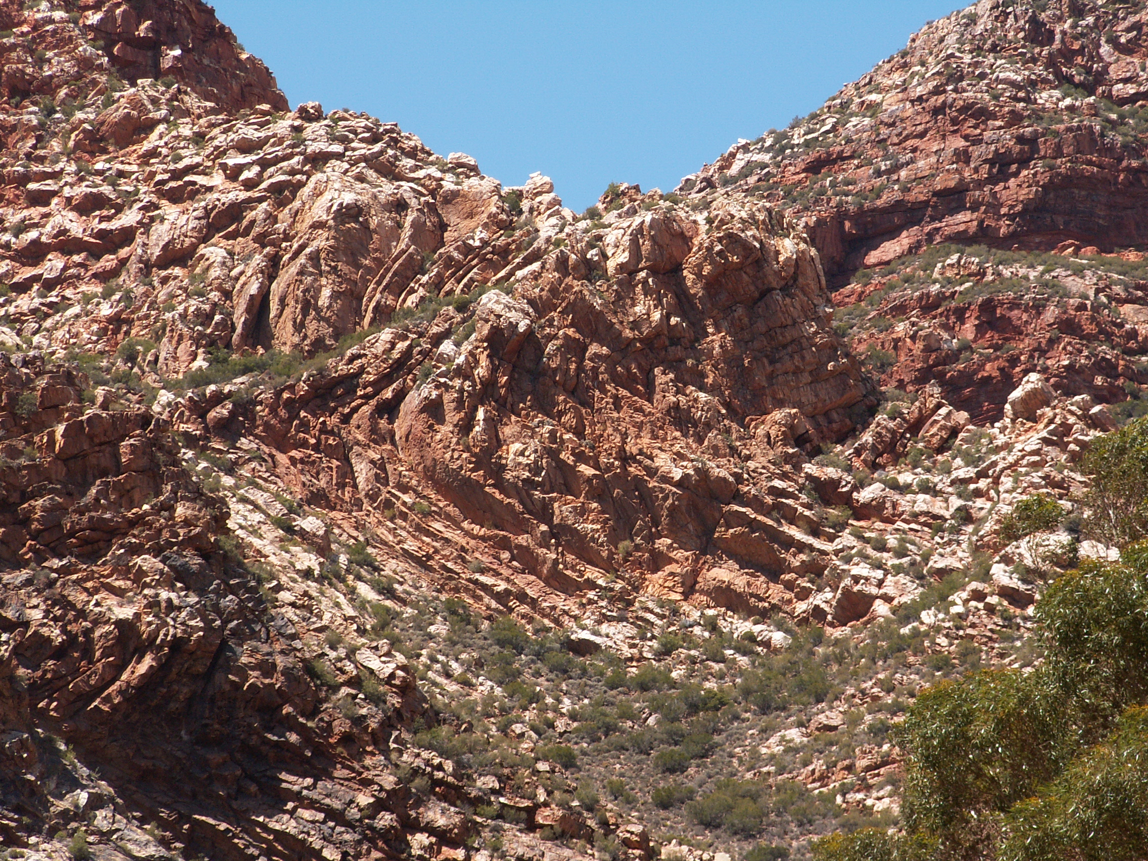
The rocks of the Cape Fold Belt are primarily sandstones and shales, and the difference between them determines the shape of the modern landscape. The erosion-resistant sandstones of the Peninsula Formation, largely quartzitic, form the parallel mountain ranges visible today. The softer shales of the Bokkeveld Group have weathered into the valley floors between them. This differential erosion has been going on for hundreds of millions of years, and the results are dramatic. The Cape Flats, that 50-kilometre-wide plain of dune sand connecting the Cape Peninsula to the mainland, sits where an entire anticline mountain once stood, its soft Malmesbury shale and granite foundation ground down to nothing. The highest surviving peak in the belt is Seweweekspoortpiek, which reaches 2,325 metres, a modest summit that hints at far greater ancestors.
A Parade of Ranges
From the Cederberg in the north to the Zuurberge in the east, the Cape Fold Belt comprises more than two dozen named mountain ranges spanning 850 kilometres of coastline. Their Afrikaans names read like a poem of the landscape: Langeberg, the 'long mountain'; Swartberge, the 'black mountains'; Hex River Mountains, the 'witch river mountains'; Riviersonderend, the 'river without end.' Indigenous names survive too: Outeniqua means 'place of honey,' Tsitsikamma means 'place of much water,' and Kouga preserves an aboriginal word whose original meaning is lost. Each range belongs to one of several geological groups. Most are Table Mountain Group sandstone, the hardest and most erosion-resistant rock in the system, but the Skurweberge, Witteberge, and Zuurberge belong to the softer Witteberg Group. The Cederberg, famous for its wind-sculpted caves and rock formations, owes its fantastic shapes to the softer Upper Peninsula Formation above the Pakhuis tillite layer.
The Belt That Built South Africa
The Cape Fold Belt did not merely shape the geography of southern Africa; it shaped its history. These mountains formed the barrier that separated Cape Town from the interior, blocking colonial expansion for decades and forcing the construction of engineering marvels like the Hex River Tunnels. The Karoo, that vast semi-arid basin to the north, was filled with sediments eroded from the original fold mountains, creating the 6-kilometre-thick Beaufort deposits that now underlie some of the country's most productive farmland. The mountains themselves create rain shadows and microclimates that support the Cape Floristic Region, one of the six floral kingdoms on Earth and the smallest, yet richest per unit area. Today, the folds remain buried beneath Karoo rocks as far as 150 kilometres north of their surface exposures, a hidden geological foundation that drilling has confirmed extends far beyond what the eye can see.
From the Air
Coordinates: 33.40S, 22.00E (approximate center of belt). The Cape Fold Belt is a dominant terrain feature visible from any altitude, running along South Africa's western and southern coastlines from the Cederberg (roughly 32S, 19E) to Port Elizabeth (roughly 34S, 26E). Parallel mountain ranges are clearly visible from cruising altitude, with the Swartberg and Outeniqua ranges particularly prominent. Nearest major airports: George Airport (FAGG) sits among the ranges; Cape Town International (FACT) lies at the belt's western terminus. Mountain weather can be severe; expect turbulence over the ridgelines.