Cape San Blas Light
Congress built it. The sea knocked it down. Congress built it again. The sea knocked it down again. For more than a century and a half, the Cape San Blas Light and the Gulf of Mexico waged one of the strangest wars in American maritime history, a cycle of construction, destruction, and bureaucratic hand-wringing that produced four separate lighthouses on a shifting spit of sand in the Florida Panhandle. The light was essential -- 120 miles of dark coastline separated Cape San Blas from Pensacola, and the treacherous shoals extending from the cape had been claiming ships since the colonial era. But the cape itself refused to hold still.
Built to Fall
The first Cape San Blas Light was completed in 1849, funded by an $8,000 Congressional appropriation made two years earlier. The customs collector at Apalachicola selected the site with the help of two experienced pilots, declaring it "entirely secure from overflow or inundation." He was wrong. The lighthouse fell down during a gale on August 23-24 of 1851, just two years after it was lit. Congress appropriated $12,000 to rebuild, and the second tower was completed in 1856. It stood for a few months before a severe storm on August 30, 1856, destroyed it utterly. The Lighthouse Board reported that the sea rose so high that waves struck the keeper's dwelling floor, elevated well above the ground. A lagoon now occupied the site of the lighthouse. Congress tried a third time in 1857, appropriating $20,000. This tower was first lighted with a third-order lens on May 1, 1858.
War, Sand, and Stubbornness
The Civil War interrupted the light's service. In 1862, Union troops aboard the USS Kingfisher landed and inflicted serious damage, destroying the keeper's dwelling and tearing out the tower's door frames and sashes. Repairs were made and the light was re-exhibited on July 23, 1865. But the greater enemy was already at work. By 1869, the beach in front of the lighthouse was washing away. In 1875, the Lighthouse Board warned that the tower's base sat nearly at sea level, barely 150 feet from the water, on shifting sand. Congress appropriated $2,000 for protection in 1877; the Board had asked for $5,000. In 1879, the Board reported it was "impracticable to build a jetty for $2,000 that can protect the site from the encroachment of the sea." By 1881, the tower's base stood in the water. Brush mattresses pinned to the sand with iron screw piles were torn to pieces by the surf. On July 3, 1882, the third tower was overthrown and completely destroyed.
The Iron Skeleton
The Lighthouse Board had learned its lesson -- or at least part of it. For the fourth attempt, authorized in 1883, the Board specified a skeleton iron tower that could be dismantled and moved if the sea encroached again. Two keepers' dwellings were erected alongside it, and the light was first displayed on June 30, 1885, showing alternate red and white flashes at thirty-second intervals. The precaution proved necessary almost immediately. By 1887, the sea had washed away a third of the 300-foot buffer. By 1889, the Board predicted the remaining beach would vanish within four months. The recommended solution -- moving the tower to the inside of the peninsula near St. Joseph Bay -- was estimated at $20,000. Congress delayed. By 1890, the tower stood just feet from the high-water mark. The appropriation finally came, but legal proceedings to acquire the new site dragged on until an 1894 gale extinguished the light and wrecked the keeper's dwelling, leaving the tower standing in the water.
A Lighthouse on the Move
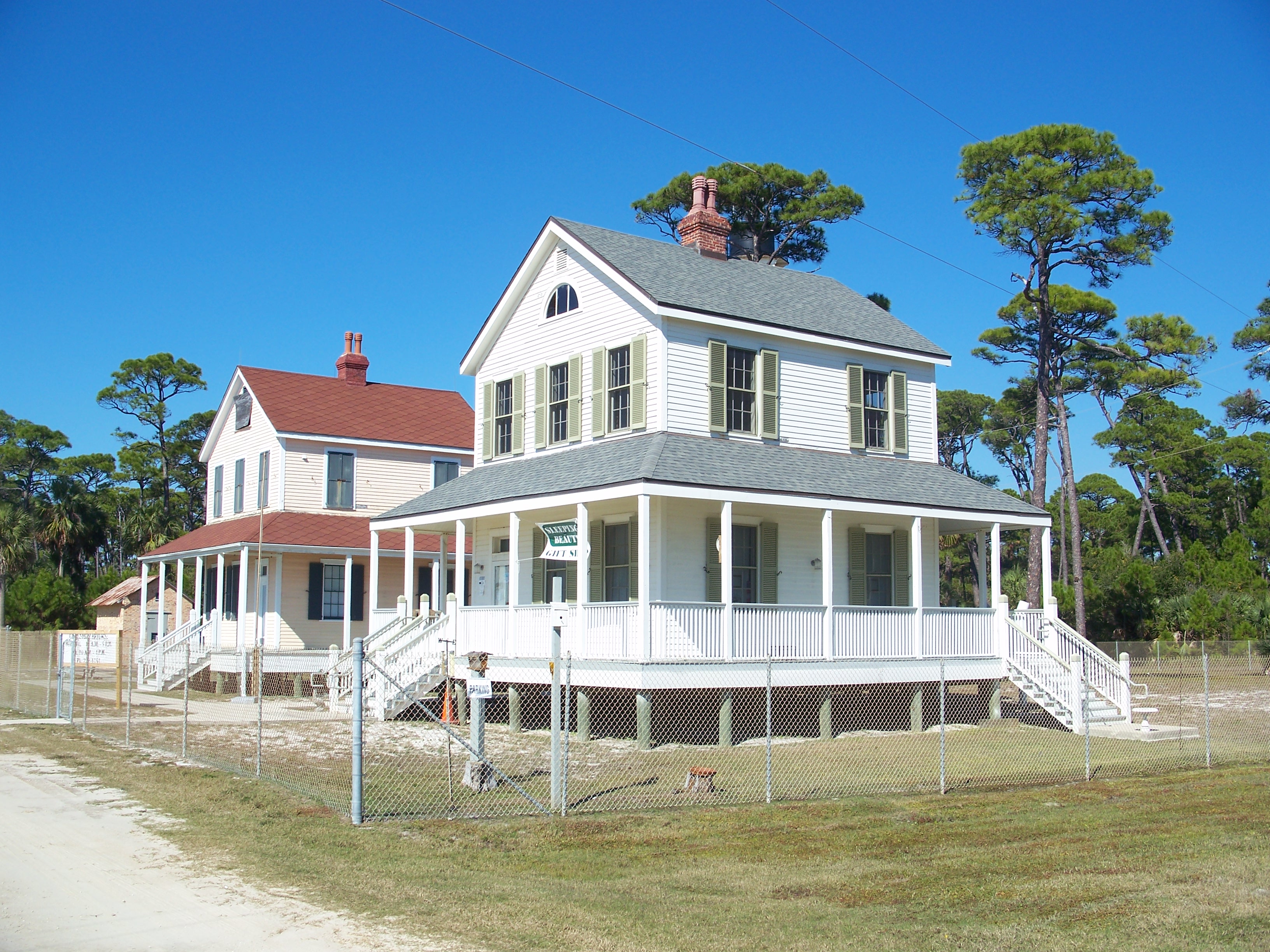
What followed was decades of relocation drama. In 1895, the station was ordered moved to Black's Island in St. Joseph Bay. Dismantling began in February 1896 but stopped in April when the money ran out. The keepers' houses had been moved and three-fourths of the foundation work completed. Congress appropriated $4,500 more in June 1897. But by then the light had been reestablished in the old tower, now standing in water at the cape's south point. In 1899, the Board changed its mind and proposed a shell ridge site instead. By 1901, the beach had paradoxically built back out, putting 100 feet between the tower and the shore. The Board considered simply staying put. Two keepers' dwellings were built at the old site in 1905 using money originally appropriated for the move. The tower finally relocated in 1919, a quarter mile north, to land the President reserved for lighthouse purposes. The Black's Island reservation was sold in 1923.
Carried to Safety at Last
The pattern continued into the modern era. As of June 2012, the Cape San Blas Light had been added to the lighthouse Doomsday List, a catalog of historic lights threatened by erosion. Hurricane Isaac in August 2012 narrowed the buffer to just fifty feet. This time, instead of waiting for the sea to win, the community acted. On July 15, 2014, the iron skeleton tower and two keepers' quarters were loaded onto a convoy stretching over 900 feet long and two lanes wide, then driven from the Gulf shores of Cape San Blas to George Core Park in Port St. Joe. Power lines and a traffic light had to be moved to let the procession pass. The lighthouse opened to visitors on September 12, 2014. On May 7, 2015, the Cape San Blas Lighthouse District was listed on the National Register of Historic Places -- a formal acknowledgment that this light, built and rebuilt and toppled and moved for over 160 years, had finally found ground that would not shift beneath it.
From the Air
The lighthouse now stands at George Core Park in Port St. Joe, Florida, at approximately 29.813N, 85.307W. The original Cape San Blas site is at the tip of the narrow peninsula extending south into the Gulf of Mexico, clearly visible from the air as a thin sandy spit. The nearest commercial airport is Northwest Florida Beaches International Airport (KECP) in Panama City, approximately 35 nautical miles to the northwest. Approach from the Gulf side at 1,500-2,000 feet AGL for the best view of both the cape's dramatic erosion and the lighthouse's current home in Port St. Joe. St. Joseph Bay, visible to the east of the cape, played a central role in the lighthouse's relocation history.