Cappadocia: The Underground Cities That Hid 20,000 People
Beneath the fairy chimneys of Cappadocia lies another world. Starting around 1200 BC, people began carving into the soft volcanic tuff, creating underground cities that eventually reached eight stories deep. Derinkuyu, the largest, could shelter 20,000 people with their livestock. These weren't crude caves - they contained churches, schools, wine presses, and ventilation shafts. For three thousand years, when invaders swept across Anatolia, entire populations vanished underground, rolling massive stone doors into place and waiting out the danger. The cities were so well hidden that they remained unknown to the modern world until 1963.
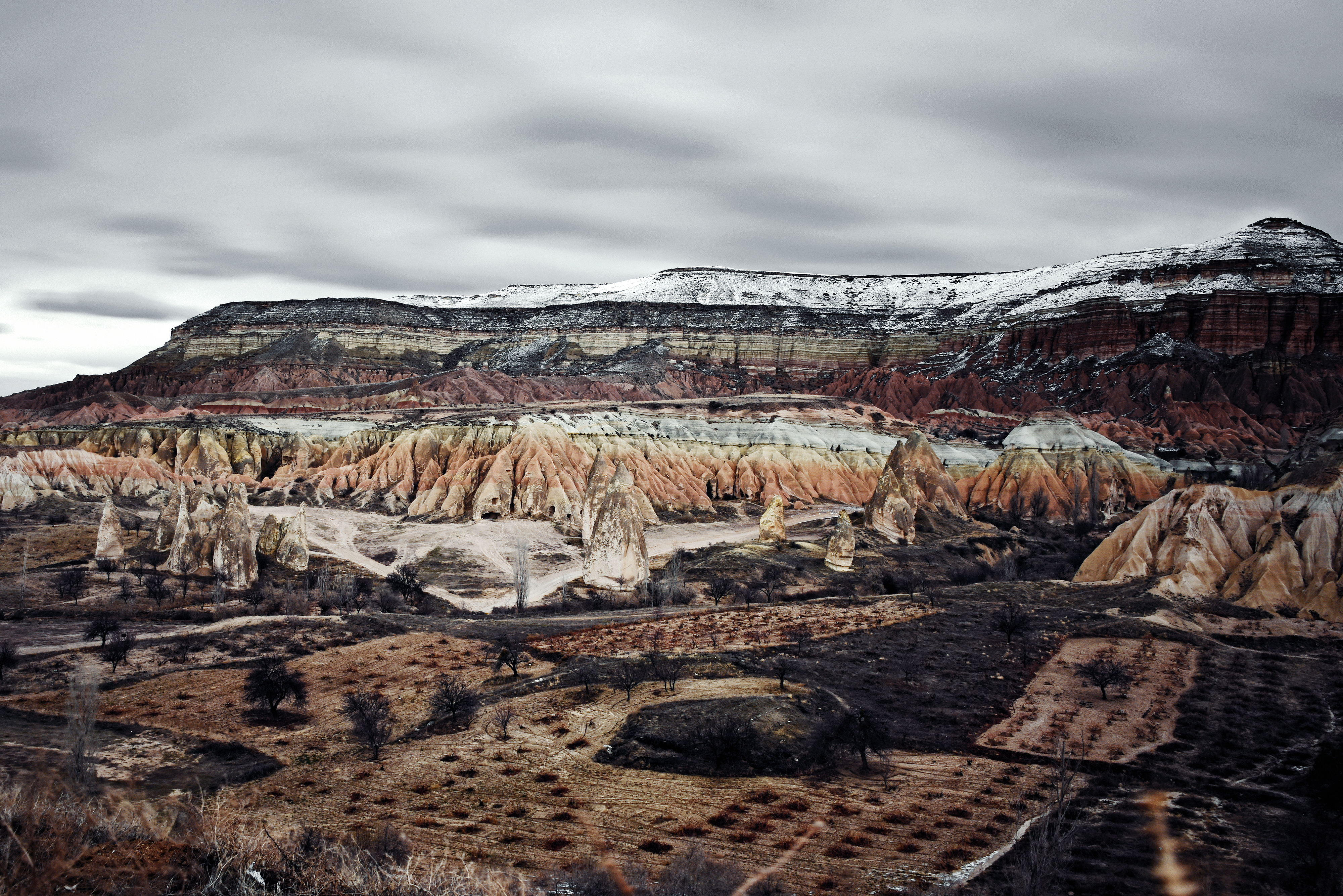
The Rock
Cappadocia's landscape was created by volcanic eruptions millions of years ago. Ash compacted into tuff - rock soft enough to carve with hand tools but hard enough to support massive structures. Wind and water eroded the surface into surreal formations: fairy chimneys, pillars, and honeycomb cliffs.
The ancient Hittites discovered they could dig into this rock. What started as storage rooms became homes, then communities, then cities. The tuff hardened when exposed to air, making carved spaces more durable over time. The deeper they dug, the more stable the temperature - a constant 55°F regardless of season.
The Cities
Over 200 underground cities have been discovered in Cappadocia, with 36 having three or more levels. Derinkuyu is the deepest - eight stories reaching 280 feet below ground. Kaymakli is the widest, with tunnels stretching for miles. Some cities connected via underground passages several kilometers long.
The engineering was sophisticated. Ventilation shafts provided fresh air to the deepest levels. Water wells reached aquifers. Each level could be sealed with circular stone doors weighing up to 1,000 pounds, rolled from the inside. Small holes in the doors allowed defenders to spear attackers. The cities were designed for siege.
The Refugees
The cities served one primary purpose: hiding. When enemies appeared on the horizon, entire villages disappeared underground with their animals, food stores, and valuables. They could survive for months.
The Hittites fled from Phrygian invasions. Early Christians hid from Roman persecution. Byzantines escaped Arab raids. Greeks sheltered from Mongol hordes. The underground cities saw continuous use from the Bronze Age through the early 20th century. During the Ottoman period, Greek Christians still retreated underground during pogroms. The same passages protected people for three thousand years.
The Discovery
In 1963, a Derinkuyu resident knocked down a wall in his basement during renovation. Behind it, he found a tunnel. The tunnel led to another room, which led to another tunnel. Local authorities were called. What they discovered was an entire city hidden for centuries.
The underground complexes had been partially known to locals, who used upper levels as storage. But the full extent - eight stories, miles of passages, room for 20,000 - was a revelation. Archaeologists are still mapping the networks. Some tunnels remain unexplored. No one knows how many more cities wait to be found.
The Legacy
Today, Cappadocia is a UNESCO World Heritage Site. Tourists descend into Derinkuyu and Kaymakli, marveling at the churches and wine cellars carved from living rock. Hot air balloons drift over the fairy chimneys at dawn, passengers unaware that beneath them lies a hidden civilization.
Some caves have been converted into hotels. Others house restaurants and shops. The tradition of living in the rock continues, though now for comfort rather than survival. The underground cities stand as monuments to human ingenuity and the lengths people will go to survive - entire populations becoming invisible when the alternative was death.
From the Air
Cappadocia (38.64N, 34.83E) lies in central Turkey. Kayseri Erkilet Airport (LTAU) is 70km northeast. Nevsehir Kapadokya Airport (LTAZ) is 40km west. From the air, the fairy chimney formations are distinctive - thousands of cone-shaped pillars dotting the landscape. The underground cities are invisible from above, marked only by ventilation shaft openings. The area is high plateau (~1000m) with continental climate - hot dry summers, cold snowy winters.