Captain Jack's Stronghold
Fifty-one warriors against 329 soldiers. Zero Modoc deaths. Thirty-five soldiers killed. The First Battle of the Stronghold on January 17, 1873, announced to the United States Army that Captain Jack's volcanic fortress was unlike anything they had faced. For months, a band of 160 Modoc - including women and children - held this maze of lava tubes, crevices, and natural fortifications against a force that outnumbered them ten to one. The Stronghold stands today as a monument to one of the most remarkable resistance campaigns in American military history.
The Land They Knew
The Modoc chose this ground because it was theirs. Long before the California genocide began - when agents of the U.S. government and private citizens systematically killed thousands of indigenous Californians in the mid-19th century - the Modoc had hunted and lived in these lava beds near what is now Lava Beds National Monument. Kintpuash, known to settlers as Captain Jack, led his people to this ancestral territory after the Battle of Lost River in November 1872. The volcanic terrain that seemed hellish to Army soldiers was home to the Modoc: they knew every cave, every crevice, every sightline that could be turned into a defensive position.
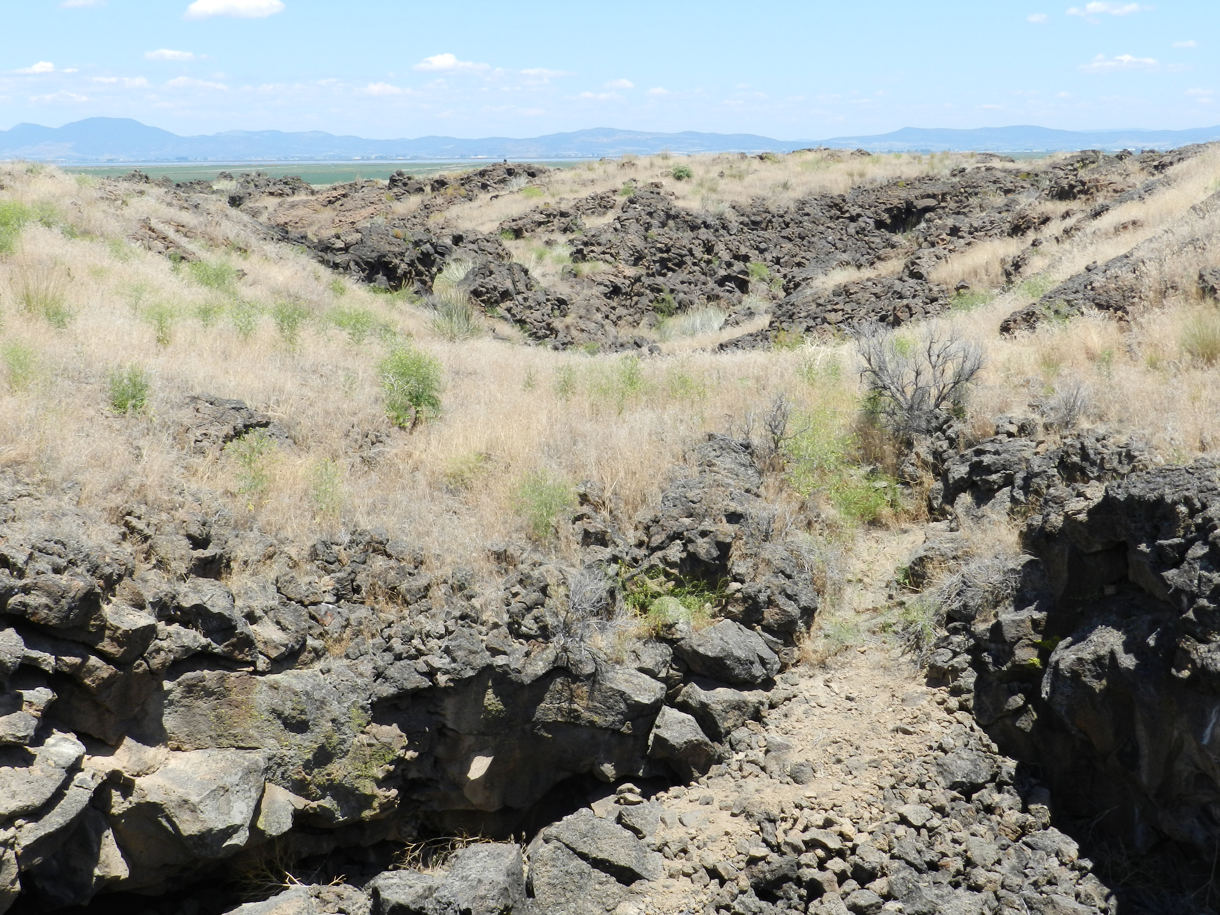
The Fortress in the Lava
The Stronghold's defenses were gifts of geology. Rough volcanic terrain slowed attackers to a crawl. Rocks provided ready-made fortifications. Irregular pathways allowed defenders to evade pursuit and appear where enemies least expected. Captain Jack positioned his 53 warriors across this natural maze while women, children, and elders sheltered in the lava tubes below. A spring provided water; Tule Lake provided additional resources. The Army would learn that numbers meant nothing in terrain where a handful of riflemen could hold off hundreds.
Humiliation in January
The First Battle of the Stronghold was a catastrophe for the U.S. Army. On January 17, 1873, a combined force of 225 regular soldiers and 104 Oregon and California volunteers assaulted Captain Jack's position. The Modoc defenders killed 35 attackers and wounded many more. Not a single Modoc warrior suffered death or serious injury. The battle exposed the gulf between conventional military tactics and guerrilla warfare in volcanic terrain. The Army retreated to regroup, and Captain Jack's legend grew.
The Spring Runs Dry
The Second Battle of the Stronghold in April 1873 succeeded where January's assault had failed - not through superior tactics, but through siege. Reinforced Army units captured the Stronghold's spring and cut off access to Tule Lake. One officer and six enlisted men died in the assault; thirteen were wounded. The only Modoc casualty was a boy killed when he tried to open an unexploded cannonball with an axe. Several Modoc women died from sickness during the siege. Without water, even the perfect fortress becomes a trap. On April 17, the Modoc slipped away through a crevice left unguarded during troop repositioning - one final demonstration of their knowledge of the land.
The Gallows at Fort Klamath
The escape bought weeks, not freedom. Over the following months, the band scattered and was hunted down. Captain Jack, John Schonchin, Black Jim, and Boston Charley were the last to be captured, surrendering on June 1, 1873. They were tried for the murder of General Edward Canby and Reverend Eleazer Thomas, killed at a peace parley in April. On October 3, 1873, all four were hanged at Fort Klamath. Canby remains the only U.S. general killed in the Indian Wars. Today, the Stronghold is California Historical Landmark #9, designated in 1932. The lava tubes and fortifications remain, silent witnesses to a people who refused to surrender their homeland without a fight.
From the Air
Located at 41.82N, 121.51W within Lava Beds National Monument, between Tulelake and Canby in northern California near the Oregon border. The volcanic terrain is distinctive from the air - dark lava flows, scattered caves and tubes, and the rugged landscape that made this natural fortress. Best viewed at 2,000-4,000 feet AGL. Tule Lake lies to the north. The Stronghold area includes interpretive trails accessible from the monument. Nearest airports: Tulelake Municipal (K33) approximately 10nm northeast, Klamath Falls (KLMT) approximately 40nm northeast.