Car Nicobar
Every village on Car Nicobar elects three captains from its council of elders -- the tuhet -- to manage daily affairs. It is a system that predates any colonial administration, and it persists alongside the Indian Air Force base, the Deputy Commissioner's office, and the hospital that cluster around the junction the islanders simply call Headquarters. This small, flat island at the top of the Nicobar chain manages to be both a military outpost and an indigenous homeland, a place where the literacy rate is 100 percent and the primary crop is still coconut.
The Northern Land of the Naked
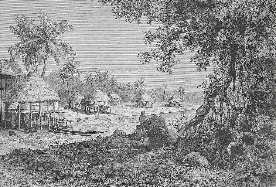
Ancient seafarers called these waters the domain of the nake, and the island at the chain's northern tip became Car Nakkavar -- a name that gradually softened into Car Nicobar. The Nicobarese people who live here call it Pu in the Car language. At just 126.9 square kilometers, the island is small compared to the Middle and South Andaman islands, but it punches well above its geographic weight. The 2011 census counted 17,841 residents, nearly half the entire Nicobar district's population, crammed onto less than seven percent of its total land area. Twenty-one villages dot the island, the largest being U-rek-ka -- known to outsiders as Malacca-Perka -- with a population of 4,200. The local names are in Nicobarese, and the bracketed tourist-friendly alternatives exist because outsiders find the originals difficult to pronounce.
Coconut Kingdom
From the air, Car Nicobar reads as an almost unbroken canopy of coconut palms interrupted by silvery beach. Unlike the central and southern Nicobar islands, which are dominated by evergreen forests, Car Nicobar has no significant native forest cover remaining. The coconut plantation is the landscape. Areca nut grows alongside it, and together they form the economic backbone of island life. The soil -- high in sand and clay -- resists most agricultural crops, so the islanders long ago adapted to what the ground would actually support. BirdLife International designated the island an Important Bird Area for its populations of restricted-range and threatened species. Nicobar sparrowhawks hunt through the palm groves. Nicobar serpent-eagles soar overhead. Andaman wood pigeons, Andaman cuckoo-doves, Andaman boobooks, white-headed starlings, and Nicobar green imperial pigeons all find habitat here, sharing the canopy with the human population below.
When the Wave Came
Car Nicobar lies 750 kilometers from the epicenter of the December 26, 2004 earthquake that tore along the Sunda Trench. The distance offered no protection. Witnesses reported waves as high as nine meters crashing into the island's low-lying coastline. By December 30, the casualty count remained unknown but was estimated to be high. One survivor described the aftermath to the Associated Press in terms that left no room for euphemism: "There's not a single hut which is standing. Everything is gone." The Indian government established relief programs -- temporary shelters, subsidized basic needs -- but rebuilding on a remote island with limited infrastructure takes years, not months. The Air Force base, built on slightly higher ground, became a critical staging point for relief operations across the entire Nicobar chain, its strategic military value suddenly repurposed for humanitarian necessity.
Outpost Between Oceans
The Air Force base evolved from a wartime airstrip the British laid down in the 1940s. The Indian Air Force later expanded it into a permanent staging installation for operations across the eastern seaboard and island territories, making Car Nicobar one of India's most forward-positioned military assets in the Bay of Bengal. The base anchors the island's administrative life -- the junction near it serves as the de facto town center with government offices, a bank, a post office, and shops. Getting here requires either a twice-weekly ship from Port Blair, 260 kilometers to the north, or a charter flight coordinated between the Andaman and Nicobar administration and the Air Force. Pawan Hans helicopter service also connects the island to Port Blair and other Nicobar islands. The tropical monsoon climate delivers about 2,600 millimeters of rain annually, with mean temperatures hovering between 23.8 and 31.4 degrees Celsius -- warm, humid, and perpetually green.
From the Air
Car Nicobar sits at approximately 9.17N, 92.75E, the northernmost island in the Nicobar chain. The island is remarkably flat at 126.9 square kilometers, easily identifiable by its uniform coconut palm canopy and silvery beaches. Car Nicobar Air Force Base (VOCX) occupies the island and is the primary aviation facility. Veer Savarkar International Airport (VOPB) at Port Blair lies 260 km to the north. The Ten Degree Channel separates Car Nicobar from Little Andaman to the north. Best viewed at 3,000-6,000 feet to see the flat terrain and the village layout.