Carr Fire
A steel rim scraped against hot asphalt on the afternoon of July 23, 2018, and sparks flew into the dry brush along Highway 299. Within days, the Carr Fire would become a monster that no one could have predicted, forcing 38,000 people from their homes, claiming eight lives, and generating a terrifying phenomenon that scientists are still working to understand: a fire tornado with winds exceeding 140 miles per hour, equivalent to an EF3 tornado. The blaze that began from a blown tire on a travel trailer would ultimately burn over 229,000 acres and cost more than $1.6 billion before firefighters could contain it.
Sparks to Inferno
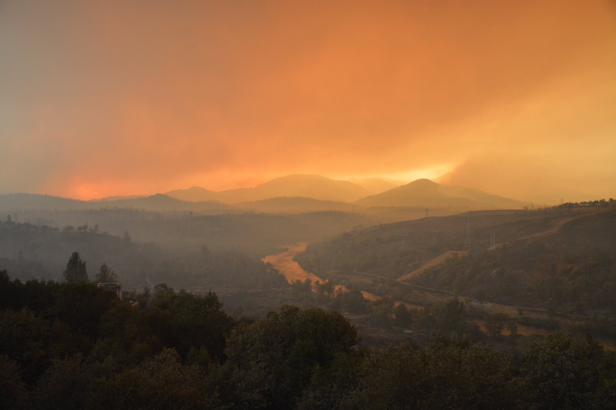
The fire's origin story reads like a cruel twist of fate. A family towing a dual-axle travel trailer through the Whiskeytown district of the Whiskeytown-Shasta-Trinity National Recreation Area suffered a tire blowout. The bare steel rim struck the pavement, throwing sparks into vegetation already parched by California's punishing summer heat. Wind seized those sparks and ran with them. By July 26, the fire had jumped the Sacramento River and was advancing on Redding, the largest city in Shasta County. The terrain worked against firefighters at every turn: steep slopes, inaccessible canyons, and temperatures that turned the landscape into kindling. Communities fell like dominoes under evacuation orders: French Gulch, Keswick, Lewiston, Shasta Lake City. The National Guard mobilized. President Trump declared a state of emergency.
The Fire Whirl
What happened on the evening of July 26 entered scientific literature and nightmare territory simultaneously. As the fire raged through western Redding, atmospheric conditions aligned to create a fire whirl of unprecedented power. For thirty minutes, from 7:30 to 8:00 p.m., a vortex of flame and wind tore through neighborhoods with the force of a major tornado. The National Weather Service later confirmed winds exceeding 143 miles per hour. The whirl reached heights of 18,000 feet, powered by a pyrocumulonimbus cloud that extended to 39,000 feet, and scoured the ground clean in areas the flames never touched. Three members of one family died when the tornado-like force blew out the walls of their home and collapsed the roof upon them. Other homes lost roofs to wind alone. Scientists had documented fire whirls before, but nothing like this: a rotating column of destruction that defied the boundaries between weather and wildfire.
The Human Toll
Eight people lost their lives to the Carr Fire, and each death tells a story of the chaos that unfolded. Contract firefighter Donald Ray Smith died operating a bulldozer, trying to carve containment lines into impossible terrain. Fire inspector Jeremy Stoke of the Redding Fire Department perished while documenting the fire's behavior. Three Marin County firefighters sustained burns defending a structure when a heat blast roared toward them. Civilian casualties included those who refused or could not evacuate in time. When Shasta College's evacuation center reached capacity on July 28, the Red Cross scrambled to open additional shelters. Celebrity chef Guy Fieri, who calls Redding home, arrived to cook for evacuees. The community drew together even as the flames continued their march.
Aftermath and Recovery
By August 30, firefighters declared the Carr Fire 100 percent contained at 229,651 acres. The destruction was staggering: 1,604 structures reduced to ash, including more than a thousand homes, with another 277 damaged. Historic buildings at Shasta State Historic Park fell to the flames, though staff had evacuated artifacts in time. The fire's cost exceeded $1.659 billion, including $1.5 billion in insured losses and over $158 million in suppression costs. For the historic town of French Gulch, it marked the second evacuation due to fire in just fourteen years. The Carr Fire Pet Rescue and Reunification network formed to help reconnect families with animals lost in the chaos of evacuation. Governor Jerry Brown toured the devastation and secured a federal disaster declaration for Shasta County.
Lessons in Flame
The Carr Fire joined an unwelcome roster of California's most destructive blazes, ranking among the worst in the state's recorded history. It arrived during a particularly brutal fire season that included the Hirz Fire, Delta Fire, and the Camp Fire, which would become the most destructive wildfire California had ever recorded. The fire whirl that devastated Redding pushed scientists to rethink what wildfires could become under extreme conditions. Fire behavior experts continue to study the meteorological and topographical factors that created that terrifying vortex. The Carr Fire stands as a reminder that disaster can spark from the most mundane moment: a tire giving way, metal meeting road, and dry brush waiting for any excuse to burn.
From the Air
The Carr Fire burn scar is visible at 40.64N, 122.52W in the hills northwest of Redding, California. From 8,000 feet, you can trace the fire's path from the Whiskeytown-Shasta-Trinity National Recreation Area toward Redding. The Sacramento River, which the fire jumped, glints below. Redding Municipal Airport (KRDD) lies 5 nautical miles southeast. Best viewed in clear weather; smoke from seasonal fires may reduce visibility. The terrain reveals why containment proved so difficult: steep ravines and dense forest stretching into the Klamath Mountains.