Carthage Punic Ports
From the air, they look like nothing much: two small lagoons in the Carthage suburbs, one circular, one rectangular, connected by a narrow channel. Visitors who see them for the first time often wonder how these modest bodies of water could possibly be the ports that launched the fleet of Rome's greatest enemy. Yet British and American excavations confirmed what the ancients described: the circular lagoon was Carthage's military harbor, capable of sheltering up to 220 warships, while the rectangular basin served as the commercial port that funneled goods from across the Mediterranean into the city the Phoenicians called Qart Hadasht -- the New City.
An Empire of the Seas
Carthage was, first and foremost, a thalassocracy -- a power whose strength rested on control of the sea. Founded around 814 BC by Dido, daughter of the king of Tyre, the city sat at the hinge between the eastern and western Mediterranean basins, perfectly positioned to dominate maritime trade. The Phoenicians who established it did not choose the location by chance. The promontory of Sidi Bou Said provided shelter from storms, the peninsula between Lake Tunis and the Sebkha Ariana offered natural defense, and the successive hills of the interior formed a defensive line. For a civilization that "lived by and for the sea," as ancient sources put it, the ports were not merely infrastructure -- they were the heart of the city's identity and the engine of its wealth.
The Lost First Harbor
The ports visible today date to Carthage's final centuries, roughly the 2nd century BC. But what about the preceding five hundred years? The location of Carthage's original harbor remains one of the great unsolved puzzles of Punic archaeology. American excavations uncovered traces of a canal, followable for about 400 meters, that functioned until it was filled in during the 4th century BC. Historian Serge Lancel documented that Lake Tunis stood significantly higher in antiquity and suggested its shores served as early refuge for shipping. The canal may have been a "line of penetration" into the city's interior, with naval dockyards, warehouses, and temples -- the emporium -- lining its edges. The original port likely sat near the area of the tophet of Salammbo, in what was then marshy, unhealthy ground closer to the coast.
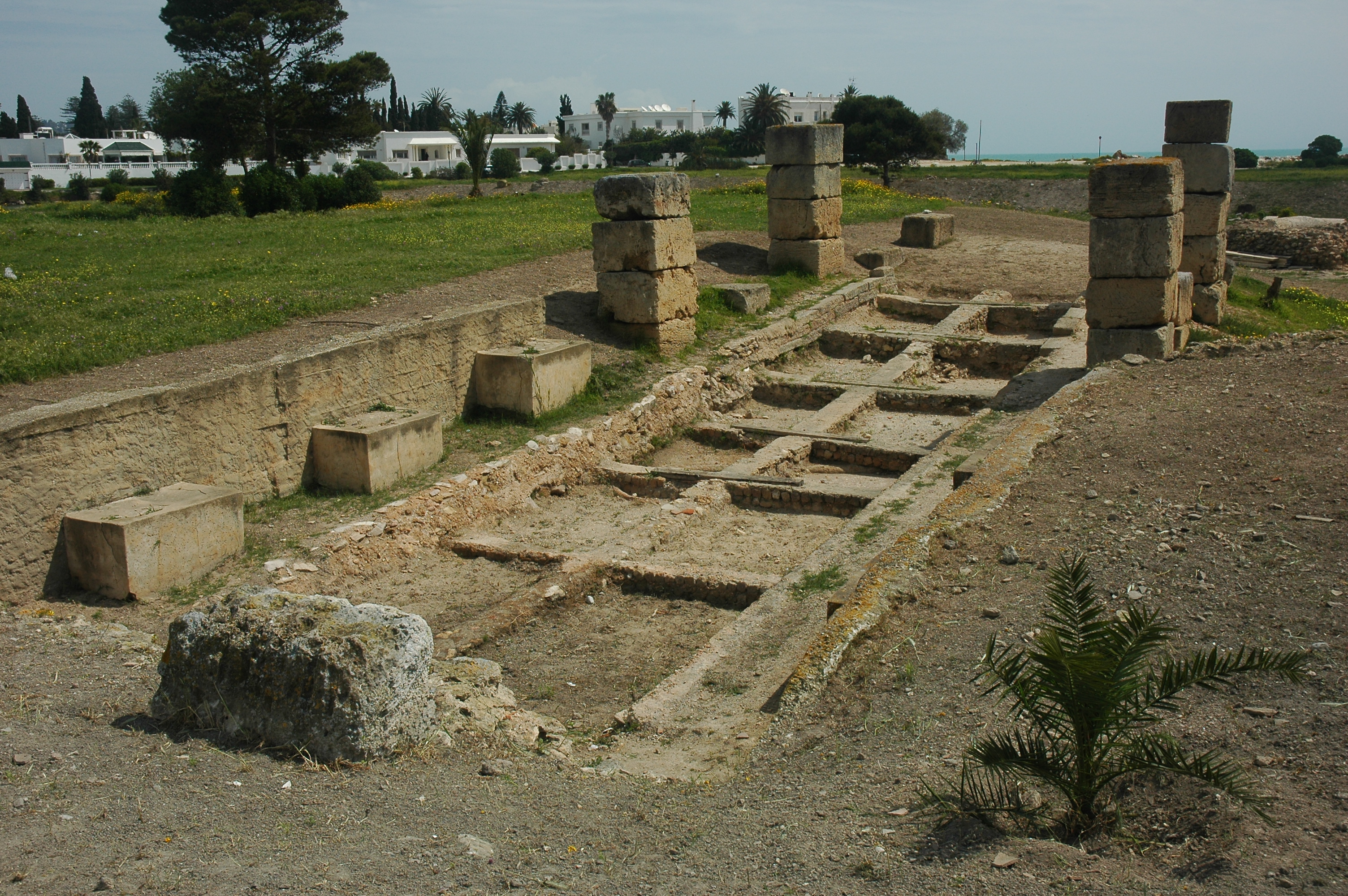
The Admiral's Island
British excavations in the 1970s revealed the military port's remarkable engineering. The circular lagoon contained a central islet -- the Admiralty Islet -- where the navarch, or fleet commander, maintained his headquarters. Ramps of beaten earth, slightly sloped, served as dry docks for wintering warships. Archaeological remains allowed researchers to extrapolate the port's capacity: 30 ship berths on the circular islet and 135 to 140 around the perimeter, totaling 160 to 170 berths. Each may have accommodated two rows of ships. In the islet's center stood an open space adjacent to a tower -- likely the navarch's tower described by the ancient historian Appian. Below the berths were storage rooms for naval equipment. The word Appian used for these harbors was cothon, a Semitic term for an artificial basin cut by human hands.
Commerce and Connection
The rectangular commercial port, roughly twice the size of the military basin at about sixteen hectares, connected to the sea through a channel that emptied into what is now Kram Bay. American excavations found the remains of a dock dating from the second half of the 3rd century BC, along with port facilities including additional docks and hangars. A foreshore area, identified by the 19th-century Danish archaeologist Falbe as a large quadrilateral structure, served as a breakwater and cargo-handling space. It was here, according to Appian's account, that goods were unloaded and stored, protected from the prevailing winds. The mercantile activities of this port were so vital that even under Roman control, the commercial harbor of Carthage remained essential for provisioning Rome itself.
The Final Assault
The organization of the ports in their last phase was so ambitious that it effectively broke the peace treaty signed in 201 BC -- the scale of the military harbor alone made clear that Carthage was rebuilding its naval power. Located at the city's southern end, the ports were protected by walls lighter than those defending the isthmus, because the Carthaginians were confident no enemy could attack from the sea. This confidence proved fatal. In 146 BC, the Roman general Scipio Aemilianus launched his final assault precisely through the harbor quarter. His forces set fire to the berths in the eastern commercial port, seized the military harbor, and threatened the agora, precipitating the fall of Byrsa hill and the destruction of the city. The ports that had built Carthage's empire became the corridor through which that empire ended.
From the Air
The Punic ports are located at 36.845°N, 10.325°E in the southern part of the Carthage archaeological zone. From altitude, the circular military port lagoon and rectangular commercial port lagoon are clearly distinguishable, connected by a narrow channel and surrounded by residential development. The Admiralty Islet is visible in the center of the circular lagoon. Tunis-Carthage International Airport (DTTA) lies approximately 2 km to the southwest. Best viewed at 1,500-3,000 feet for the clearest view of the two basins and their relationship to the coastline.