Caspian Iran: Where the Desert Nation Turns Green
Most people picture Iran as arid - a country of deserts and dry plateaus stretching endlessly under a harsh sun. Caspian Iran shatters that assumption. Fly north over the Alborz Mountains from Tehran, and the landscape transforms in minutes: brown gives way to green, dry scrub to dense broadleaf forest, and the vast inland sea appears on the horizon like a mirage that turns out to be real. The three provinces of Gilan, Mazandaran, and Golestan share this narrow coastal strip, and the people who live here have always been a little different from the rest of Iran - speaking their own languages, cooking with fish instead of lamb, and living under clouds that would feel more familiar in the Pacific Northwest than in the Middle East.
The Forest That Predates the Ice Ages
The Hyrcanian forests that blanket these coastal mountains are among the oldest on Earth. Named for the ancient region of Hyrcania, they survived the last ice age when glaciers scoured Europe bare, making them a living relic of forests that once covered much of the temperate world. UNESCO recognized them as a World Heritage Site for exactly this reason - they are a refugium, a place where species persisted when they vanished elsewhere. Walking beneath the canopy of Caspian ironwood, Persian oak, and Oriental beech, you are standing in a forest whose lineage stretches back twenty-five to fifty million years. The trees drip with moisture from clouds that pile against the Alborz barrier, dropping their rain on the northern slopes before passing dry over Tehran.
A Babel of Tongues
Persian is the lingua franca, but it is nobody's first love here. In Gilan, people speak Gilaki. In Mazandaran, they speak Mazanderani - a distinct language that locals confusingly also call Gilaki, though linguists insist otherwise. In Golestan Province, particularly around Gonbad and Bandar Torkaman, Turkmen dominates. This linguistic richness reflects the region's history as a crossroads where Turkic, Persian, and Caucasian cultures have overlapped for centuries. The differences run deeper than vocabulary. Each province has its own cuisine, its own folk music, its own relationship with the sea and the mountains. Gilan is known for its rice paddies and distinctive architecture; Mazandaran for its tea plantations and thermal springs; Golestan for its steppe grasslands and nomadic heritage.
Monuments in Brick and Stone
The Gonbad-e Qabus tower rises 53 meters above the city of Gonbad in Golestan Province - the tallest pure-brick tower in the world. Built in 1006 CE as a tomb for the Ziyarid ruler Qabus ibn Voshmgir, it has stood for over a thousand years, its cylindrical form tapering to a conical roof that seems almost modern in its clean geometry. UNESCO designated it a World Heritage Site. Not far away lie the remains of the Great Wall of Gorgan, one of the longest defensive walls ever built, third only to the Great Wall of China and the Cheolli Jangseong of Korea. Stretching roughly 195 kilometers, this Sasanian-era fortification once guarded the empire's northeastern frontier against nomadic incursions from the steppe. Most visitors to Iran never see either monument. They should.
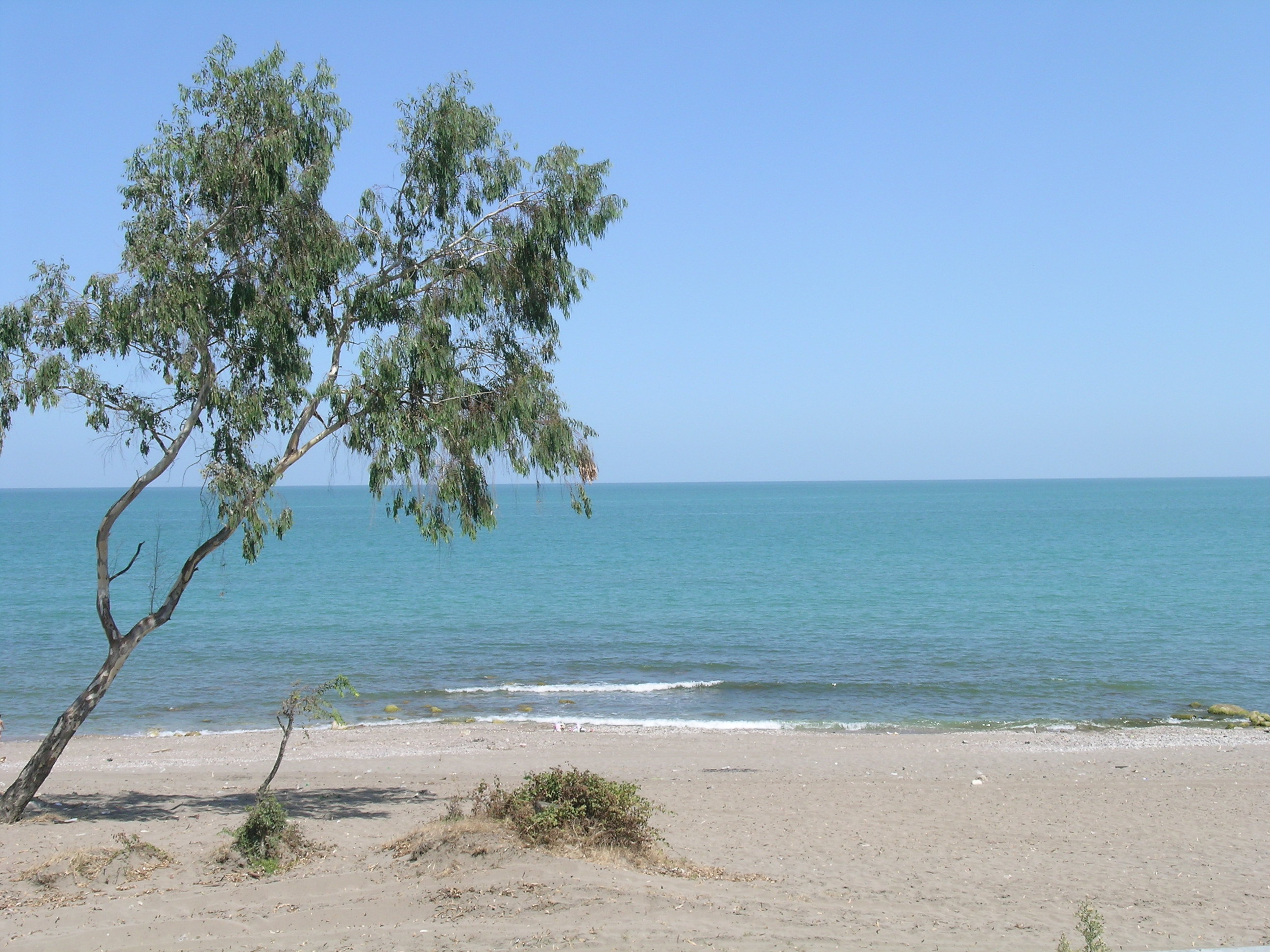
The Sea That Is Not a Sea
The Caspian is the world's largest enclosed body of water - technically a lake, though its size, saltiness, and depth make the distinction feel absurd. On the Iranian shore, the beaches are popular summer destinations for Tehranis escaping the capital's heat and smog. The coastal towns of Ramsar, Nowshahr, and Chalus fill with vacationers during holidays, the roadways between them choked with traffic. Ramsar is famous for its mineral water springs, some warm and some cold, scattered through the forested valleys south of town. The Caspian sturgeon that once made this coast synonymous with caviar has declined sharply, but fishing remains central to the local economy and identity. A meal here revolves around fish - grilled, smoked, or stewed - accompanied by salads, yogurt, olives, and the wide flatbread called barbari.
Over the Mountains
The Alborz range that separates Caspian Iran from the interior plateau is both wall and gateway. Historically, crossing these mountains was a serious undertaking - the roads wind through steep valleys and narrow passes where weather could turn deadly. The Trans-Iranian Railway, one of the great engineering feats of the twentieth century, threads through this barrier via tunnels and bridges, including the famous Veresk Bridge that soars 110 meters above a valley floor. Today, highways connect Tehran to the coast, but the journey remains dramatic: you climb from the dry central plateau into clouds, through tunnels bored through rock, and emerge into a different climate entirely. The contrast between the two sides of the mountains - one dry, dusty, and sun-bleached, the other misty, green, and dripping with rain - is as stark as any border between nations.
From the Air
Located at 36.00°N, 53.00°E along the southern shore of the Caspian Sea. From altitude, the contrast between the arid Iranian plateau to the south and the lush green Caspian coast to the north is immediately striking, with the Alborz Mountains forming a sharp dividing line. The coastal plain is narrow and densely settled. Major airports include Rasht (OIGG), Ramsar (OINR), Sari (OINZ), and Gorgan (OING). The Caspian Sea stretches north like an ocean. Best viewed on clear days when the Alborz peaks, some exceeding 4,000 meters, frame the green lowlands against the blue water.