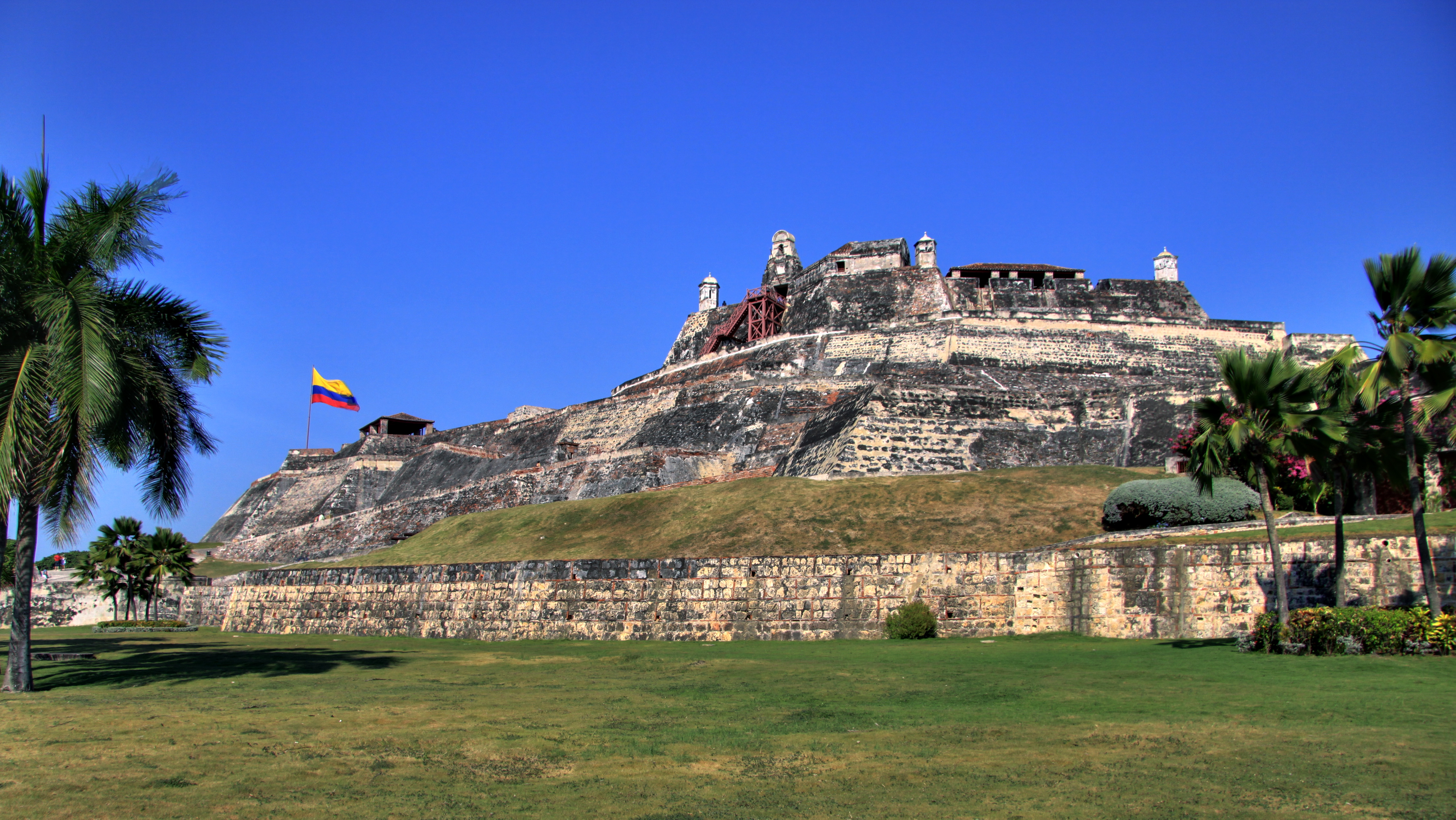
Castillo San Felipe de Barajas
Admiral Blas de Lezo had already lost his left leg at fifteen, his left eye at twenty-four, and his right arm at thirty-one -- injuries accumulated across decades of naval combat that earned him the nickname Mediohombre, Half-Man. In March 1741, he stood atop the Castillo San Felipe de Barajas with roughly 3,600 soldiers and 600 militia, watching 186 British warships fill the horizon off Cartagena. Admiral Edward Vernon had assembled the largest naval expedition in history to that date: nearly 24,000 troops, including 4,000 colonial militia from the American colonies. Vernon was so confident of victory that he had already commissioned commemorative medals declaring Cartagena taken. He was wrong.
A Hill Named for the Sick
The fortress rises from the Hill of San Lazaro, named for a nearby leper hospital, dominating every approach to Cartagena by land or sea. Construction began in 1536 and the main fort was expanded between 1639 and 1657, built into a triangular shape with eight batteries and a garrison of 200 soldiers. The labor was performed by enslaved Africans under Spanish supervision -- the hands that shaped every wall, cut every tunnel, and laid every stone belonged to people who would never enjoy the fortress's protection. The castle took its name from Philip IV of Spain, and its design reflected a single obsession: making itself impossible to capture piecemeal. Each battery and parapet protected its neighbors, so that no attacker could take one position without overcoming the entire defensive system.
The Battle That Humbled an Empire
Vernon's 1741 assault should have been a foregone conclusion. The British force outnumbered the defenders roughly six to one. But Lezo understood his fortress. He used its interconnected tunnels to move troops invisibly between positions, launching surprise counterattacks that threw the British off balance. The narrow approaches funneled Vernon's numerical superiority into killing grounds where the castle's 68 guns could concentrate their fire. After weeks of bloody fighting, Vernon withdrew with catastrophic losses -- an estimated 18,000 casualties, making it one of Britain's worst military defeats before the twentieth century. Those commemorative medals became an enduring embarrassment. Lezo himself died of wounds and plague shortly after the battle, never knowing the full scale of his victory.
Stone and Shadow Underground
Walk through the castle today and you descend into a maze of tunnels that honeycomb the hill. The main underground gallery runs along the perimeter at sea level, with chambers that could be deliberately collapsed to bury attackers advancing overhead. Channels and breakwaters managed the torrential Caribbean rains, while cisterns called aljibes stored drinking water for prolonged sieges. The tunnels were engineered so that whispered conversations carried clearly from one end to the other -- an acoustic feature that let defenders detect approaching sappers. Above ground, the batteries of Santa Barbara, San Carlos, the Apostles, the Hornabeque, the Cruz, the Redencion, and San Lazaro ringed the hilltop in overlapping fields of fire.
Centuries of Neglect, Then Recognition
After the wars of independence swept through South America in the early nineteenth century, the fortress lost its military purpose. Tropical vegetation swallowed the battlements. Soil filled the tunnels and trenches. For decades, one of the most significant military structures in the Western Hemisphere lay quietly disintegrating under vines and rain. In 1984, UNESCO listed the castle alongside Cartagena's historic center as a World Heritage Site. Since 1990, the Colombian government has used the fortress to host presidential summits and diplomatic events, including the Summit of the Non-Aligned Movement in 1995 and the Summit of the Rio Group in 2000. Today visitors can explore parts of the tunnel network, though much of the labyrinth remains closed.
The Fortress from Above
From the air, the Castillo San Felipe de Barajas reveals its strategic logic in a way the ground never can. The triangular central fort crowns the hill, its star-shaped batteries radiating outward like the points of a compass rose, each one covering the blind spots of its neighbors. The hill itself rises 41 meters above sea level -- modest by mountain standards, commanding by coastal ones -- and the old approach causeways trace lines across the flat terrain that make the funneling effect of the defenses immediately legible. To the west, Cartagena's walled old city clusters around its harbor. To the east, the modern city sprawls. Between them, the castle sits as it has since the seventeenth century: watching every direction at once.
From the Air
Located at 10.4222N, 75.5381W on the Hill of San Lazaro, east of Cartagena's walled old city. The triangular fortress and its radiating batteries are clearly visible from altitude. Rafael Nunez International Airport (SKCG) lies approximately 2.5 nautical miles to the north-northeast. Best viewed at 2,000-4,000 feet AGL, where the star-shaped battery layout and tunnel entrances become visible against the surrounding green hillside. Cartagena Bay to the west and the modern city to the east provide strong visual references.