Castlewood Canyon State Park
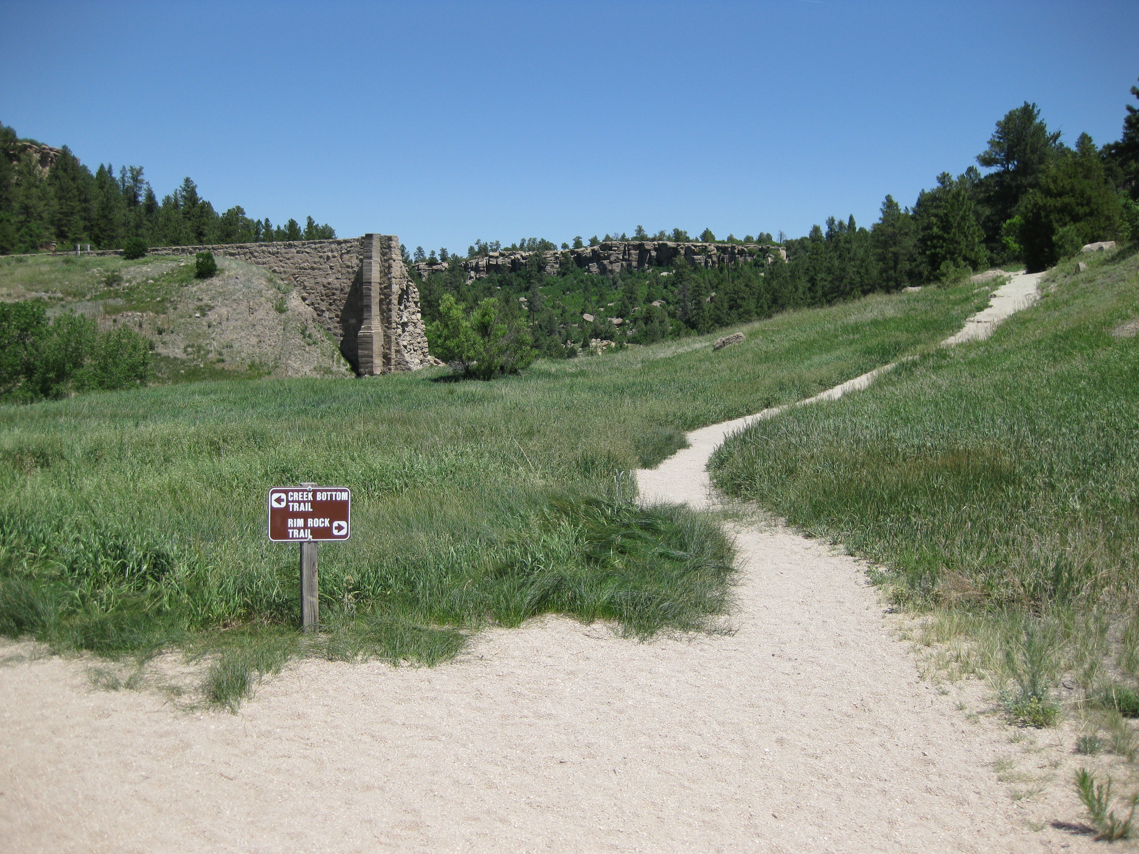
The concrete ruins jut from the canyon walls like broken teeth, moss-covered and half-buried in sediment. In 1890, someone thought it was a good idea to dam Cherry Creek here in Castlewood Canyon. Forty-three years later, on the night of August 3, 1933, heavy rains proved them wrong. The dam collapsed at 1:00 a.m., sending a fifteen-foot wall of water rushing down Cherry Creek toward Denver, fifteen miles away. Today, visitors hiking through Castlewood Canyon State Park can still trace the damage left by that night, a dramatic centerpiece in a park that offers far more than its most famous catastrophe.
The Night the Dam Broke
The Castlewood Dam was built in 1890 to store water for irrigation along Cherry Creek. For decades it held, but the structure was never engineered for the kind of cloudburst that struck on the night of August 3, 1933. The dam suffered a complete collapse, and the released water formed a fifteen-foot wall that roared down the creek toward Denver. Warnings reached the city by 4:00 a.m., giving most residents enough time to move out of the flood's path. The event reshaped how Colorado thought about dam safety and water management, and the remnants of the dam remain visible along the canyon trails, a permanent monument to engineering hubris.
Where the Plains Meet the Pines
Castlewood Canyon sits on the edge of the Palmer Divide, a geologically upraised area that catches more moisture than the surrounding eastern Colorado plains. This extra rainfall waters the northernmost extension of the Black Forest, creating a surprising band of ponderosa woodland in otherwise open grassland. The park encompasses terrain with elevations ranging from 6,200 feet upward, and its geology draws visitors as much as its trails. The caprock formations, erosion-resistant layers that cap softer rock beneath, give the canyon its distinctive stepped profile. Five distinct ecosystem zones coexist within the park: grasslands, shrublands, riparian corridors, foothills-conifer forest, and the caprock zone itself.
Wings and Rattles
The canyon's varied habitats support a surprising density of wildlife for a park so close to the Denver metro area. Golden eagles and prairie falcons ride the thermals above the rim, while turkey vultures circle the canyon on broad, tilted wings. On the ground, coyotes and red foxes hunt cottontail rabbits through the scrub. Mountain lions and black bears pass through, though sightings are uncommon. The more reliable residents include prairie rattlesnakes sunning on rocky ledges and Woodhouse's toads calling from the creek bed. Even the virile crayfish makes an appearance in Cherry Creek's pools, a small crustacean far from any ocean.
Layers of Human History
Long before the dam was built, people sheltered in these canyon walls. The Cherry Creek Rockshelter, an archaeological site within the park, preserves evidence of ancient habitation along the creek. The park itself came together in stages: an 87-acre land purchase in 1961, an additional 792 acres acquired in the late 1970s, and official establishment as Castlewood State Park in 1964. Today it serves as a refuge for hikers, trail runners, and rock climbers who make the short drive from the Denver suburbs to walk among the cottonwoods and sandstone, past the ruins of a dam that once held back a creek and lost.
From the Air
Castlewood Canyon State Park is located at approximately 39.33N, 104.74W, near Franktown, Colorado. The canyon cuts through the Palmer Divide southeast of Denver. From the air, the canyon is a narrow green incision in the surrounding prairie and woodland. The historic Cherry Creek Bridge is visible within the park boundaries. Nearest airports: Centennial (KAPA) 18nm northwest, Colorado Springs Municipal (KCOS) 35nm south, Denver International (KDEN) 40nm north.