Cavalla River
Portuguese sailors in the late 1400s noticed something unusual where this West African river emptied into the Gulf of Guinea: schools of cavalla, the horse mackerel, churning the brackish water at its mouth. They named the river for the fish, and the name stuck through centuries of trade, colonization, and independence. Today the Cavalla stretches 515 kilometers from its headwaters near Mont Nimba in Guinea to the sea, making it the longest river in Liberia and one of the most important waterways in the region. For roughly two-thirds of that distance, it does double duty as the international boundary between Liberia and Ivory Coast -- a border drawn not by diplomats with rulers but by the river itself, carving its slow, persistent line through the West African lowlands.
A River of Many Names
The Cavalla goes by different names depending on who you ask and where along its course you stand. In Ivory Coast it is the Cavally. Upstream communities know it as the Youbou or the Diougou. Each name reflects a different relationship with the same water -- the same current that begins as mountain runoff near Guinea's highest peaks and gathers strength as it flows southwest toward the coast. With its major tributaries, the Duobe and the Hana, the Cavalla drains an area of roughly 30,225 square kilometers, a basin that spans three countries and sustains communities that have depended on its seasonal rhythms for generations. The river is navigable for about 80 kilometers upstream from its mouth, which made it, historically, one of the deeper inland trade routes in the region.
Where Nations Meet
Borders in West Africa often follow rivers, and the Cavalla is one of the clearest examples. It forms the southern two-thirds of the boundary between Liberia and Ivory Coast, entering the Gulf of Guinea about 21 kilometers east of Harper, Liberia's southeasternmost coastal city. This is not a symbolic line on a map; the river is the border, and crossing it means crossing between nations. Harper itself, perched near the river's mouth, was founded in 1834 by the Maryland State Colonization Society as a settlement for freed African Americans. The Cavalla's final stretch to the sea passes through lowland forest and mangrove, where the fresh water mixes with salt and the fish that gave the river its name still gather in abundance.
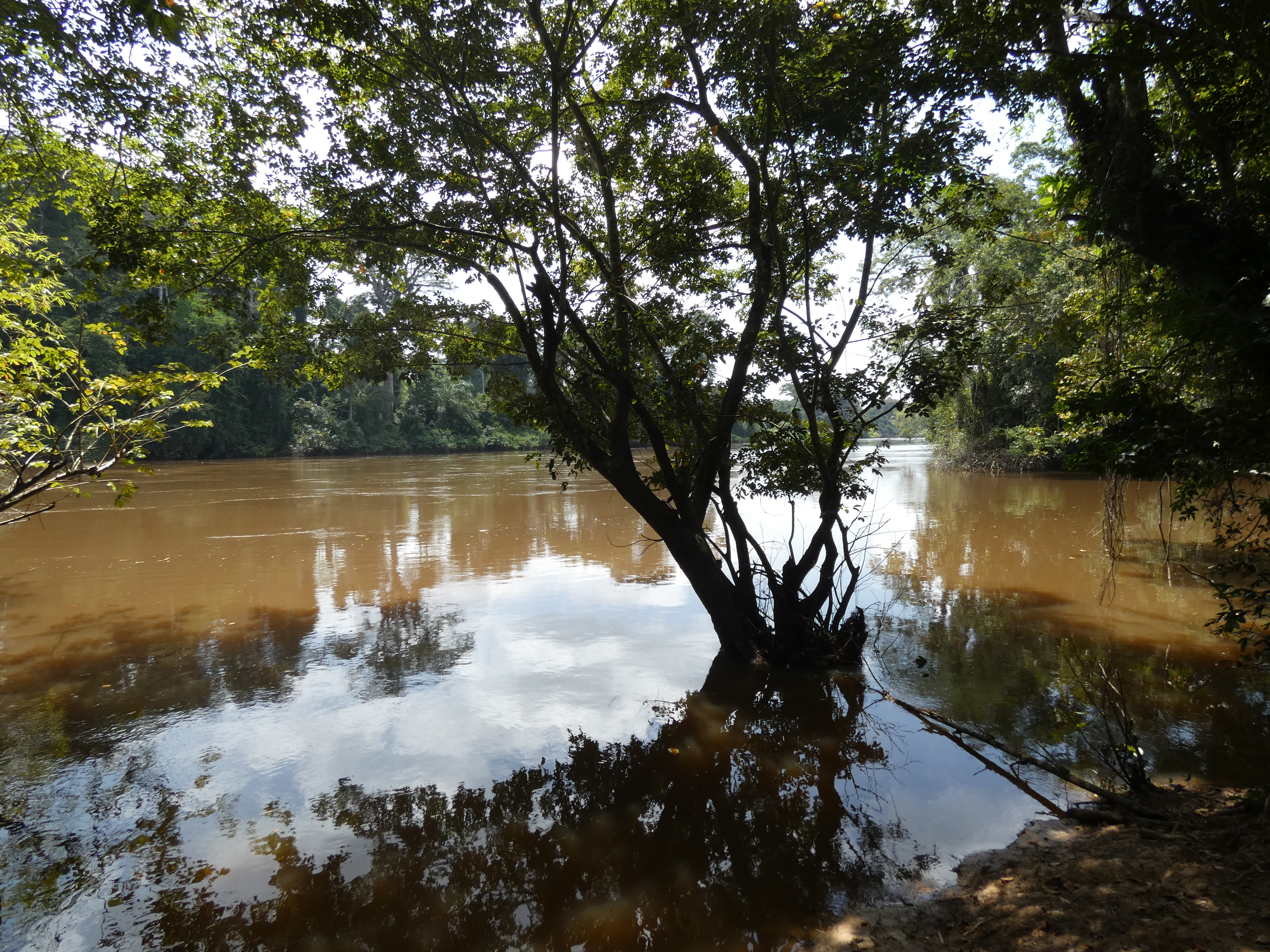
Life Along the Current
Beneath the tea-brown surface of the Cavalla lives a world adapted to its particular chemistry and flow. The river is home to the endemic Chiloglanis normani, a small suckermouth catfish found nowhere else on Earth. Barracuda, mackerel, and other species concentrate near the mouth, where freshwater nutrients meet the ocean. Along the banks, the river sustains farming communities, provides drinking water, and serves as a transportation corridor in a region where roads can be unreliable. The Cavalla's headwaters rise on the flanks of Mont Nimba, a UNESCO World Heritage Site, and the river carries something of that highland biodiversity all the way to the coast, threading through landscapes that shift from montane forest to savanna to coastal wetland over the course of its 515-kilometer journey.
Seen from Above
From the air, the Cavalla is unmistakable: a dark, winding ribbon cutting through the green canopy of the Liberian-Ivorian borderlands. Unlike the broader, lazier rivers of the Sahel to the north, the Cavalla keeps a relatively narrow channel as it twists through dense forest, widening only as it approaches the coast. The river's course is a study in persistence -- it has been carving this path through Precambrian bedrock for millennia, following the same geological grain that shapes the hills and ridges of the Guinea Highlands. In the dry season, exposed sandbars and rock shelves break the surface. When the rains come, the Cavalla swells and accelerates, carrying sediment and nutrients downstream in a seasonal pulse that the entire ecosystem depends on.
From the Air
The Cavalla River is located at approximately 7.59N, 8.50W. It is visible as a winding dark waterway cutting through dense forest along the Liberia-Ivory Coast border. The river flows generally southwest to the Gulf of Guinea, entering the sea about 21 km east of Harper, Liberia. Nearest airport is Spriggs Payne Airport (GLRB) in Monrovia, approximately 300 km northwest. Roberts International Airport (GLRB) is also in the region. Best viewed at 3,000-5,000 feet AGL to trace the river's course through the forest canopy. The river is most visually striking during the dry season when sandbars are exposed.