Cedar Key, Florida
A Spanish cartographer marked these islands on a map in 1542, labeling them "Las Islas Sabines" -- The Cedar Islands -- for the red cedars that grew thick along their shores. Nearly five centuries later, Cedar Key is home to just 687 people, a population that has actually shrunk since 2010. Yet this tiny cluster of islands off Florida's Big Bend coast has been fought over by the Seminoles, the U.S. Army, Confederate rifle companies, and a parade of hurricanes -- each leaving its mark on what remains one of the most historically layered small towns on the Gulf of Mexico.
Twelve Thousand Years of Occupation
Archaeological evidence puts human presence on and around the Cedar Keys at 12,000 years, based on Paleo-period arrowheads and spear points collected by local historian St. Clair Whitman and now displayed at Cedar Key Museum State Park. A dig at Shell Mound, north of Cedar Key, uncovered artifacts dating to 500 BC buried in the upper layers of an ancient midden. The only ancient burial found in Cedar Key proper was a 2,000-year-old skeleton discovered in 1999. In 1801, followers of William Augustus Bowles -- a self-declared "Director General of the State of Muskogee" -- built a watchtower near the islands before Spanish forces destroyed it the following year. Before the First Seminole War, British agents Alexander Arbuthnot and Robert Ambrister used the Cedar Keys to deliver supplies to the Seminoles, and the islands may have served as a refuge for people who escaped slavery in the early 1820s.
Fort, Hospital, Hurricane
During the Second Seminole War, the U.S. Army established Fort No. 4 on the mainland adjacent to the Cedar Keys. General Zachary Taylor requested the islands be reserved for military use, and General Walker Keith Armistead ordered a hospital built on Depot Key, which became the Army's headquarters in Florida. On nearby Seahorse Key, Cantonment Morgan served as a troop deployment station and holding facility for captured or surrendered Seminoles awaiting forced removal westward. Then on October 4, 1842, a hurricane with a massive storm surge struck the Cedar Keys, destroying Cantonment Morgan and devastating Depot Key. Seminole leaders who had been negotiating their surrender at Depot Key refused to return after the storm. Colonel William J. Worth declared the war over in August 1842, and the Army abandoned the islands.
Pencils, Railroads, and War Prizes
Settlement came quickly after the Armed Occupation Act of 1842 opened the islands to homesteaders. Augustus Steele, the U.S. Customs officer for Hillsborough County, claimed Depot Key and renamed it Atsena Otie Key. Cedar Key became an important port for lumber and naval stores. By 1860, two mills on Atsena Otie Key were producing cedar slats shipped to northern pencil factories. That same year, David Levy Yulee's Florida Railroad reached the islands, making Cedar Key the western terminus of a line connecting to Fernandina Beach on the Atlantic coast. The first train arrived on March 1, 1861, just weeks before the Civil War began. Confederate forces at Cedar Key scored an early naval coup: on July 3, 1861, Lieutenant Colonel M. Whit Smith led two rifle companies and a six-pounder cannon twenty miles offshore on the steamer Madison, capturing four Federal schooners and effecting the first capture of a U.S. Naval officer at sea during the war.
The Lighthouse on Seahorse Key
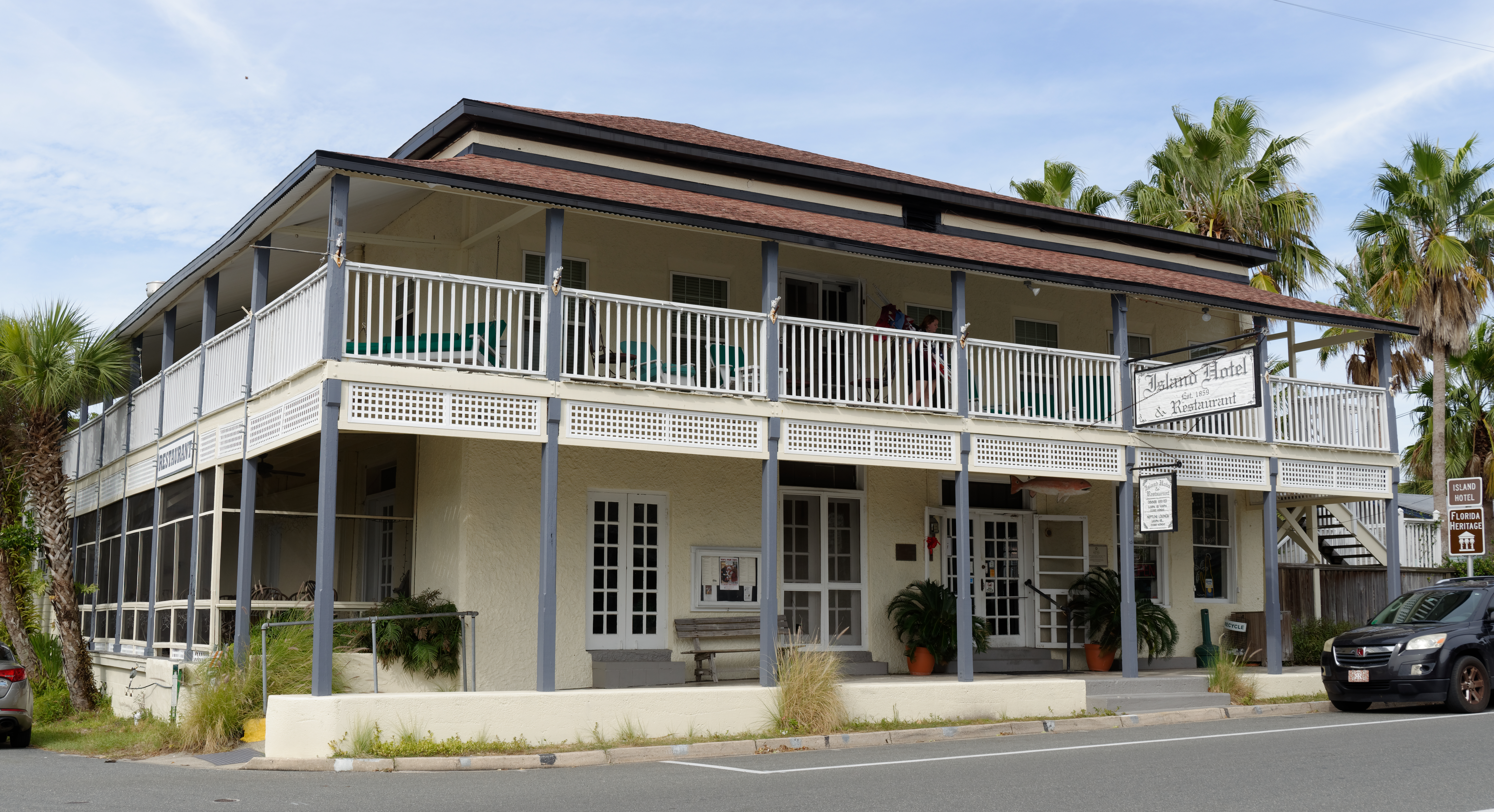
Congress appropriated funds for a lighthouse on Seahorse Key in 1850, and the Cedar Key Light was completed in 1854. The lantern sits atop a hill, placing the light well above sea level and visible for miles across the Gulf. Wood-frame residences were later added to each side of the structure. When war came in 1861, Confederate agents climbed the tower, extinguished the light, and removed its supply of sperm whale oil. Parsons and Hale's General Store, built on Way Key in 1859 -- the same year the town was platted -- still stands today as the Island Hotel, one of the oldest commercial buildings in the region. Together, the lighthouse and the hotel anchor a landscape where the 19th century has never fully let go.
Battered but Standing
Cedar Key's relationship with hurricanes is as old as its recorded history. The 1842 storm that ended the Seminole War military presence was only the beginning. In November 2020, Hurricane Eta made one of its Florida landfalls near Cedar Key as a tropical storm. In August 2023, Hurricane Idalia brought storm surge that reached record levels above high tide, damaging businesses along Dock Street. Then in September 2024, Hurricane Helene surpassed Idalia's record, delivering major floods, wind gusts, and a new high-water mark. Each time, the town of fewer than 700 people rebuilds. Cedar Key endures the way its namesake trees once did -- stubbornly rooted in shallow soil, bending under winds that would snap something less determined.
From the Air
Located at 29.145N, 83.039W on Florida's Gulf Coast Big Bend region, Cedar Key is a cluster of small islands visible as a distinctive landform extending into the Gulf of Mexico. The George T. Lewis Airport (CDK) sits on the island with a single runway. Seahorse Key and its lighthouse are visible to the southwest. The Cedar Keys National Wildlife Refuge surrounds the area. Nearest major airport is Gainesville Regional Airport (KGNV) approximately 50 miles northeast. The islands stand out clearly at 3,000-5,000 feet AGL against the shallow turquoise Gulf waters. Look for the long causeway road (SR 24) connecting the islands to the mainland.