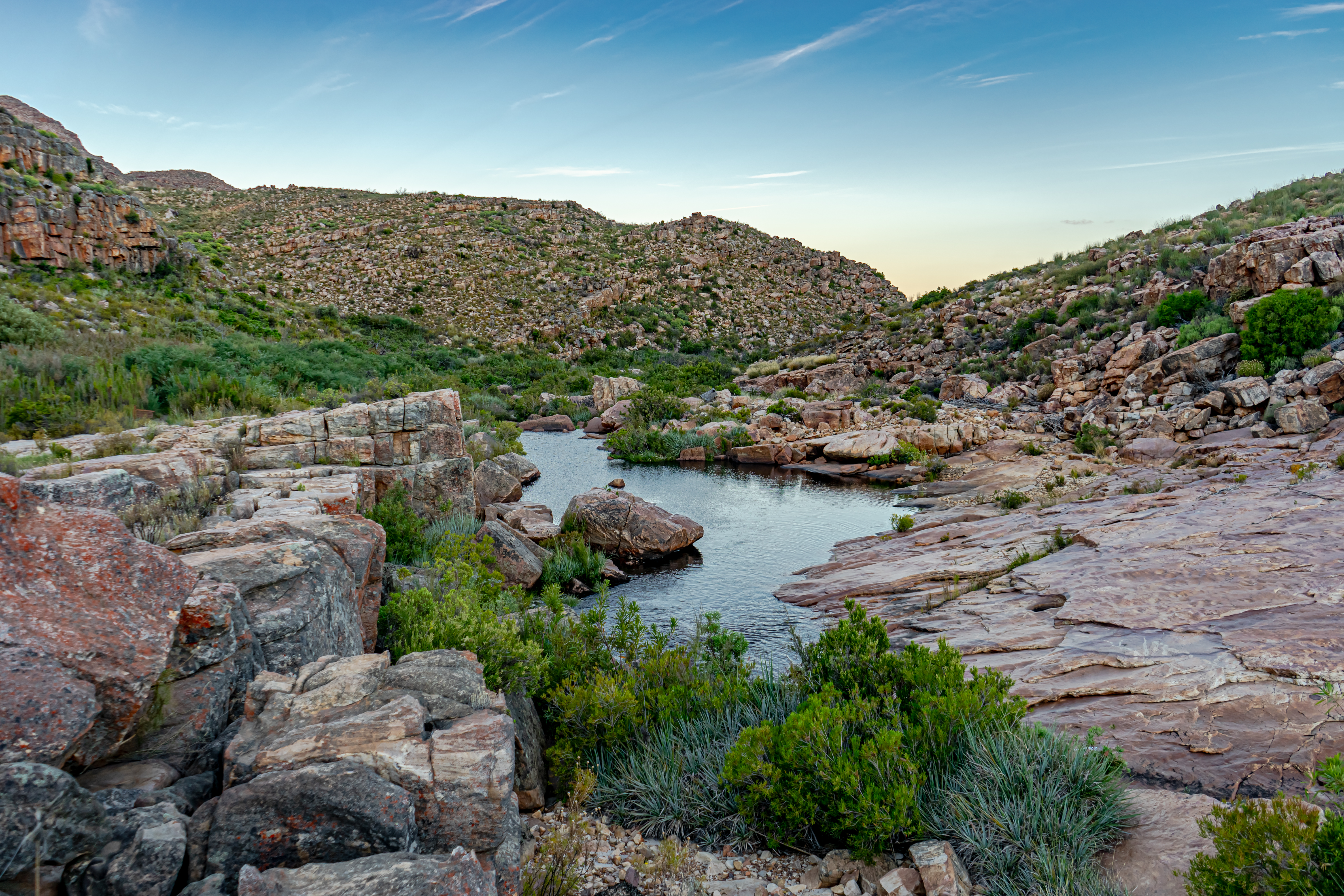
Cederberg
Wind has been the patient sculptor here. Over millennia, it has hollowed the upper sandstone layers of the Cederberg into arches, overhangs, and formations so improbable they look designed -- the Maltese Cross, a freestanding pillar shaped like a stone crucifix; the Wolfberg Arch, a natural bridge framing the sky; the Wolfberg Cracks, narrow fissures that climbers squeeze through to reach the plateau above. These mountains, stretching 50 kilometers north-to-south and 20 east-to-west in the Western Cape of South Africa, take their name from a tree that is losing its grip on them: the endangered Clanwilliam cedar, once so abundant it named a town, now reduced to scattered survivors clinging to the highest, most remote slopes.
Four Hundred and Fifty Million Years of Stone
The geology of the Cederberg reads like a textbook cross-section of deep time. The dominant rock belongs to the Table Mountain Group of the Cape Supergroup -- the same formation that underlies Table Mountain in Cape Town, 300 kilometers to the south. A layer of Pakhuis Formation tillite, deposited by glaciers roughly 450 million years ago during a brief Ordovician ice age, divides the Peninsula Formation Sandstone into a lower and upper portion. The lower sandstone is ancient, hard, and erosion-resistant, forming the highest peaks including Sneeuberg at 2,026 meters and Tafelberg at 1,969 meters. The upper sandstone above the tillite is softer, more yielding to wind and water, and it is this layer that has been carved into the Cederberg's famous shapes. In the valleys below, Bokkeveld mudstones support the vineyards and orchards of the Western Cape, while the fossils of primitive fish discovered in the shale bands date back to the same Ordovician period as the glacial till.
Cedar, Fynbos, and the Creatures Between
The Clanwilliam cedar -- Widdringtonia cedarbergensis -- is endemic to these mountains and endangered. Thousands were felled during the colonial era for telephone poles, furniture, and housing, and the species has never recovered. Today the survivors grow in remote high-altitude refuges, beyond the reach of easy logging but increasingly vulnerable to changing fire regimes and climate. They share the slopes with Mediterranean fynbos in the wetter south and west, transitioning to semi-desert scrub in the drier north and east. The snow protea, Protea cryophila, is also endemic here, found nowhere else on Earth. Leopards and caracals patrol as apex predators. Cape mountain zebras -- a vulnerable subspecies -- graze the higher slopes, while rock hyraxes, meerkats, and chacma baboons occupy every ecological niche the terrain provides. In the streams, endangered Clanwilliam yellowfish and sawfin hold out against invasive species and habitat change.
Sacred Walls and Contested Ground
In caves and overhangs throughout the Cederberg, San rock art records the presence of the earliest human inhabitants -- paintings and engravings that represent one of the richest concentrations of rock art in southern Africa. These are sacred cultural heritage sites, testifying to communities that lived in these mountains for thousands of years before European arrival. That arrival brought devastation: the cedar forests were stripped, and the San population was eliminated through violence, displacement, and disease. In the northern Cederberg, the Moravian mission station of Wupperthal was established for Khoikhoi communities and endures today as a small village known for handmade veldskoene -- traditional leather shoes. The Cederberg was also possibly the southernmost battleground of the Second Boer War. A small band of Boer guerrillas penetrated into the mountains from the north, hoping to rally local Dutch-descended farmers. The attempt failed. A lone Englishman is said to have confronted the commandos and ordered them to surrender; when he refused to back down, they shot him dead. The ravine where he fell is called Engelsmanskloof -- Englishman's ravine.
Rooibos, Rock, and Stars
Arable land is scarce in the Cederberg -- too high, too dry, too rocky for most agriculture. But the terrain that defeats wheat and cattle proves ideal for rooibos tea, the area's most famous export, which thrives in the acidic, nutrient-poor soils. The Cederberg also hosts South Africa's highest-altitude winery. Tourism, though, has become the dominant economy. The Algeria campsite, run by CapeNature, serves as the main base for hikers and climbers drawn to the world-class routes on the Krakadouw and Tafelberg peaks. Clear skies for most of the year make the Cederberg an exceptional site for stargazing, and the area has its own amateur astronomical observatory. On summer nights, the Milky Way arcs over rock formations sculpted by wind and time, and the only sounds are the calls of the birds that give the hiking trails their names.
From the Air
The Cederberg mountains are at approximately 32.33S, 19.08E, a prominent terrain feature visible from altitude as a reddish sandstone range running roughly north-south. Sneeuberg (2,026 m) and Tafelberg (1,969 m) are the highest peaks. The N7 highway runs along the western edge of the range. Nearest towns are Citrusdal to the southwest and Clanwilliam to the north. Cape Town International (FACT) is approximately 300 km to the south. Caution: mountain weather can change rapidly; peaks may receive snow in winter.