Cedros Island
In 2017, archaeologists on Cedros Island announced a discovery that challenged everything we thought we knew about the peopling of the Americas. The shell fishhooks they unearthed dated to 11,000 years before present, the oldest found anywhere in the New World, crafted by people who were fishing deepwater species from boats. This fog-shrouded island off Baja California, where Monterey pines cling to misty highlands and endemic deer browse among unique cacti, may hold clues to one of prehistory's greatest migrations.
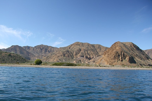
The Island of Fogs
Cold Pacific currents wrap Cedros Island in frequent fog, especially during spring and summer. This marine layer creates what scientists call "fog oases," pockets where plants extract moisture directly from the air. On the island's northern and western slopes, Monterey pines grow at elevations between the fog's lower and upper limits, covering less than half a percent of the island's total area. California junipers share these heights, while chaparral vegetation including the endemic Cedros Island live oak crowns the peaks. The contrast is striking: over 90 percent of the island remains desert scrub, yet these misty highlands harbor relict forests.
First Peoples
Human remains on Cedros Island predate the Clovis culture, long considered the earliest evidence of people in the Americas. The island's rich marine environment and relative abundance of fresh water made it a natural stop for coastal migrants. Ancient spear points and shell fishhooks found here match artifacts scattered in an arc across the Pacific from Okinawa to Peru. The early inhabitants fished, gathered shellfish, and hunted seals, sea lions, and seabirds. Their deepwater fishing hooks indicate a sophisticated maritime culture 6,000 years before similar technologies appeared on the California coast.
Spanish Arrival and Island Life
When Francisco de Ulloa's expedition landed in 1539, they found villages with populations in the hundreds. Jesuit missionaries eventually relocated these indigenous people to mainland missions in 1732. Seal and sea otter hunters worked the island between 1790 and 1850. Gold and copper mining near Punta Norte operated from 1890 to 1914. The fishing village of Cedros was founded in 1922, and the cooperative Pescadores Nacionales de Abulon, specializing in lobster and abalone, formed in 1943. A Mitsubishi-Mexican government partnership built the company town of Puerto Morro Redondo to support salt transshipment from Guerrero Negro.
Evolution's Laboratory
Cedros Island harbors an extraordinary concentration of endemic species. The Cedros Island mule deer, brush rabbit, and cactus mouse exist nowhere else on Earth. A unique subspecies of side-blotched lizard evolved here. The botanical list runs longer: Cedros Island sage, Cedros Island penstemon, Cedros Island liveforever, and more than a dozen endemic plant species. Unlike Guadalupe Island, where feral goats devastated native vegetation, Cedros's goats compete with native deer, keeping their population in check. Large sea lion colonies haul out on the western rocks, and California yellowtail gather in the kelp beds to breed.
Modern Cedros
About 1,350 people live on Cedros Island today, scattered across several settlements. The town of Cedros serves as the administrative seat, with a population of 747 in 2010. Air service connects to Ensenada on Mondays and Wednesdays, landing at an airstrip near the company town. Travelers can also arrange open launch rides from Bahia Tortugas on the mainland, weather permitting. The island remains a subdivision of Ensenada municipality, its economy still dependent on the fishing that has sustained communities here for thousands of years.
From the Air
Located at 28.18N, 115.22W off the Pacific coast of Baja California. The island stretches roughly north-south, with Monte Cedros as the highest point. Approach from the east for the clearest views; fog frequently obscures the northern and western coasts. The airstrip at the south end provides a visual reference. Nearest mainland airport is Ensenada (MMEP).