Central Boulevards of Brussels
By 1865 the Senne river had become unbearable. Once Brussels' main waterway, it now ran black with sewage, flooded the working-class districts on its banks, and stank in summer so badly the city government had to act. The mayor, Jules Anspach, chose a radical answer: bury the river. Vault it over, demolish the slums above it, and build straight, Parisian-style boulevards on top. The plan worked, and it didn't. The Senne disappeared. The boulevards rose. But the people displaced by the demolitions were not the ones who moved in, and the new buildings sat half-empty for two decades. Today those same boulevards — pedestrianized since 2015 — are again the heart of Brussels' lower town, fought over and renegotiated every generation.
Burying a River
The Senne flowed through the lowest part of Brussels, which meant it flowed through the poorest part. As the city grew, the river became a sewer, choked with garbage and decaying matter, flooding the surrounding districts again and again. Various engineers floated proposals, but the cost was enormous and the human disruption greater still — the vaulting plan required expropriating and demolishing entire working-class neighborhoods. Anspach pushed the design by architect Léon Suys through anyway, in the face of fierce opposition. The contract went to a British company that promptly imploded in an embezzlement scandal, forcing the city to retake control. Despite all of it the river was covered between 1867 and 1871 and four new boulevards laid out on top: from south to north, the Boulevard Maurice Lemonnier, the Boulevard Anspach, and the forked pair of Boulevard Adolphe Max and Boulevard Émile Jacqmain. Brussels had a new spine.
The Architecture Competitions
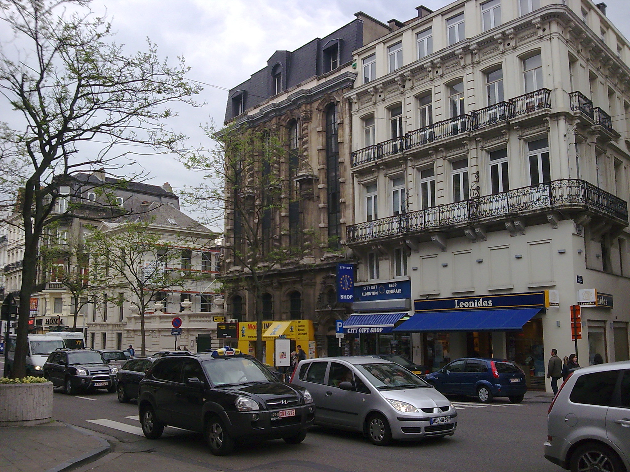
Wide straight avenues alone do not make a Paris. They had to be lined with buildings worthy of them. The Brussels middle class, however, preferred the new suburbs to the city center. Land prices on the boulevards were too high for working families, and life in apartment buildings had fallen out of fashion among the bourgeoisie. The lots sat unattractive to private investors. The city tried incentives: two architectural competitions, in 1872–1876 and 1876–1878, encouraged elaborate façades with minimal stylistic constraint. The only firm rule was a 15-meter minimum height to discourage speculation. The first competition's top prize — 20,000 Belgian francs — went to Henri Beyaert for his Maison des Chats on the Boulevard du Nord, named for the cat motifs that gave it the Dutch label *Hier is't in den kater en de kat*. Even with the competitions and the prestigious Bourse Palace (completed 1873) anchoring the avenues, it still took until 1895 for the boulevards to fill in solidly along their length.
The Long Eclipse of the Car
For most of the 20th century, the boulevards belonged to traffic. The 1958 Brussels World's Fair, Expo 58, accelerated a planning ideology that wanted to push everything else aside for the automobile. The era left such a mark on the city that urbanists invented a word for it: *Brusselization*, the destruction of a city's character through aggressive modernization. Trams went underground in 1976 with the opening of the North-South Axis premetro line. The boulevards became a noisy, polluted axis of through traffic. Pedestrians made do with narrow sidewalks alongside something that wanted to be a motorway. The protest came in 2012, when activists held what they called *protest picnics* on the Boulevard Anspach to call out the city's mobility policy. Mayor Freddy Thielemans responded by closing the boulevard to cars on summer Sunday afternoons. His successor Yvan Mayeur went further: in 2015, the central stretch between the Place de la Bourse and the Place de Brouckère became permanently car-free, part of a 50-hectare pedestrian zone covering much of the historic center.
Walking the Boulevards Today
Each boulevard still has its own character. The Boulevard Maurice Lemonnier — renamed in 1919 to honor an alderman held captive in Germany during the First World War — runs from south up to the Place Fontainas, lined with neoclassical bourgeois houses, apartment blocks, and the South Palace. The Boulevard Anspach, renamed in 1879 for the mayor who pushed the whole project through (he died that same year), carries the most weight. The Bourse Palace anchors it, and the Ancienne Belgique music hall draws crowds at night. The Adolphe Max branch, named in 1919 for the wartime mayor who defied the German occupiers, lifts upward with five-story Second Empire façades, the Northern Gallery shopping arcade, and the Hotel Le Plaza. The Émile Jacqmain branch, mostly occupied by offices now, still shows traces of Second Empire grandeur with Art Deco and Functionalist intrusions from the interwar years. Walk all four and you are walking on the buried Senne, on demolished slums, on a Parisian dream Brussels half-realized and is still negotiating with.
From the Air
The Central Boulevards run roughly north-south through central Brussels at 50.849°N, 4.350°E, on the west side of the Grand-Place. From altitude they appear as a straight, broad cut through an otherwise medieval-irregular street pattern — the most obvious sign of 19th-century urban planning in the lower town. The Bourse Palace and the round form of the Place de Brouckère are visible landmarks along the axis. Brussels Airport (EBBR) lies about 12 km northeast. The boulevards roughly follow the buried course of the Senne river, which still surfaces briefly to the north and south of the urban core.