Central Freeway
The 1989 Loma Prieta earthquake cracked the Central Freeway's upper deck, and in doing so cracked open a debate that had been simmering since the Freeway Revolt of the 1960s: did San Francisco really need an elevated highway slicing through its neighborhoods? The answer took a decade of political battles, two ballot measures, and one of the most dramatic examples of highway removal in American urban history. Where a double-decker freeway once cast its shadow over Hayes Valley, an oak-lined boulevard called Octavia now connects the neighborhood to the city. The transformation proved that tearing out a highway could create more value than the highway ever delivered.
The Freeway That Ate the Neighborhood
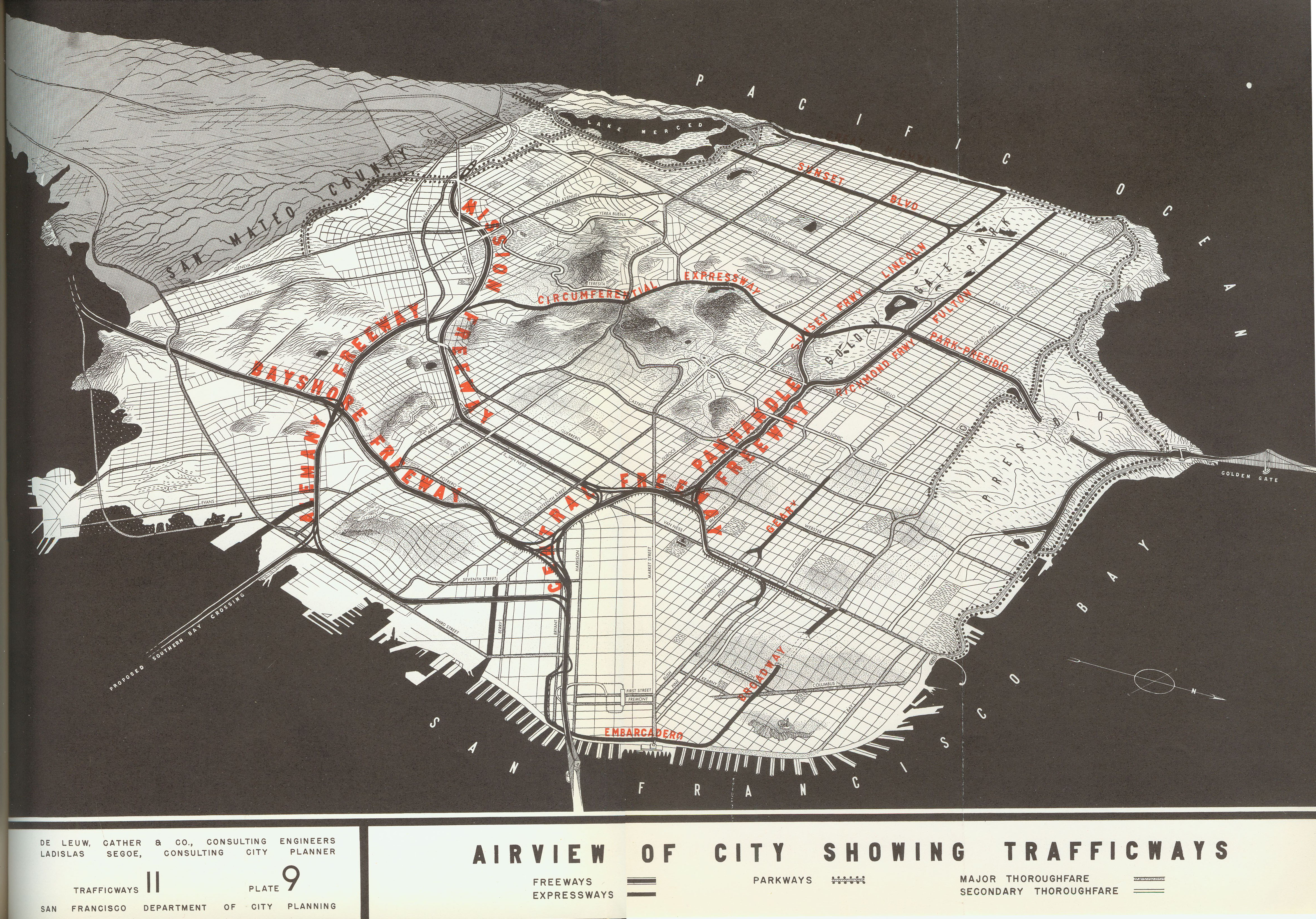
The Central Freeway originated in the 1948 Transportation Plan for San Francisco, a postwar vision of elevated highways connecting the city's major arteries. As built, it carried US 101 from the Bayshore/James Lick Freeway north through the South of Market and Hayes Valley neighborhoods on its way to the Golden Gate Bridge. The double-decker structure rose above the streets like a concrete wall, severing the connection between the neighborhoods on either side. Hayes Valley, caught in the freeway's shadow, declined into a corridor of noise, pollution, and blighted real estate. The freeway did what it was designed to do -- move cars -- but the neighborhoods beneath it paid the price.
Earthquake as Catalyst
The Loma Prieta earthquake on October 17, 1989, damaged the upper deck of the Central Freeway badly enough to force its closure. Caltrans demolished the upper level, leaving the lower deck in service. What happened next surprised the transportation planners: traffic rerouted itself without the catastrophe that had been predicted. The neighborhoods around the freeway suddenly experienced something they hadn't felt in decades -- sunlight, quiet, and street-level visibility. Hayes Valley residents, who had watched their neighborhood deteriorate for forty years under the freeway's shadow, saw the closure as an opportunity rather than a crisis.
Two Votes and a Boulevard
The political fight to remove the freeway permanently took years. In 1998, San Francisco voters passed a ballot measure supporting demolition of the remaining freeway ramp, but Caltrans and commuter advocates pushed back. A second vote affirmed the city's decision. Demolition of the remaining Central Freeway stub proceeded, and in its place the city built Octavia Boulevard -- a tree-lined street with a central median designed by landscape architect Allan Jacobs. The boulevard reconnected Hayes Valley to the neighborhoods south of Market Street, restoring the urban fabric that the freeway had torn apart since the 1950s.
The Hayes Valley Transformation
The removal of the Central Freeway triggered one of the most dramatic neighborhood transformations in modern American urbanism. Hayes Valley went from blighted freeway shadow to one of San Francisco's most desirable commercial and residential districts. Boutiques, restaurants, and galleries opened along Hayes Street. Real estate values surged. Patricia's Green, a small park built on a former freeway on-ramp, became a gathering place for the neighborhood. The roughly one-mile elevated freeway that remains connects US 101 and I-80 to the Hayes Valley neighborhood, ending at a surface-level transition. It is the shortest and most politically contested freeway in San Francisco -- a remnant of the highway-building era that the city decisively rejected.
From the Air
Located at 37.77°N, 122.421°W in central San Francisco. The roughly one-mile remaining freeway stub is visible as an elevated structure running from the I-80/US 101 interchange to Hayes Valley. Octavia Boulevard, which replaced the demolished northern section, can be seen as a tree-lined street. Best viewed at 2,000-4,000 feet AGL. Nearest airports: KSFO (11 nm south), KOAK (10 nm east).