Central Persian Desert Basins
From altitude, it looks like the surface of another planet. Vast white salt flats crack and shimmer beneath a sun that pushes temperatures past 42 degrees Celsius. Gravel plains stretch to every horizon, interrupted only by dunes that shift with winds funneled between distant mountain walls. This is the Central Persian desert basins -- a landlocked ecoregion covering much of the Iranian Plateau, where no river reaches the sea and water that enters simply vanishes into salt. Walled in by some of Asia's great mountain ranges, these basins have been filtering life through an unforgiving sieve for millennia, and what survives here has earned its place.
Walled by Mountains, Emptied by Sun
The geography reads like a fortress blueprint. The Zagros Mountains seal the west and south. The Alborz range, running along the Caspian Sea, closes the north. To the northeast, the Kopet Dag mountains mark the border with Turkmenistan. Lower ranges along the Afghan frontier complete the encirclement. Within this ring of stone, the Iranian Plateau traps whatever moisture makes it past the walls -- which is very little. The basins are endorheic, meaning they have no drainage outlet to any ocean. Rivers run inward and die in salt pans. The Dasht-e Kavir, one of the world's great salt deserts, occupies a massive portion of this terrain, its crusted surface too salty and too unstable for most travelers to cross. Temperature swings are savage, plunging well below freezing in winter before climbing past 42 degrees Celsius in summer.
Plants That Drink Salt
Nothing about the vegetation here is accidental. Every species is a specialist. In the broad interior basins, dwarf scrub of sagebrush and Astragalus clings low to the ground, minimizing exposure to desiccating winds. The more arid zones support halophytes -- salt-tolerant plants that have evolved to thrive where salt concentrations would kill nearly anything else. On the margins of the Dasht-e Kavir's salt pans, saxaul trees anchor the soil with deep root systems, while Salsola species -- whose Latin name comes from salsus, meaning salty -- extract moisture from ground that tastes of brine. The sand deserts host Ephedra and Calligonum, plants so drought-adapted they seem to subsist on heat itself. Gravel desert margins support tamarisk, one of the few woody plants tough enough to colonize these wastelands. The result is a botanical catalogue of extremophiles -- organisms pushed to the edges of what plant life can endure.
Ghosts of a Wilder Time
The mammals tell a story of retreat. These basins once supported populations of large predators and grazers that have since been pushed to the brink. The Asiatic cheetah, a subspecies distinct from its African cousin, is now critically endangered -- perhaps fewer than thirty individuals survive, almost all of them in Iran's central deserts. Striped hyenas still patrol the margins, classified as near threatened. Mountain gazelles, once common across these plains, are now endangered. Persian leopards, listed as vulnerable, haunt the rocky slopes where the desert meets the encircling mountains. Even the Marbled polecat, a small but striking predator with a piebald coat, carries a vulnerable designation. Over 12 percent of the ecoregion falls within officially protected areas, including Kavir National Park, Khar Turan National Park, and Khojir and Sorkheh Hesar National Parks closer to Tehran. These reserves represent fragile islands of enforcement in a landscape too vast to fully patrol.
The Basin from Above
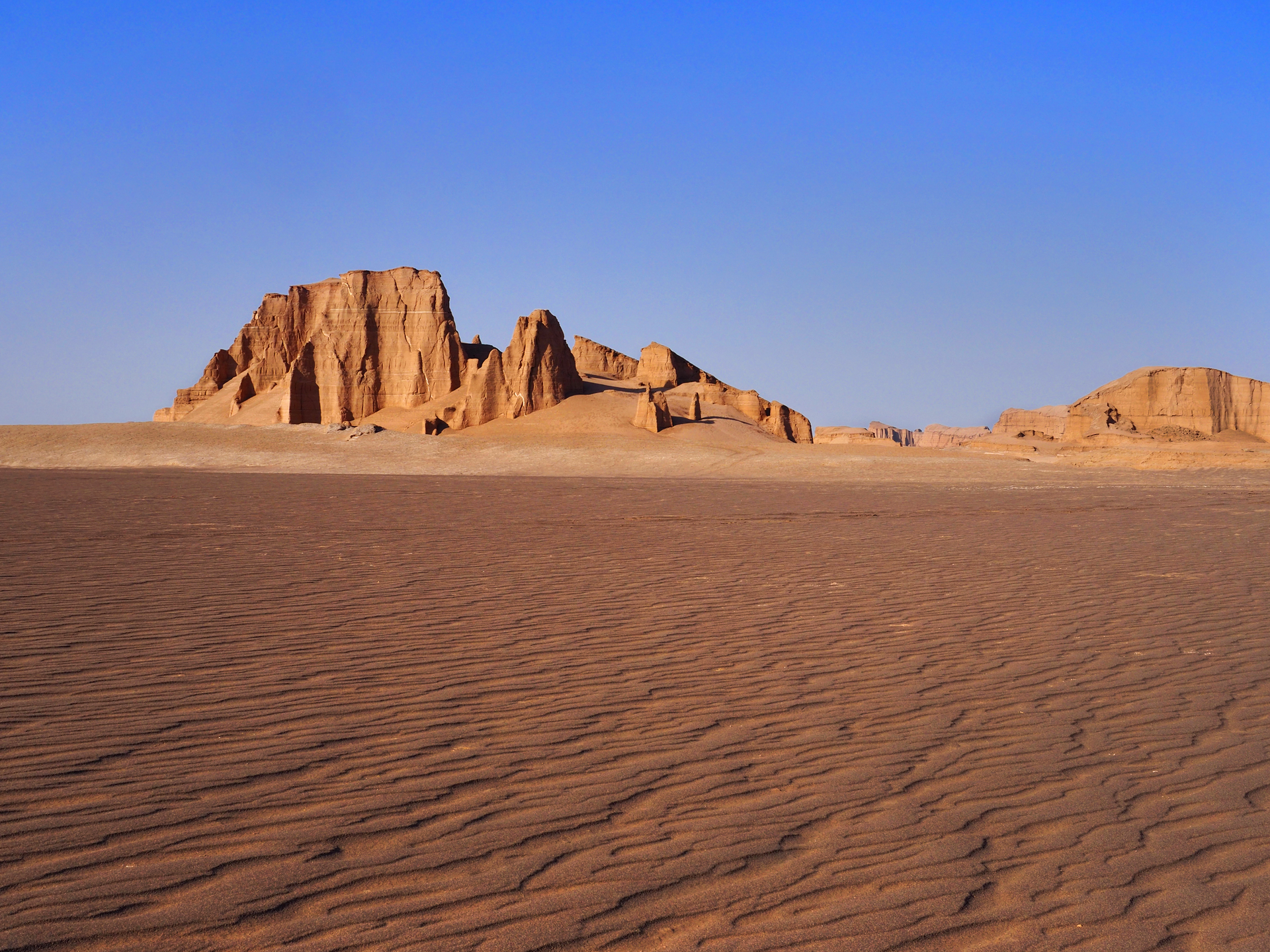
From a flight path crossing central Iran, the desert basins reveal their full scale. The salt flats of the Dasht-e Kavir gleam white and featureless, broken occasionally by polygonal cracking patterns that look geometric from altitude. Sand seas shift between rust and gold depending on the angle of light. The mountain walls that define the ecoregion's boundaries rise abruptly from the basin floor, their snowcapped peaks in winter contrasting sharply with the baked flatlands below. It is a landscape of extremes made visible -- the interplay of mountain shadow and desert glare, of frozen peaks and scorched flats, of life that persists in pockets and emptiness that dominates everything between them. The few settlements cluster near qanats, ancient underground water channels that have sustained human habitation here for thousands of years. From above, their green patches look like emeralds dropped on a sheet of hammered copper.
From the Air
Centered near 33.75N, 54.75E on the Iranian Plateau. The ecoregion is enormous, spanning much of central Iran from the Zagros Mountains in the west to the Afghan border in the east. The Dasht-e Kavir salt desert is prominently visible from cruising altitude as a vast white expanse. Nearby airports include Yazd Shahid Sadooghi Airport (OIYY) to the south, Isfahan International Airport (OIFM) to the southwest, and Imam Khomeini International Airport (OIIE) near Tehran to the northwest. Visibility is typically excellent in the dry interior, though dust storms can reduce it dramatically.