Central region (Eritrea)
At 2,250 metres above the Red Sea coast, the air goes sharp and the temperature drops. This is the highland plateau of Eritrea's Central region - the smallest of the country's six administrative regions, just 1,300 square kilometres - which contains within its boundaries the capital city of Asmara and the vast majority of Eritrea's national institutions. In December the plateau touches freezing. In May it reaches 30 degrees. What makes the Central region remarkable is not size but density: more than half a million people live here, and the architecture above their heads looks like no other African capital.
Little Rome
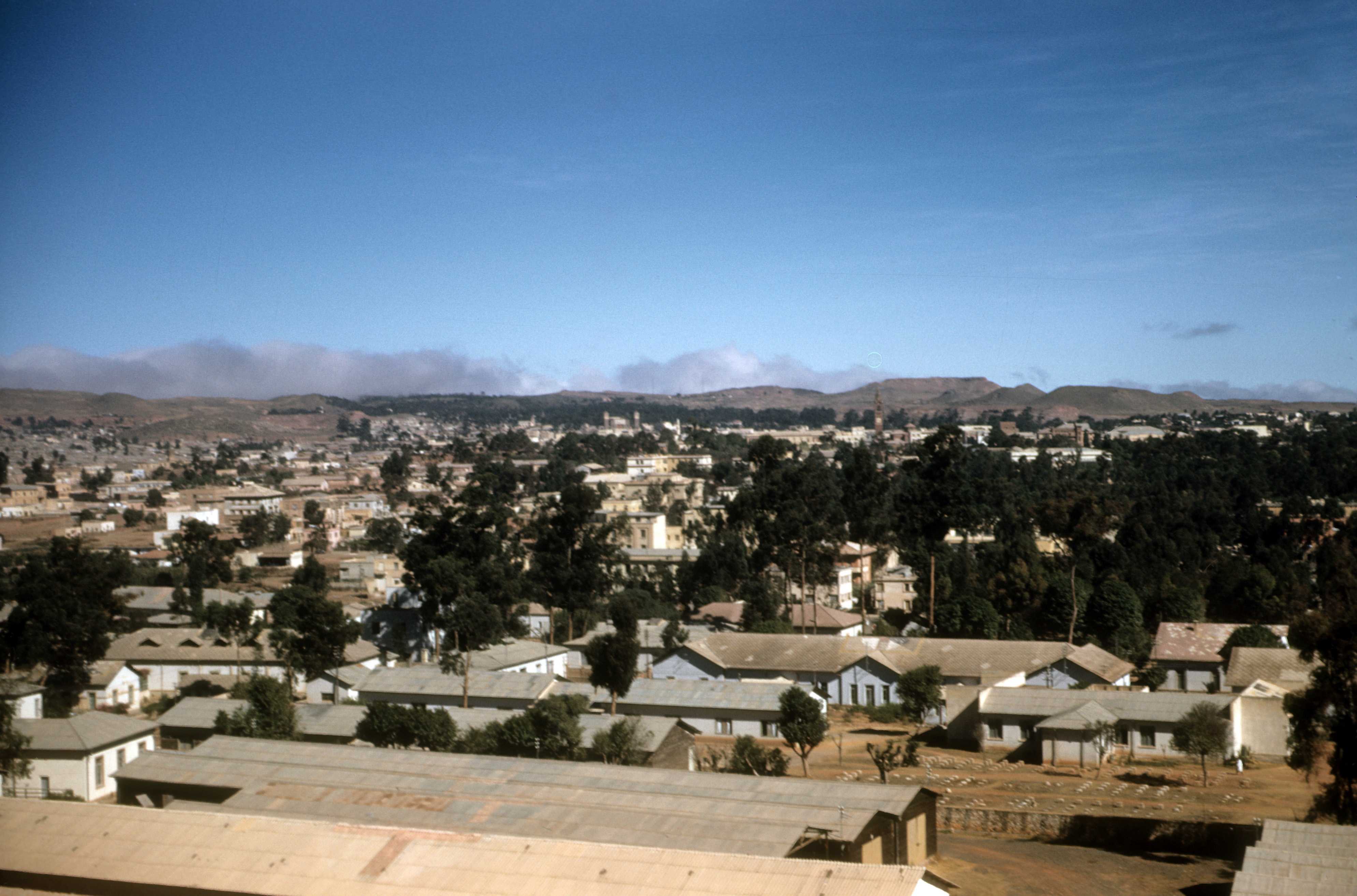
When Italian colonial planners laid out Asmara in the 1930s, they built it as an experimental field for modernist architecture - Rationalist buildings, Novecento theatres, Art Deco cinemas. The Fiat Tagliero service station, shaped like an aeroplane with 15-metre concrete wings, still operates as a filling station. The Cinema Impero still runs films. The Cattedrale di Asmara rises in Lombard Romanesque brick. When UNESCO inscribed Asmara as a World Heritage Site in 2017, the citation read: a modernist city of Africa. The plateau below the city, cooler than the coast and better watered, supported the colonial farms and roadworks of Italian Eritrea. Much of it still does.
Hamasien, Renamed
The Central region was carved out on 15 April 1996 from the older province of Hamasien - one of the historical provinces that Eritreans had inhabited long before the Italians arrived in 1885. The land borders Anseba to the northwest, the Northern Red Sea region to the northeast, the Southern region to the south, and Gash-Barka to the west. Two rainy seasons water it: a heavier one in summer, a lighter one in spring. Average rainfall runs about 508 millimetres, enough for cereals and vegetables. The soil is conducive to agriculture, as the government demographer has it - which is shorthand for the fact that the plateau has been farmed for centuries by smallholders growing teff, barley, and sorghum.
Numbers of a Country
By 2005 the Central region had a population of 675,700, up from 595,900 in 2001 - a growth rate of 11.81 percent. Density runs around 520 people per square kilometre, making it by far the most densely populated region in the country. Literacy stands at 85 percent for men and 72 percent for women according to 2002 figures. The region is divided into seven subregions - Berikh, Ghala Nefhi, North Eastern, North Western, Serejaka, South Eastern, South Western - plus Asmara itself, which forms a separate administrative area. The regional administrator is Major General Ramadan Osman Awliyai.
One Party, No Elections
Eritrea became independent from Ethiopia on 24 May 1991 after a 30-year liberation war. The transitional government formed in 1993 never gave way to elected successors. Scheduled elections in 2001 were postponed indefinitely. The People's Front for Democracy and Justice - PFDJ, the successor to the Eritrean Liberation Front that won independence - remains the only legal party. No others may contest. Elections at regional and local level are held on a restricted framework with PFDJ representatives presiding. Opposition and dissenters have been imprisoned, sometimes for decades. The Central region, which contains most of Eritrea's journalists, academics, and civil servants, has felt the weight of this more directly than most.
The Plateau
Travel up from Massawa on the Red Sea coast by the road that Italian engineers cut through the escarpment, and the climb does the work of the story. The heat breaks around 1,500 metres. By 2,000 metres the vegetation shifts - junipers, acacias, scattered olive trees - and you see the distant outline of Asmara's modernist skyline against the plateau. The Central region is this journey turned into a polity: the place where the coast ends and the Ethiopian Highlands begin. It is cooler than the coast, more Italian-looking than anywhere south of Tripoli, and more tightly ruled than most of the African states it borders. It is also, simply, home to most of what Eritrea has.
From the Air
The Central region centres on Asmara at roughly 15.33N, 38.92E at about 2,250m (7,400 ft) elevation. Asmara International Airport (HHAS/ASM) sits at 2,325m, which means hot-and-high operations in summer - expect significantly reduced aircraft performance on takeoff. The plateau drops abruptly eastward to the Red Sea; Massawa airport (HHMS/MSW) is at sea level, 90 km east. Eritrean airspace has been historically restricted; current clearances are required. Recommended viewing altitude 12,000-14,000 ft AGL to take in the plateau-to-coast transition.