Cerro El Copey National Park
Stand anywhere on the dry coastal plains of Margarita Island and look east, and you will see something that does not belong: a green mountain, its summit wrapped in cloud, rising 930 meters above a landscape of cactus and sunbaked rock. Cerro El Copey is an ecological anomaly -- a patch of humid montane forest growing on a Caribbean island where annual rainfall on the lowlands barely qualifies as semi-arid. The trade winds push moisture up the mountain's flanks, feeding forests and grasslands that exist nowhere else on the island. Everything below is brown. Everything above the cloud line is green. The park that protects this improbable summit holds the only permanent freshwater sources on Margarita Island.
Water From Thin Air
Cerro El Copey's existence as a green refuge depends on a single atmospheric mechanism: the trade winds. As consistent Caribbean winds encounter the mountain, they are forced upward, cooling as they rise. The moisture they carry condenses into fog and light rainfall at the summit, feeding montane grasslands and cloud forests that would be impossible at the same latitude at sea level. This process creates the only permanent water sources on Margarita Island -- springs and streams that flow down from the mountain into an otherwise parched landscape. The park was established in 1974 specifically to protect this hydrological asset, recognizing that the island's human communities, agriculture, and wildlife all ultimately depend on the water that Cerro El Copey captures from passing clouds.
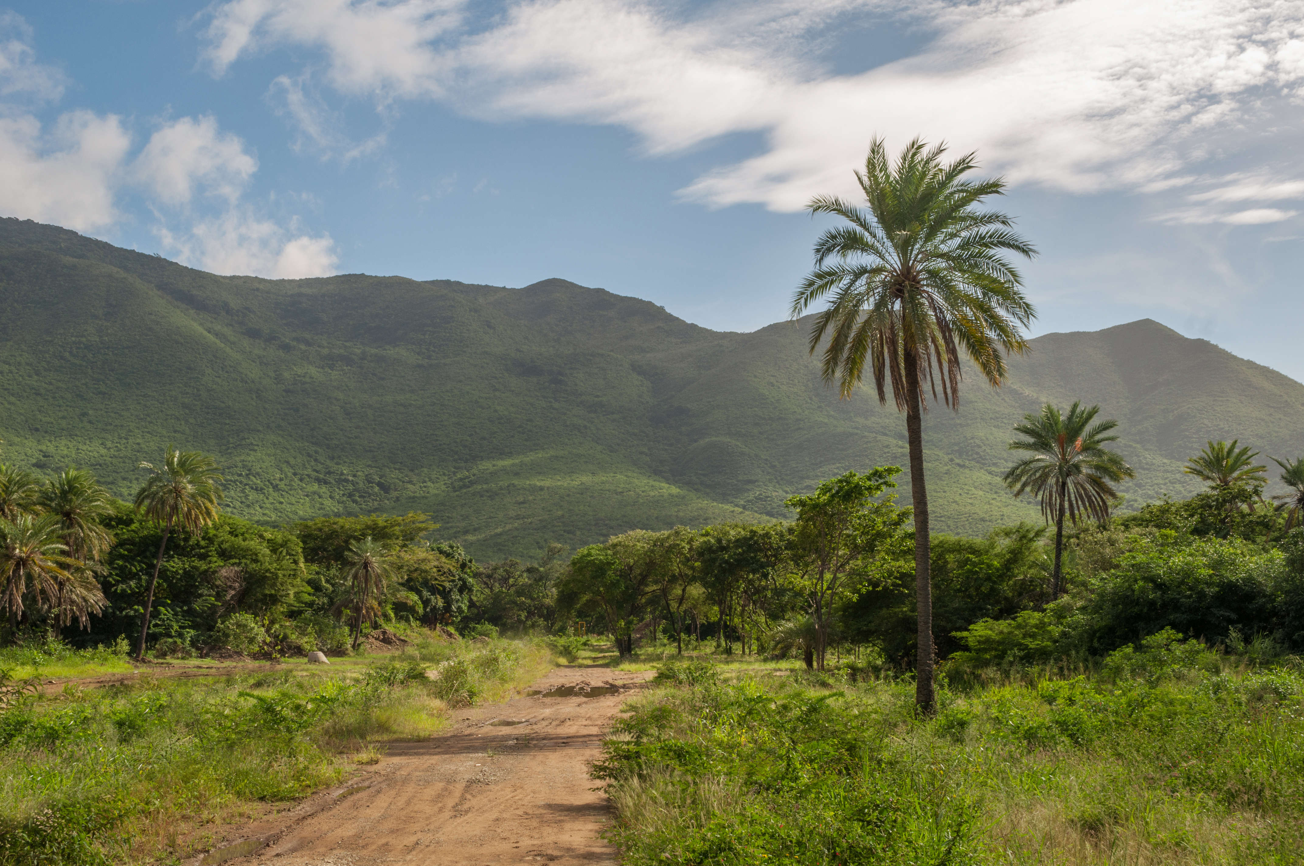
Layers of Green
The park's vegetation changes dramatically with altitude. On the lower slopes, dry and semi-deciduous forests dominate -- trees that shed their leaves during the driest months, adapted to the arid conditions that prevail across most of the island. Higher up, where the trade winds deliver persistent moisture, the forest becomes denser and greener. True montane forest occupies the upper elevations, with epiphytes, ferns, and moss-covered trunks creating a landscape more reminiscent of an Andean cloud forest than a Caribbean island. At the summit, montane grasslands stretch across exposed ridges, buffeted by wind and saturated with fog. The transition from desert scrub at the base to cloud forest at the peak covers less than a thousand vertical meters, compressing several climate zones into a distance you could walk in an afternoon.
The Island's Rare Inhabitants
Isolation breeds uniqueness, and Cerro El Copey has had enough isolation to generate high levels of endemism -- species found here and nowhere else on earth. BirdLife International has designated the park an Important Bird Area because it supports significant populations of bird species that depend on its specific habitat conditions. The combination of montane forest, cloud cover, and permanent water creates ecological niches unavailable anywhere else on the island or, in some cases, anywhere else in the world. Several plant species are restricted to the mountain's upper slopes, surviving in the narrow band where conditions are neither too dry nor too exposed. The park's role as a biodiversity refuge grows more critical as development encroaches: villages and plantations surround the park on all sides, and some have recently expanded into the park's boundaries.
A Mountain Under Pressure
Cerro El Copey is not a wilderness in the conventional sense. It is a mountain surrounded by people -- the villages, farms, and plantations that ring its base have been there for generations, and the boundary between human activity and protected forest is neither clean nor static. Some agricultural plots have crept into the park's designated area, driven by the same water that makes the mountain valuable in the first place. The tension is straightforward: the mountain provides the island's only permanent water, the water enables agriculture, and the agriculture threatens the forest that captures the water. It is a feedback loop that the park's 1974 designation was meant to interrupt but has not entirely stopped. From the air, the contrast is vivid -- the green summit of Cerro El Copey stands out against the brown plains like a bruise of color, surrounded on all sides by a landscape that would be far drier without it.
From the Air
Located at 11.01°N, 63.89°W on the eastern half of Isla Margarita, Venezuela. Cerro El Copey rises to 930 meters, making it the island's highest point in the national park and a prominent landmark from any altitude. From the air, the mountain is unmistakable: a green, cloud-capped summit surrounded by brown desert plains. The nearest airport is Santiago Mariño Caribbean International Airport (SVMG) near Porlamar, approximately 12 km to the southeast. The park's boundaries are visible as a transition from cultivated lowlands to dense forest on the mountain slopes. Best viewed in morning light when cloud formations on the summit are most dramatic.