The Mystery of Chaco Canyon: America's Lost Civilization
In a remote canyon in northwestern New Mexico, the Ancestral Puebloans built something extraordinary. Between 850 and 1150 AD, they constructed massive multi-story buildings with hundreds of rooms, precisely aligned to solar and lunar cycles. They built 400 miles of roads connecting distant communities, even though they had no wheels or pack animals. Then, around 1150, they left. Chaco Canyon was abandoned, its great houses falling silent. What was Chaco? A ceremonial center? A trading hub? An astronomical observatory? And why did the people who built it disappear? After over a century of study, the mysteries of Chaco Canyon remain only partially solved.
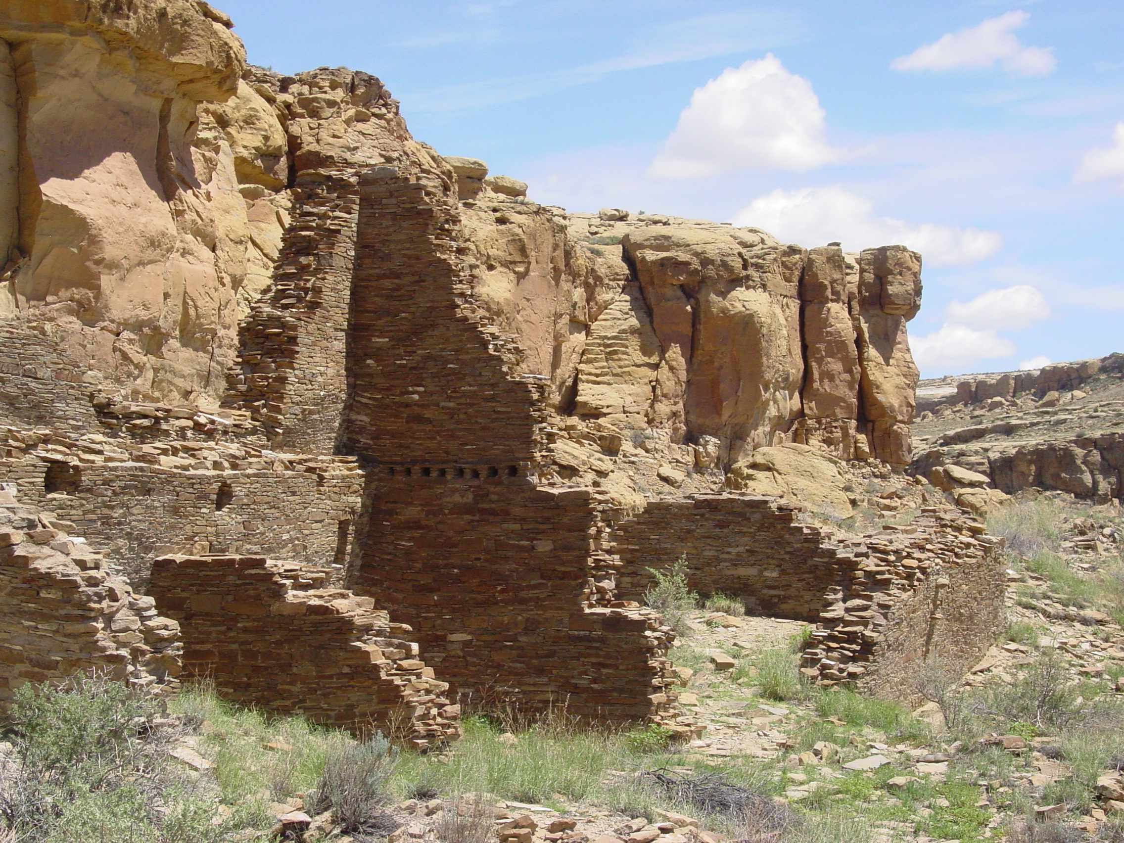
The Buildings
Chaco's 'great houses' were the largest buildings in North America until the 19th century. Pueblo Bonito, the largest, contained over 600 rooms arranged in a perfect D-shape, rising four stories high. The walls were constructed with intricate stone masonry. Some rooms required 30 million quarried stone pieces.
The engineering was remarkable. Without metal tools, wheels, or draft animals, the Chacoans moved thousands of 200-pound wooden beams from forests 50 miles away. They built elaborate drainage systems. They aligned their buildings to astronomical events with accuracy that would impress modern surveyors.
The Astronomy
Chaco was designed around the sky. The primary axis of Pueblo Bonito aligns to the north-south meridian within half a degree. A spiral petroglyph on Fajada Butte marks the solstices and equinoxes with a 'sun dagger' - shafts of light that pierce the spiral's center only on specific days.
The 18.6-year lunar standstill cycle - the maximum and minimum extremes of the moon's rising and setting points - is marked by multiple structures. The Chacoans tracked celestial cycles that most modern people have never heard of. Their buildings were calendars written in stone.
The Roads
Over 400 miles of roads radiate from Chaco Canyon. These weren't trails worn by feet - they were engineered highways, 30 feet wide, cut into the desert rock, running in straight lines that ignored terrain. Staircases were carved into cliffs where the roads crossed them.
But the roads present a puzzle: the Chacoans had no wheeled vehicles and no pack animals. Why build highways? Some roads lead to distant outlying communities. Others seem to go nowhere. Were they pilgrimage routes? Trade networks? Symbolic connections between communities? The roads remain enigmatic.
The Purpose
What was Chaco for? The great houses have few domestic features - few fire pits, few grinding stones, little evidence of permanent habitation. They may have been ceremonial centers, visited for rituals and pilgrimages but not continuously occupied.
The enormous quantities of turquoise, cacao, and macaw feathers found at Chaco suggest it was a trading center, drawing goods from as far as Mexico. It may have been a political capital, a religious center, an astronomical observatory - or all of these at once. The Chacoans left no written records. The stones are silent.
The Abandonment
By 1150, Chaco was abandoned. Tree-ring data shows severe droughts in the 12th century. Deforestation may have depleted resources. Some evidence suggests increasing violence in the region. The population may have simply moved to more sustainable locations.
The descendants of the Chacoans - today's Pueblo peoples - regard Chaco as an ancestral homeland. They speak of Chaco in their oral traditions. But the canyon itself stands empty, its great houses crumbling slowly under the desert sun. Chaco remains one of North America's greatest archaeological sites - and one of its deepest mysteries.
From the Air
Chaco Culture National Historical Park (36.06N, 107.96W) lies in remote northwestern New Mexico. Albuquerque International (KABQ) is 250km southeast. The canyon is accessible only by rough dirt roads. The terrain is high desert mesa. The great houses and roads are visible from the air. Weather is semi-arid - hot summers, cold winters, frequent clear skies ideal for stargazing.