Chaharbagh: Isfahan's Avenue of Four Gardens
Shah Abbas I had a problem with vineyards. Four of them, specifically, stood between his vision and its realization. So he bought them all. The avenue he built through their former grounds in the 1590s became the Chaharbagh, literally "Four Gardens," the ceremonial spine of a capital city he was determined to make the most magnificent in the world. Isfahan had been chosen as the new Safavid capital in 1591, replacing Qazvin, and Abbas intended to announce the move with architecture that would stop foreign ambassadors mid-sentence. The Chaharbagh did exactly that. Stretching roughly six kilometers through the city, lined with the residences of dignitaries and the gardens of the powerful, it was never meant to be a highway. It was a promenade, a statement, a garden you happened to walk through on your way somewhere else.
Half the World in One Street
Isfahan earned the epithet "Nesf-e Jahan," Half the World, and the Chaharbagh was its central artery. The chief architect of Shah Abbas's urban transformation was Shaykh Bahai, the polymath scholar Baha' ad-Din al-'Amili, who organized the city around two monumental features: this grand avenue and the vast Naqsh-e Jahan Square, the "Exemplar of the World." Down the center of the Chaharbagh, water flowed in stone channels, dropping from terrace to terrace in miniature cascades. Plane trees, cypresses, pines, and junipers lined both sides. The avenue reached a maximum width of 48 meters. Foreign dignitaries built their residences along it. At its southern end, the Si-o-se-pol, the Bridge of Thirty-Three Arches, carried the boulevard across the Zayanderud River. This was urban planning as spectacle, designed to overwhelm.
Gardens Within Gardens
The name "Four Gardens" refers to more than the purchased vineyards. It invokes a traditional Persian garden form: the chahar bagh, where four plots are divided by waterways or paths in a cruciform plan, symbolizing the four rivers of paradise described in Islamic tradition. Walking the Chaharbagh was meant to feel like entering paradise on earth. On its eastern flank stood two of Isfahan's great garden palaces. The Hasht Behesht, the Palace of Eight Paradises, displayed the Safavid talent for merging architecture with landscape. Nearby, the Chehel Sotoun, the Palace of Forty Columns, reflected its twenty wooden columns in a long pool, doubling them to produce the name. Gardens were political statements in Safavid Iran. They demonstrated control over water, mastery of horticulture, and the wealth to maintain beauty on a grand scale.
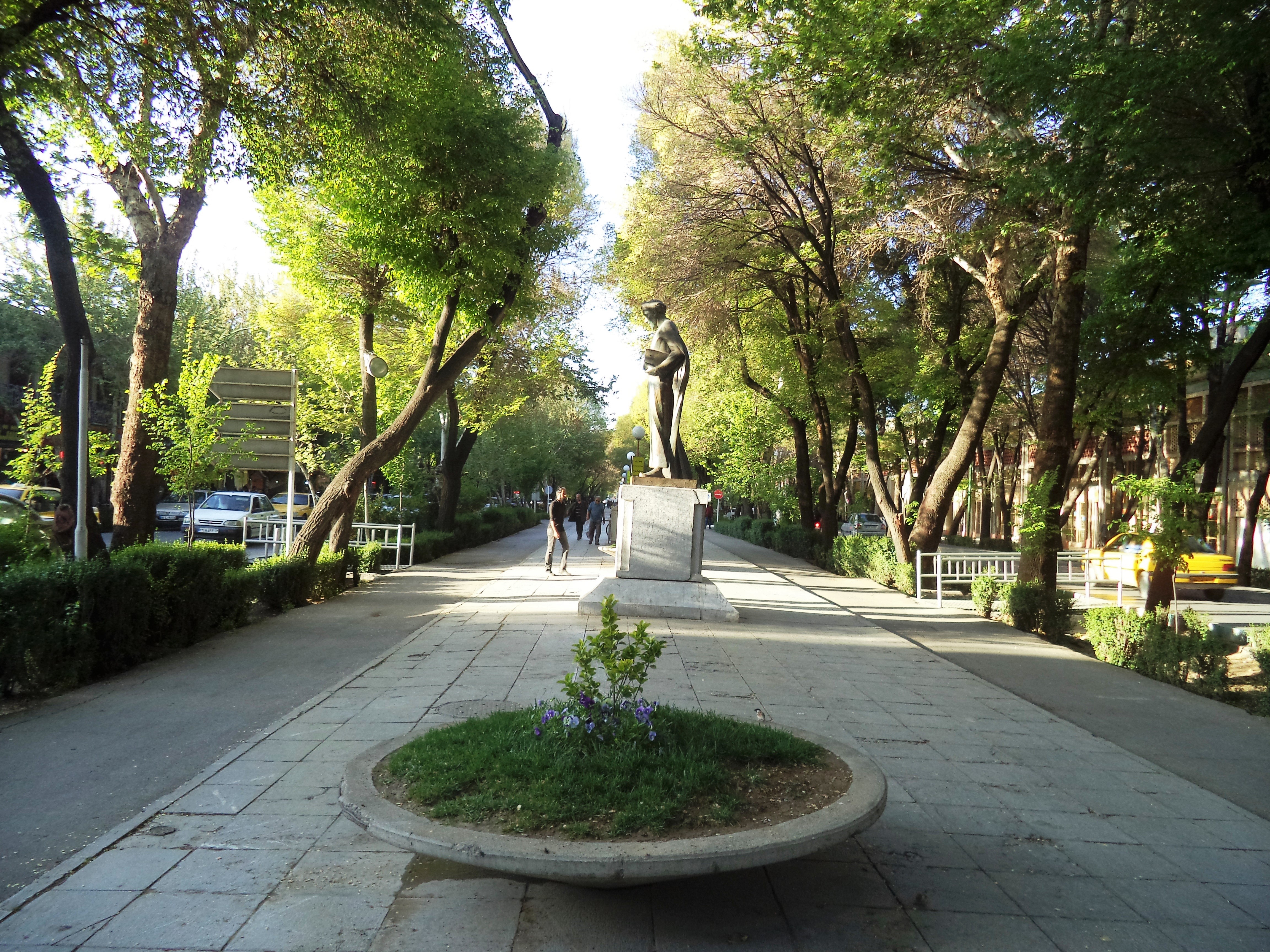
The Champs-Elysees of the East
European travelers who encountered the Chaharbagh reached for the grandest comparisons they knew. Many called it the Champs-Elysees of Isfahan, a comparison that has stuck for centuries. In some ways the analogy undersells the original. The Champs-Elysees was built for display and movement. The Chaharbagh was built for pleasure. Shah Abbas never intended it as a transportation corridor. It was a place of recreation, where Isfahanis walked among trees and flowing water, where social life unfolded in the shade of centuries-old plantings. The avenue's three sections each carried distinct character. Chaharbagh Pa'in, the northern stretch, connected the old city core from Shohada Square southward. Chaharbagh Abbasi, the celebrated middle section, has been pedestrianized in modern times, restoring something of its original purpose. Chaharbagh Bala, the southern section, extends from the great bridge to Azadi Square.
Still Walking After Four Centuries
Isfahan today is a city of more than two million people, and the Chaharbagh remains its most recognizable boulevard. The opening of the Enghelab metro station allowed the middle section, Chaharbagh Abbasi, to be closed to vehicle traffic, returning it to pedestrians. The water channels are quieter now, the plane trees older, but the essential experience Shah Abbas designed persists: a wide avenue where people walk for the sake of walking, where shade invites lingering, where the city's history lines both sides of the path. The Safavid dynasty that built it fell in 1722 when Afghan invaders sacked Isfahan. Subsequent rulers, the Qajars among them, maintained and adapted the boulevard. Wars, revolutions, and modernization altered the city around it. The avenue endured. Some urban spaces survive because they are preserved as monuments. The Chaharbagh survives because it is still useful, still beautiful, still exactly what Shah Abbas intended: a garden you pass through on your way to the rest of the world.
From the Air
Located at 32.66°N, 51.67°E in Isfahan, Iran, running roughly north-south through the city center. From altitude, the Chaharbagh appears as a tree-lined boulevard bisecting Isfahan's dense urban fabric, connecting to the Si-o-se-pol bridge over the Zayanderud River at its southern extent. The Naqsh-e Jahan Square, one of the largest public squares in the world, lies to the east. Isfahan International Airport (OIFM) is approximately 20 km to the northeast. The Zagros Mountains form the western backdrop, while the city sits on the edge of Iran's central plateau. The Zayanderud River, Isfahan's lifeline, is clearly visible threading through the city.