Chattooga River
The river that Burt Reynolds paddled down in 1972 does not care about its Hollywood credentials. The Chattooga moves through some of the oldest rock on Earth, carving its way between Georgia, South Carolina, and North Carolina through granite born in the ancient Blue Ridge Mountains. Before it was the fictional Cahulawassee River in James Dickey's novel Deliverance, before it became the first river east of the Mississippi to earn Wild and Scenic protection, the Chattooga flowed through Cherokee homeland. A town called Chattooga stood along its upper banks until an 1816 treaty forced the people to cede the territory. The river kept flowing -- as it has for millions of years, possibly changing direction only once in its entire geological life.
A River That Switched Oceans
The Chattooga begins southwest of Cashiers, North Carolina, in southern Jackson County, and flows southwestward to its confluence with the Tallulah River at Lake Tugalo. From there its waters join the Tugaloo, then the Savannah, and finally reach the Atlantic Ocean near Savannah, Georgia. But geologists believe this was not always the plan. Originally, the Chattooga probably flowed southwesterly into the Chattahoochee River and on to the Gulf of Mexico. At some point deep in geological time, the Savannah River eroded its way northward until it captured the Chattooga, stealing its waters and redirecting them to the Atlantic. The Blue Ridge granite through which the river cuts is ancient even by geological standards. Boulders in the riverbed are not permanent fixtures -- during Hurricane Ivan in 2004, the Chattooga's flow surged to levels rivaling the typical flow of the Colorado River through the Grand Canyon, knocking massive boulders off the banks and reshuffling the riverbed.
Cherokee Waters
The Chattooga forms part of the boundary between Georgia and South Carolina, but it was not always a border. Prior to 1816, the river ran through the heart of Cherokee territory. A Cherokee town named Chattooga stood along the upper river, and the name itself -- spelled variously as Chatooga, Chatuga, and Chautaga, with the variant name Guinekelokee River -- reflects the deep Indigenous connection to these waters. The US Board on Geographic Names settled on the 'Chattooga' spelling in 1897. An 1816 treaty between the United States and the Cherokee extended South Carolina's boundary to the river, and the Cherokee were forced to surrender the land. The river did not change, but everything around it did. The forests that once sheltered Cherokee towns would eventually become three separate National Forests spanning three states: the Chattahoochee in Georgia, the Nantahala in North Carolina, and the Sumter in South Carolina.
Deliverance and Designation
James Dickey's 1970 novel Deliverance made the Chattooga famous before most Americans had ever heard of Wild and Scenic Rivers. The 1972 film adaptation, starring Jon Voight, Burt Reynolds, Ned Beatty, and Ronny Cox, shot its iconic whitewater scenes along the Chattooga, and the river's signature rapids appeared in some of cinema's most harrowing sequences. The attention cut both ways -- the movie brought throngs of paddlers to a river that could be unforgiving. Just four years after the film's release, on May 10, 1974, the Chattooga became the first river east of the Mississippi to receive Wild and Scenic River designation. A protected corridor now shields the river, with no roads or development permitted within a quarter mile of the commercially rafted sections. The Chattooga also bisects the Ellicott Rock Wilderness, which straddles all three states. It remains the only Wild and Scenic River east of the Mississippi that is commercially rafted.
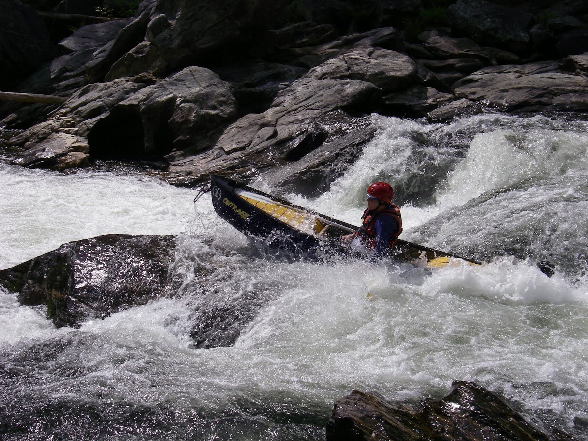
Five Falls and the Limits of Adventure
The Chattooga is divided into numbered sections, each with its own character. Section 2 starting at Highway 28 is a gentle Class II float. Section 3 delivers Class II to IV rapids, culminating in the thundering Bull Sluice. Section 4 is where the river shows its teeth: Class II through V rapids, including the famous Five Falls -- five major rapids packed into roughly a quarter mile. The minimum age to raft Section 3 is eight; for Section 4, it is twelve. Boating on the upper reaches was prohibited for decades under a 1976 Forest Plan, and when the US Forest Service expanded access in 2012 to include Section 1, the decision proved controversial due to the number of deaths on the river. Boating remains illegal above Greens Creek and below Licklog Creek. The upper sections are difficult, often clogged with flood debris, and flow infrequently. The Chattooga rewards respect and punishes overconfidence.
From the Air
Located at 35.12N, 83.12W along the Georgia-South Carolina-North Carolina tri-state border in the southern Blue Ridge Mountains. The river is a clearly visible silver thread winding through dense forest canopy from the air. It flows roughly southwest from its headwaters near Cashiers, NC, to Lake Tugalo on the GA-SC border. The Ellicott Rock Wilderness, which the river bisects, is a roadless area visible as unbroken forest cover. The nearest airports are Habersham County Airport (KAJR) in northeast Georgia and Oconee County Regional Airport (KCEU) in South Carolina. Recommended viewing altitude: 3,000-5,000 feet AGL to follow the river corridor through the mountain gorge.