Chermin Island: The Fortress That Swallowed a Sultan
Sultan Abdul Hakkul Mubin knew he was running out of options. It was the 1660s, Brunei was tearing itself apart in civil war, and the man who had seized the throne after orchestrating the assassination of his predecessor needed a place that was both palace and fortress. He chose Chermin Island -- a five-hectare knot of jungle and rock at the mouth of the Brunei River, rising 34 meters above the water, its steep slopes crawling with crocodiles and snakes. It was, in every sense, a desperate choice. When his enemies finally came for him, Mubin loaded the royal regalia into a cannon and fired them into Brunei Bay rather than surrender them. He was killed on the island he had fortified, and it is said he was buried there too, though the jungle has long since consumed any trace of his grave.
Five Hectares of Teeth and Venom
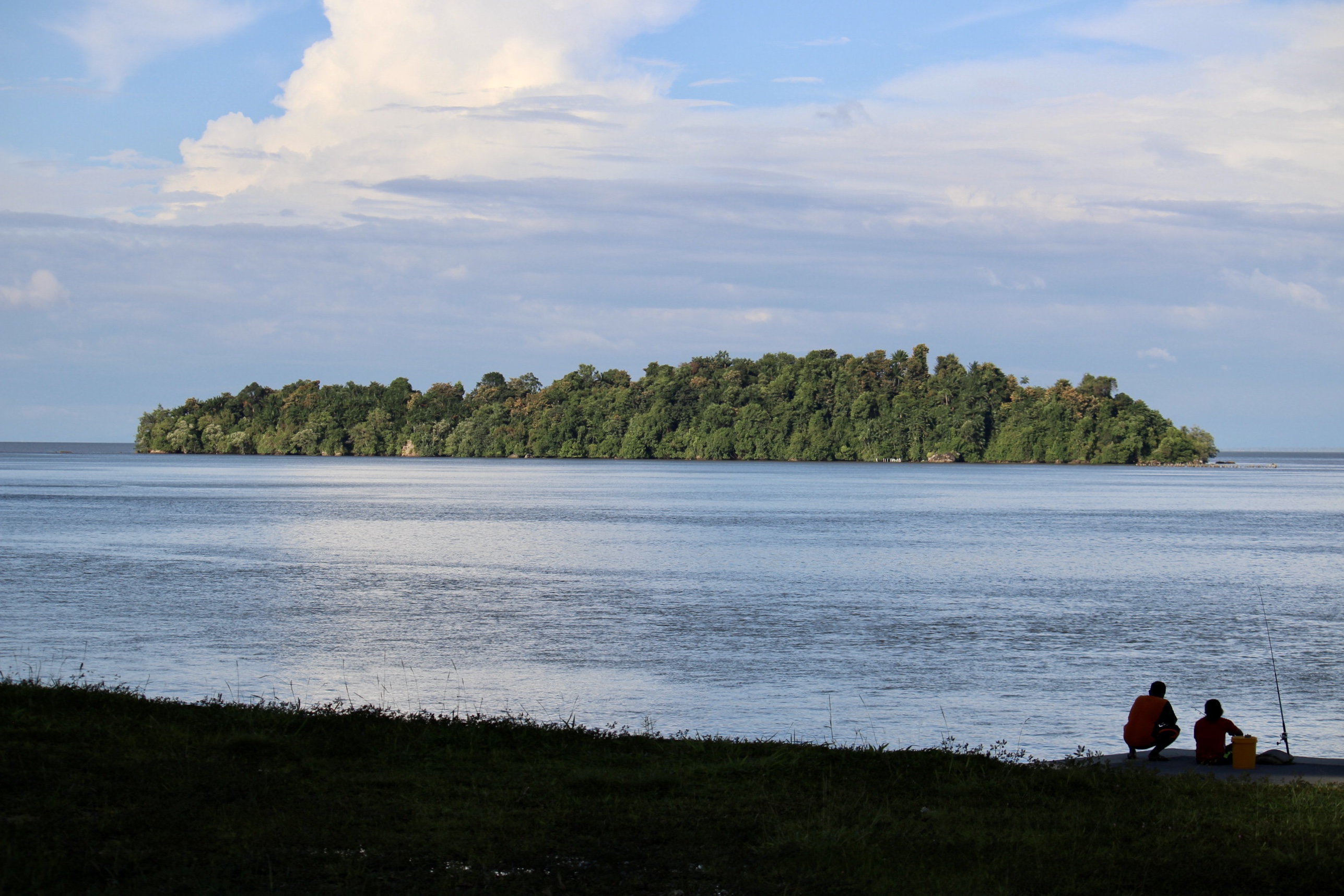
Chermin Island sits at the mouth of the Brunei River, within the secondary bay southwest of Brunei Bay. Despite its proximity to Bandar Seri Begawan -- close enough that people frequently mistake it for part of the capital -- the island has never been truly tamed. Its terrain is steep and densely forested, the kind of impenetrable tropical vegetation that reasserts itself within a single monsoon season. Crocodiles patrol its shoreline, and snakes thread through the undergrowth, making any landing an exercise in calculated risk. The northern end is marked by a large rock, and Chermin Rock lurks nearby, mostly submerged at less than two meters depth -- a hazard that has caught at least one ship off guard. On the evening of 27 December 1958, the SS Juno, traveling downstream from Brunei Town with a pilot aboard, struck the turning light beacon off Chermin Island and brought the structure crashing down.
The Castilian Scars
The island's military significance predates its most famous resident by a century. After the Castilian War of the late sixteenth century -- during which Spanish forces from the Philippines devastated Brunei's capital -- the sultanate undertook a systematic effort to fortify the approaches to the Brunei River. Chermin Island, positioned at the river's mouth near the narrow channel leading upstream to the seat of power, became a key defensive point. Forty boats loaded with stones were reportedly sunk to construct a fort connecting Chermin Island to nearby Keingaran Island, creating a barrier that could control passage into the river. The fortifications reflected a hard-won lesson: a maritime empire that could not defend its own waterways was an empire waiting to fall.
A Civil War's Island Throne
The civil war that erupted between 1661 and 1673 pitted Sultan Muhyiddin against Sultan Abdul Hakkul Mubin, and it turned Chermin Island into the stage for one of the most dramatic episodes in Bruneian history. Mubin relocated the administrative capital from Kota Batu to the island, building a palace and houses on its heights. The Pengiran Bendahara had proposed the construction, and the Pehin Orang Kaya Digadong Seri Nara ordered it built. From this jungle fortress, Mubin governed -- or tried to. Meanwhile, Muhyiddin declared himself the fourteenth sultan from his own power base around Kampong Ayer, and the country split between two competing claims to the throne. When Muhyiddin's forces finally assaulted the island, aided by troops from the Sultan of Sulu, they found the fortifications already shattered by an earlier bombardment from Tanjong Kindana. Mubin was captured and executed. His final defiant act -- firing the royal regalia from a cannon into the bay -- ensured that the symbols of sovereignty would belong to no one.
The Second Assassination
Chermin Island's association with political violence did not end with Mubin. In 1828, Sultan Muhammad Alam was allegedly assassinated on the island by a hired killer, an event that marked the close of yet another period of civil strife. The account is contested. Historian Jamil Al-Sufri has questioned the claim, noting a lack of supporting evidence. An alternative version holds that Muhammad Alam left Brunei voluntarily and relocated to Putatan in Sabah, where a gravestone believed to be his has been identified. The tombstone's style closely resembles other royal burial markers in Brunei, lending some credibility to the Sabah theory -- though it hardly resolves the mystery. Whether he died on Chermin Island or departed from it, the islet's reputation as a place where sultans met their end was cemented.
Printed on the Currency
In 1992, the University of Brunei Darussalam's Biology Department surveyed Chermin Island and recommended its preservation -- not for its violent history, but for its ecological value. The island's rich sediment, diverse wildlife, and dense plant life had survived precisely because its terrain and resident reptiles discouraged development. By 2000, Chermin Island was gazetted under the Antiquities and Treasure Trove Act, granting it formal legal protection. Four years later, the government placed the island's image on the reverse of the B$100 note, an honor that elevated a crocodile-infested rock where sultans were murdered to the status of national symbol. The juxtaposition is characteristically Bruneian: a country comfortable with the full complexity of its past, willing to put its most turbulent history on its highest-denomination banknote.
From the Air
Chermin Island sits at approximately 4.93N, 115.025E at the mouth of the Brunei River, clearly visible as a small, densely forested islet within the secondary bay southwest of Brunei Bay. The island rises to 34 meters and is distinctive from the air due to its compact jungle canopy surrounded by water. Best viewed at 1,500-2,500 feet AGL. Brunei International Airport (WBSB) is approximately 10 nm to the northeast. Nearby landmarks include Kampong Ayer (stilt village) upstream and the town of Muara to the northeast. Chermin Rock, mostly submerged, lies near the island's northern end -- a navigational hazard worth noting.