Cherokee Heritage Center
For four years, the Cherokee Heritage Center existed in the basement of a retired Army colonel's house. Marty Hagerstrand had started researching Cherokee history as a hobby in the late 1950s, but what began as personal curiosity became an obsession that would transform a jungle of vines and sinkholes on the grounds of the old Cherokee Seminary in Park Hill, Oklahoma, into one of the most authentic cultural preservation sites in the country. When it opened in 1967, more than 5,000 people watched the governor of Oklahoma dedicate a village that had been built entirely by hand, using native materials and ancient Cherokee methods.
From Basement to Blowguns
Colonel Hagerstrand found an essential partner in William Wayne Keeler, Principal Chief of the Cherokee Nation, who publicly championed the preservation of Cherokee culture and heritage. The concept was economic development fused with cultural preservation -- the Heritage Center would draw visitors to Tahlequah while keeping Cherokee traditions alive. In 1966, a design contract was signed with a Tulsa architecture firm, and construction began under Hagerstrand's direct supervision. Starting with twelve full-blood Cherokee workers, crews cleared the overgrown seminary site, salvaged foundation stones from the old building, and began constructing the Ancient Village -- a complete reproduction of a mid-18th century Cherokee township. Hand labor and traditional techniques ensured authenticity. By opening day, visitors could walk through a seven-sided council house, try their hand at using a blowgun, and play stickball.
Two Villages, Two Eras
The Cherokee Heritage Center grounds tell the Cherokee story across time through two reconstructed villages. The Ancient Village reproduces Cherokee life as European explorers would have encountered it, with a traditionally built council house, a brush arbor, and demonstrations of hunting techniques, religious practices, and traditional crafts. The Adams Corner Rural Village depicts a typical Cherokee settlement after removal to Indian Territory -- a different era with different architecture, but the same resilient culture adapting to a new homeland. Between the two, visitors experience the enormous upheaval of the Trail of Tears and the forced removal of the 1830s, not as abstraction but as a physical journey across the grounds, from one way of life to another.
Roots and Branches
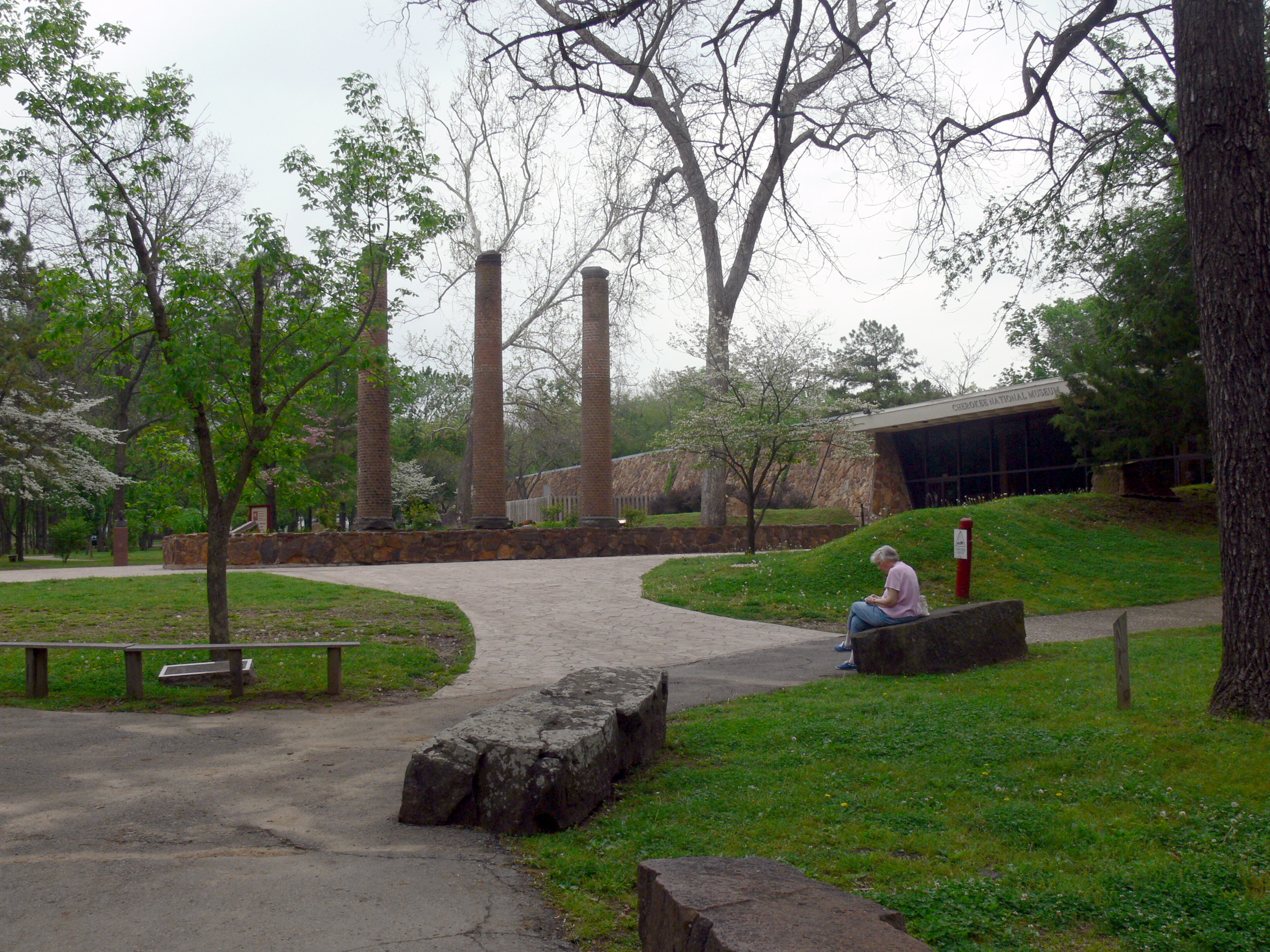
Cherokee artist Cecil Dick advised on planting trees and herbs important to Cherokee culture, and the grounds now feature a rich variety of plant species used traditionally for medicine, food, construction, and tools. The abundant native plant life has attracted diverse animal species, making the Heritage Center grounds an excellent spot for birdwatching and hiking. The Cherokee National Museum houses an extensive collection of ancient artifacts, historic documents, art, and cultural objects, including relics from the 1830s march along the Trail of Tears. The center also serves as the central genealogy database and research center for the Cherokee people -- a place where descendants can trace their family lines back through centuries of history.
A Living Tradition
Every spring since 1971, the Cherokee Heritage Center has hosted the Trail of Tears Art Show, a juried exhibition open to artists from all tribes. Each fall, Cherokee Homecoming welcomes artists enrolled in one of the three federally recognized Cherokee tribes. From 1969 to 2005, an outdoor amphitheater on the grounds hosted The Trail of Tears, a dramatic production commissioned by the Cherokee Nation that told the story of forced removal and subsequent life in Oklahoma. The Heritage Center is sponsored by the Cherokee Nation and the United Keetoowah Band of Cherokee Indians, and it remains what Hagerstrand and Keeler envisioned: a place where Cherokee history is not locked behind glass but walked through, touched, and passed to the next generation.
From the Air
Located at 35.867N, 94.956W in Park Hill, Oklahoma, a suburb of Tahlequah -- the capital of the Cherokee Nation. The center is surrounded by rolling wooded hills of the Ozark foothills. Nearest airports include Tahlequah Municipal Airport (KTQH). The Illinois River valley provides a prominent visual landmark to the east. Best viewed at 2,000-3,000 ft AGL.