Chic-Chocs Wildlife Reserve
The Appalachian Mountains do not end where most people expect. They push northeast through Maine, cross into New Brunswick, and make one last dramatic stand on Quebec's Gaspe Peninsula, where the Chic-Choc range rises to nearly 1,270 meters -- high enough to create alpine tundra in a province most people associate with river valleys and farmland. The Reserve faunique des Chic-Chocs sprawls across this highland backbone east of Gaspe National Park, a territory of boreal forest, wind-scoured ridges, and cold lakes where brook trout still run thick and the endangered Gaspe caribou clings to survival in one of its last refuges south of the St. Lawrence.
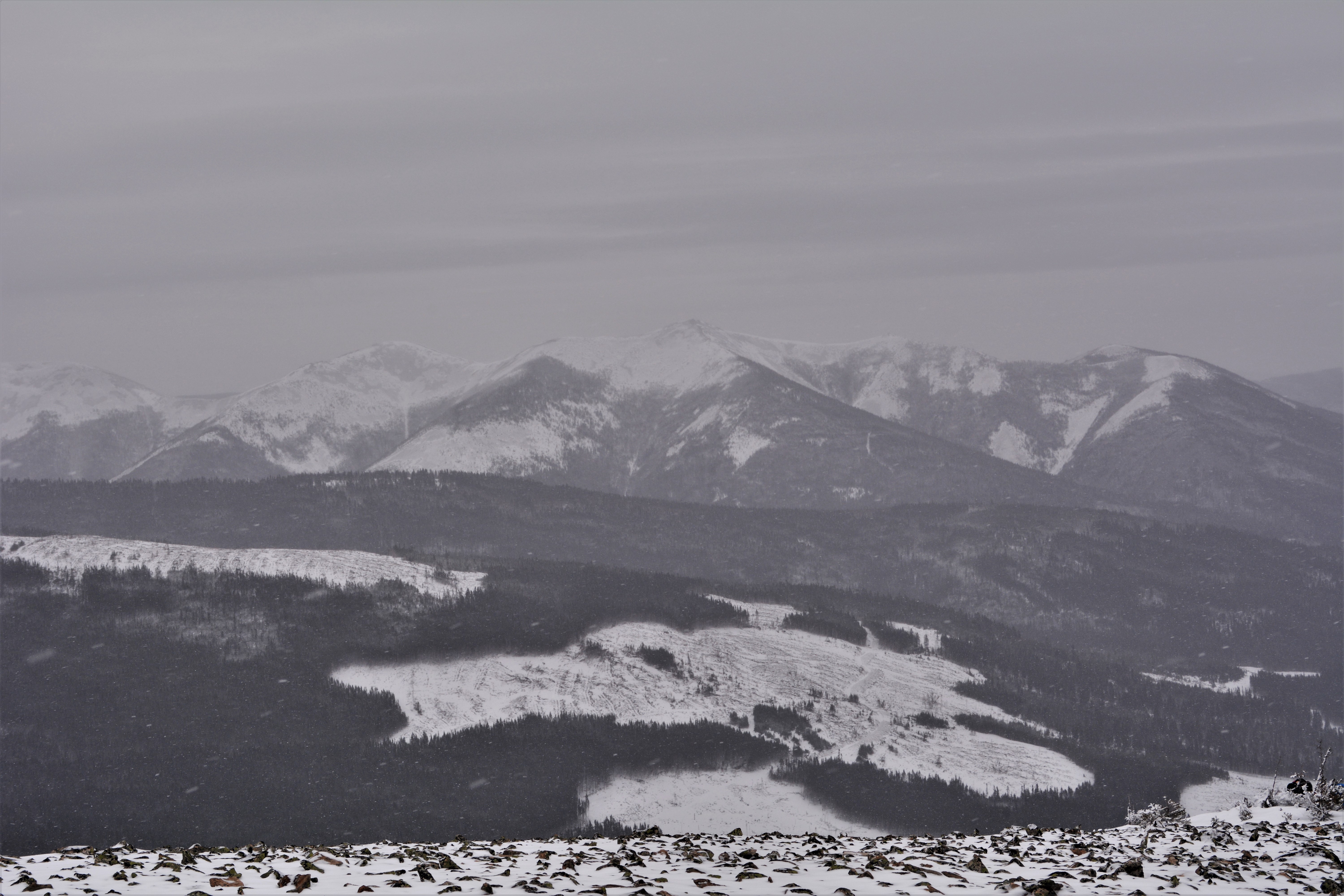
Appalachia's Northern Rampart
The reserve is defined by two mountain groups: the Chic-Chocs and the McGerrigle Mountains. Mont Jacques-Cartier, the highest summit in southern Quebec at 1,268 metres, anchors the massif, surrounded by peaks like Blanche-Lamontagne at 930 meters and Brown at 855 meters. These altitudes create something unusual for this latitude: a vertical compression of ecosystems. At the base, balsam fir and white birch dominate, their stands periodically reshaped by spruce budworm outbreaks that sweep through like slow-motion fires. Higher up, the forest thins to krummholz and then to open alpine terrain where caribou lichens carpet the ground. The different elevations feed a web of rivers -- the Madeleine, Mont-Louis, Sainte-Anne, Marsoui, Cascapedia, and Bonaventure -- that drain into both the St. Lawrence and Chaleur Bay, making this highland a hydrological hub for the entire peninsula.
The Caribou's Last Southern Stand
The Gaspe caribou is a woodland caribou population that once ranged widely across the peninsula. By 2004, it occupied approximately 802 square kilometers in Gaspesie National Park and 290 square kilometers in the surrounding area, including much of the Chic-Chocs reserve. COSEWIC, Canada's Committee on the Status of Endangered Wildlife, has designated this population as threatened. The animals need large, continuous tracts of mature coniferous forest, lichens, muskegs, and peat bogs -- exactly the kind of habitat that road construction and logging fragment. As ecosystems shrink, caribou become easier targets for black bears, Canada lynx, and coyotes. Since 1992, Quebec's forestry ministry has promoted a series of habitat protection measures in and around the reserve, including forest management plans designed to preserve the old-growth stands the caribou depend on. The reserve's high-value conservation zones -- the Saint-Real valley, Mont Saint-Pierre, and Mont Sainte-Anne -- represent the heart of this effort.
Where Hunters and Anglers Come to Test Themselves
For all its conservation significance, the Chic-Chocs reserve is also a working landscape managed by SEPAQ, Quebec's outdoor recreation network. Moose density here is high compared to other reserves in the region, and the annual moose hunt -- running from early September through late October -- draws hunters from across the province. Black bear hunting is permitted for a shorter window between May and June. Fishing, particularly for brook trout and lake trout, is the reserve's other economic engine. In 2015, anglers recorded roughly 7,551 catches across the reserve's lakes and rivers. The season runs from late May to early September, with fishermen limited to ten brook trout and two lake trout per day. Lakes Adam, Mont-Louis, Madeleine, Sainte-Anne, and Branche-Nord offer multi-day fishing camps accessible by reserve roads, while day-fishing permits are available from the administration office at Mont-Saint-Pierre.
Into the High Country
Beyond the hunting and fishing, the reserve offers something harder to quantify: the experience of genuine remoteness in eastern Canada. Viewing towers scattered through the territory provide chances to spot moose and bears without leaving marked trails. A four-kilometer hiking route crosses the McGerrigle Mountains past Lac a Pierre, offering panoramic views of the boreal highlands. For newcomers, a gentler trail departs from the Branche Lake-North chalet along route 22. Access is via Route 299 from Mont-Saint-Pierre or Sainte-Anne-des-Monts, or Route 198 through L'Anse-Pleureuse -- roads that wind through river valleys before climbing into a landscape that feels far older and wilder than the fishing villages along the coast below.
From the Air
Located at 48.94N, 65.83W in the interior highlands of the Gaspe Peninsula. The Chic-Choc and McGerrigle mountain ranges are clearly visible from altitude as the highest terrain on the peninsula, with Mont Jacques-Cartier prominent. Nearest airports are Mont-Joli Airport (CYMJ) to the west and Michel-Pouliot Gaspe Airport (CYPG) to the east. Approach from the north over the St. Lawrence for dramatic views of the mountain wall rising from the coast. Terrain rises to approximately 1,270 meters.