Chicago River
The name Chicago comes from shikaakwa, the Native American word for wild leeks that once grew abundantly along this river's banks. The city took its name from the plant, the plant took its place from the water, and the water -- well, the water no longer goes where nature intended. In 1900, engineers reversed the flow of the Chicago River, forcing it to drain away from Lake Michigan and into the Mississippi River watershed instead. They did this because the river had been carrying the city's sewage into the same lake that provided its drinking water, and typhoid fever was the predictable result. The reversal was so massive, so consequential to the hydrology of two entire river basins, that a U.S. Supreme Court decision now governs how much water Chicago is allowed to divert. The river that gave the city its name became the river the city remade in its own image.
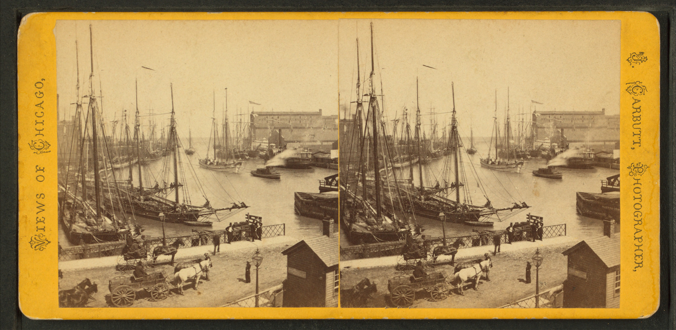
Where Three Branches Meet
The Chicago River is a system of rivers and canals that runs through the heart of the city, its three branches converging at Wolf Point. The North Branch rises in the northern suburbs where the Skokie River, Middle Fork, and West Fork come together, flowing south through forest preserves and golf courses before entering the city near Milwaukee Avenue. The South Branch runs from Wolf Point past Willis Tower, the Civic Opera House, and Union Station before emptying into the Chicago Sanitary and Ship Canal. The main stem connects Lake Michigan to Wolf Point, threading between the Tribune Tower, Wrigley Building, Merchandise Mart, and Marina City. The river is represented on Chicago's flag by two blue stripes, and its Y-shaped confluence inspired the city's municipal device -- a three-branched symbol found on buildings and structures throughout Chicago.
A River Running the Wrong Way
During the last ice age, the area that became Chicago sat under Lake Chicago, which drained south into the Mississippi Valley. As the ice retreated, a short ridge separated the Great Lakes watershed from the Mississippi basin, and the Chicago River began its sluggish eastward flow into Lake Michigan. By the mid-1800s, this meant the city's sewage went straight into its water supply. An 1885 extreme weather event threatened the water supply so severely that the Illinois General Assembly decided to reverse the flow. The state created the Chicago Sanitary District, which replaced the inadequate Illinois and Michigan Canal with the much larger Chicago Sanitary and Ship Canal. Completed by 1900, the project used canal locks and pumping stations to pull Lake Michigan water into the river and send it flowing west instead of east. The American Society of Civil Engineers named the system a 'Civil Engineering Monument of the Millennium' in 1999.
The Morning the Eastland Rolled
On July 24, 1915, the SS Eastland -- an excursion steamer packed with more than 2,500 passengers -- rolled over at its dock on the south bank between the Clark Street and La Salle Street bridges. The ship had not even left the pier. It capsized so quickly that 844 people were killed, many trapped beneath the hull or crushed by pianos, tables, and the weight of other passengers. The victims were mostly employees of the Western Electric Company and their families, headed for a company picnic across Lake Michigan. Frantic rescue attempts followed, and early versions of what would become trauma teams formed to address the overwhelming scene. A memorial at the southeast end of the La Salle Street Bridge, first dedicated in 1989, marks the site of one of the deadliest disasters in Great Lakes history.
Plumbers, Green Dye, and a Sixty-Year Tradition
Every year around Saint Patrick's Day, the Chicago River turns emerald green. The tradition began by accident in 1961 when plumbers used fluorescein dye to trace illegal pollution discharges and noticed the vivid green color it produced. They proposed a continuing celebration to Mayor Richard J. Daley, and the practice stuck. Cook County has the highest number of Irish Americans of any county in the United States. Environmental concerns eventually ruled out fluorescein -- it was harmful to the river -- and the plumbers' union, which still sponsors the dyeing, now uses a formula it closely guards. The environmental organization Friends of the Chicago River disapproves, saying the practice 'gives the impression that it is lifeless and artificial.' In 2009, First Lady Michelle Obama, a Chicago native, had the White House fountains dyed green in tribute to the tradition.
The Flood Beneath the Streets
On April 13, 1992, the Chicago River poured into an abandoned freight tunnel near the Kinzie Street railroad bridge after a pile driven into the riverbed months earlier cracked the tunnel wall. The tunnels belonged to the former Chicago Tunnel Company, a narrow-gauge freight railway that had operated beneath downtown until 1959. Many businesses did not even know they were connected to the tunnel network -- openings had been boarded up or bricked over, but never made watertight. The Merchandise Mart declared a water emergency at 5:57 AM. City Hall flooded by 6:02 AM. The Federal Reserve Bank went under at 8:29 AM. The entire downtown shut down for days. Insurance battles dragged on for years, centered on whether the incident was a 'flood' or a 'leak' -- floods were not covered, leaks were. It was eventually classified as a leak, earning it the name 'the Great Chicago Leak.'
From the Air
Located at 41.89°N, 87.64°W, the Chicago River is one of the most visible water features in the Chicago metropolitan area from the air. Its distinctive Y-shaped confluence at Wolf Point is easily identified from altitude. The main stem runs east-west between the Loop skyscrapers, and the river's green-dyed color during Saint Patrick's Day is visible from high altitude. The South Branch leads southwest toward the Chicago Sanitary and Ship Canal. Nearest airports: Chicago O'Hare (KORD, 15 miles northwest) and Chicago Midway (KMDW, 9 miles southwest). Best viewed at 1,500-3,000 feet AGL where the full course through downtown is visible.