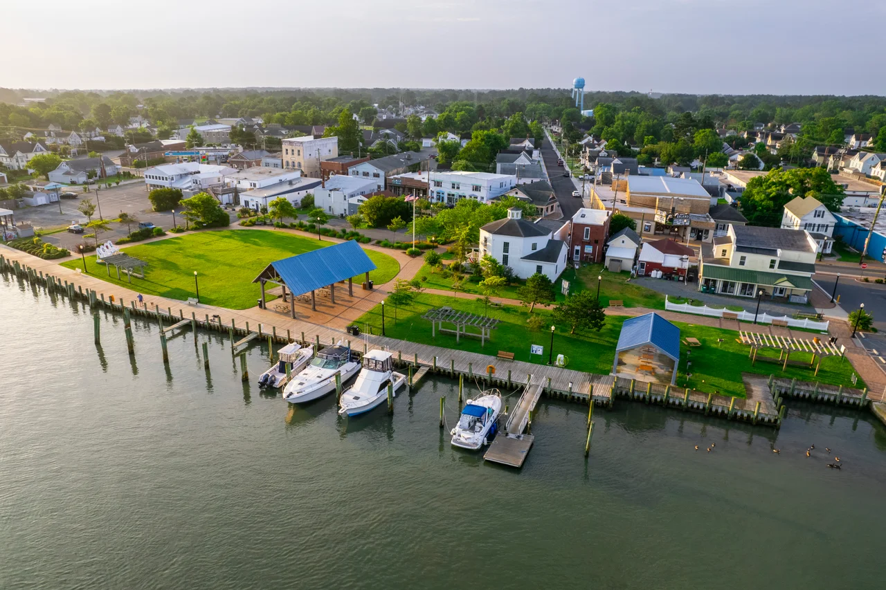

Chincoteague, Virginia
On the last Wednesday of July, at slack tide, the ponies swim. Saltwater Cowboys on horseback herd a wild herd off Assateague Island into the channel; the foals struggling, the older mares leading; a flotilla of small boats keeping clear; and then the whole herd emerges streaming onto the Chincoteague shore. They are walked through town down Main Street to pens at the carnival grounds. The next day the volunteer fire company auctions that year's foals - the proceeds fund the company and control the herd size. On Friday the remaining ponies swim back to Assateague. This has happened almost every year since 1925, and in 1947 a children's book made the rest of the world fall in love with it.
The Town in the Water
Chincoteague is a town that is mostly water. Its 96.7 square kilometers include 23.6 of land and 73.1 of marsh, bay, and channel - about three-quarters water by area. The whole town sits at an elevation of three feet above sea level, which is something the residents think about more often than the tourists do. The population was 3,344 at the 2020 census. The first settlers arrived in 1671; by 1672 the Bishop, Bowden, Jester, and Tarr families had large farms here. By 1838 there were 36 houses. The town's loyalties have always been quietly contrary to expectation: in 1861, with the Civil War looming, the island voted 132-2 against secession and against slavery. The only military action it saw was the Battle of Cockle Creek, fought offshore that same year.
Misty and the Ponies
The legend says the feral ponies on Assateague descend from survivors of a Spanish galleon that sank off the coast in 1750. The historians think they descend from domestic stock that Eastern Shore farmers turned loose on the island in the 1600s to avoid mainland fencing requirements and grazing taxes. Either way the ponies are small, tough, salt-tolerant, and entirely their own thing - separate enough genetically that a Chincoteague Pony is a recognized breed. The Pony Penning began in 1925 as a way for the volunteer fire company to raise money. It would have stayed a regional event if not for Marguerite Henry, who visited in 1946, met a pony farmer named Clarence Beebe and his grandchildren Paul and Maureen, and wrote a children's book published the next year. "Misty of Chincoteague" won the Newbery Honor in 1948 and never went out of print. A 1961 film followed, shot on location. The actual Misty lived on the Beebe Ranch, and there is now a bronze statue of her on Main Street.
Ash Wednesday
On Ash Wednesday in 1962 a nor'easter parked off the Mid-Atlantic coast for three days and refused to leave. Five high tides hammered the barrier islands. Chincoteague went completely underwater. Power was out for days. On Assateague, where development was just starting to push in - lots had been platted, roads laid out, a few cottages built - the storm erased nearly everything. The catastrophe ended up saving the wilder island. In 1965 most of Assateague was preserved as Assateague Island National Seashore, partly because the storm had made development costs unjustifiable and partly because people had seen what happens when you build on sand. The Assateague Lighthouse and the Captain Timothy Hill House are both on the National Register. In March 2020 the town received $53.9 million in critical flood protection funding - because the water has not stopped rising and Chincoteague has not stopped paying attention.
Refuge and Beach
The Chincoteague National Wildlife Refuge spreads across the southern end of Assateague: pine forest, salt marsh, freshwater impoundments engineered for waterfowl, and the long sandy beach that draws summer crowds. The 3.2-mile Wildlife Loop and shorter trails - Swan Cove, Black Duck, Marsh, Snow Goose - thread through habitat where snow geese arrive by the thousands every fall and piping plovers nest on the sand every spring. The 7.5-mile service road runs north along the island, open to hikers year-round and to bikes and cars during November's Waterfowl Week. The Herbert H. Bateman Educational Center and the Tom's Cove Visitor Center anchor each end. The mosquitoes are notorious - bring repellent or regret it. The bike paths into the refuge run from town across the Assateague Channel bridge, and bicycles enter the refuge free.
The Rockets Next Door
Just south, on Wallops Island, NASA's Wallops Flight Facility and the Mid-Atlantic Regional Spaceport launch rockets - Antares vehicles carrying Cygnus cargo modules to the International Space Station, Northrop Grumman Minotaurs, and Rocket Lab Electrons from Launch Complex 2. When a launch is scheduled, every motel in town fills up and the Chincoteague waterfront becomes the best free seat in the Mid-Atlantic for watching a rocket ride a column of orange fire over the marsh. The town has, over time, accumulated a strange and pleasing layered identity: oyster town, decoy-carving town, pony town, beach town, rocket town. It manages all of them at once.
From the Air
Chincoteague is at 37.93N, 75.37W on the Atlantic side of the Delmarva Peninsula. The town sits on its own island connected by bridges to the mainland and to Assateague to the east. Recommended viewing 2,000-4,000 ft to take in the whole archipelago: Chincoteague town, the Assateague Channel, the lighthouse, the long sandy spine of Assateague, and the MARS launch pads just south at Wallops. Nearest airports: Wallops Flight Facility (KWAL) about 4 nm south, Accomack County (KMFV) about 10 nm southwest. Active restricted airspace (R-6604) around Wallops during launch operations and routine NASA activity - check NOTAMs.
Nearby Stories
- Tangier, Virginia 7.8 km away
- SS Marine Electric 9.3 km away
- Worcester County, Maryland 15 km away
- SS Monroe (1902) 16 km away
- Battle of Gwynn's Island 33 km away
- Harriet Tubman Underground Railroad 38 km away
- SMS Ostfriesland 59 km away
- USS Jacob Jones (DD-130) 61 km away