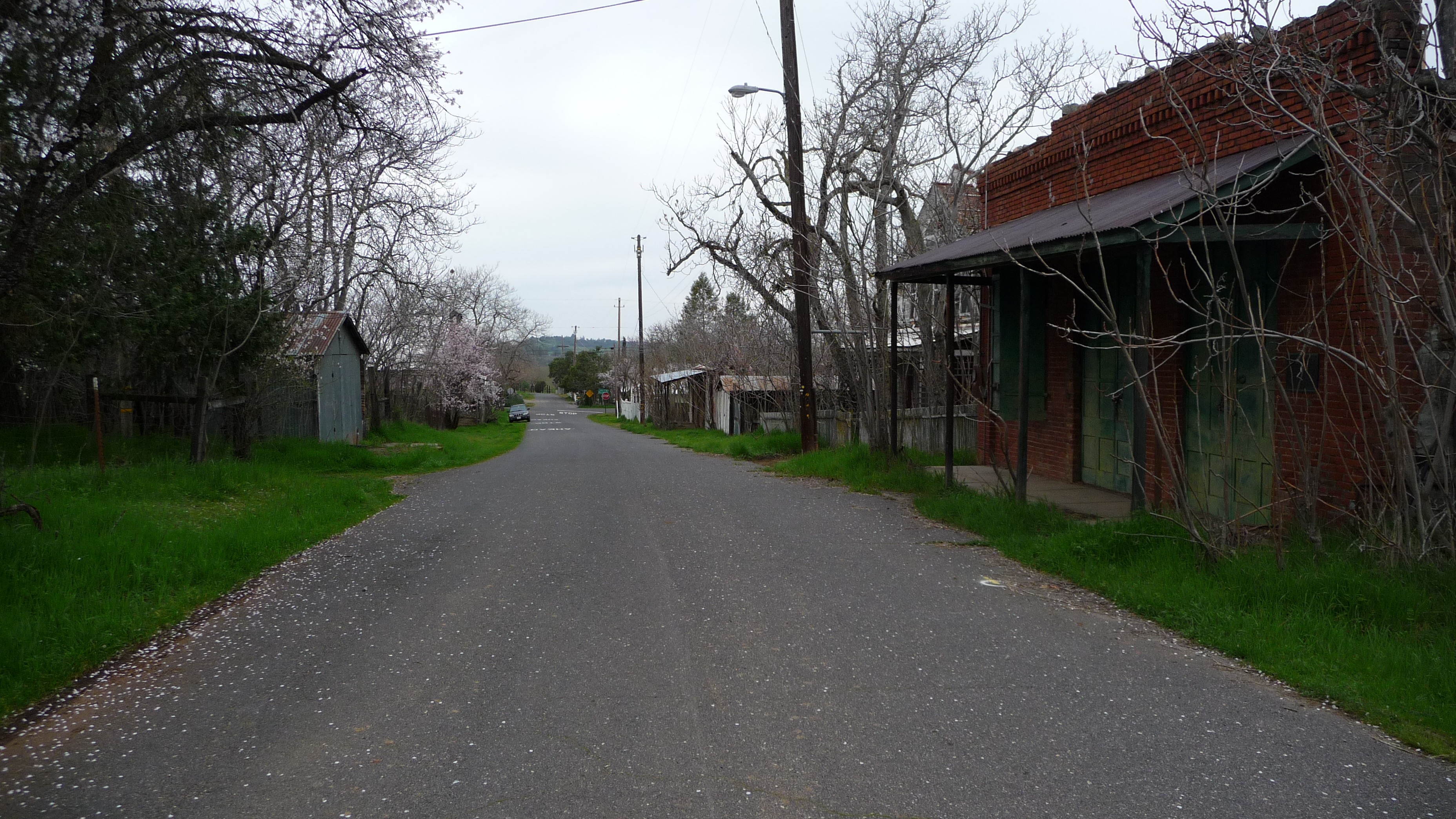
Chinese Camp
Ninety people live in Chinese Camp. That number, stark enough on its own, gains weight when you learn that five thousand once did. In the early 1850s, this settlement in the grassy foothills below the Sierra Nevada was one of the largest Chinese communities in California, a place where miners driven from neighboring claims converged to dig for what they called Gold Mountain. Today the town is a census-designated place so small that a single departing family shifts the demographics. What remains - a Catholic church from 1855, a scattering of historical markers, and one of the most threatened plant species in the country - tells a story of boom, bust, and the stubborn persistence of memory.
Gold Mountain's Orphans
The camp began as Camp Washington, or Washingtonville, one of countless settlements that sprang up along the southern end of California's Gold Country in 1849. Its transformation into Chinese Camp came not from choice but from expulsion. Some of the first Chinese laborers to arrive in California were driven from neighboring Camp Salvado and resettled here, and the area quickly became known as "Chinee" or "Chinese Camp" or "Chinese Diggings." The name stuck because the community grew. Between 1849 and 1882, thousands of Chinese immigrants poured into the foothills seeking fortune on the legendary Gold Mountain. At its peak, the town held an estimated 5,000 Chinese residents - a remarkable concentration at a time when anti-Chinese sentiment was already hardening into law. The Foreign Miners' Tax, first enacted in 1850, targeted non-American prospectors with punitive fees, and violence against Chinese miners was common throughout the Mother Lode.
Stones and Steeples
The Saint Francis Xavier Roman Catholic Church, established in 1855, stands as the oldest church in Tuolumne County. That a Catholic church became the enduring landmark of a predominantly Chinese settlement speaks to the layered history of Gold Country, where communities overlapped, displaced one another, and left behind structures that outlasted their builders. The church was renovated in 1949 alongside the 1854 post office, both survivors of a town that otherwise shrank steadily through the late nineteenth and twentieth centuries. Chinese Camp earned California Historical Landmark designation - number 423 - in 1949, the same year the church was restored. Just north of town, the Montezuma site carries its own landmark plaque, number 122, commemorating a community that peaked at 800 people in 1852 and was nearly destroyed by an arson fire at Clark's Hotel on June 29, 1866. A placer nugget found at Montezuma in 1853 weighed eighteen pounds and eight ounces - the kind of find that could make a man's fortune or doom a town to frenzied destruction of its own landscape.
The Last Brodiaea
In the wilderness near Chinese Camp grows Brodiaea pallida, the Chinese Camp brodiaea - a delicate, pale-flowered plant known from only two small populations in the world. Federally listed as threatened, this species clings to the grasslands and oak woodlands surrounding the town - its primary population here, and a second population discovered in 2000 about fifteen miles away in Calaveras County. It is a quietly astonishing fact: a flower so rare that nearly its entire known existence is tethered to the margins of a near-ghost town in the Sierra foothills. The brodiaea blooms in late spring, pushing slender stems through the dry grass to open clusters of pale lavender flowers. Its survival depends on the specific soil and moisture conditions of this particular stretch of foothill terrain - conditions that development, altered hydrology, or a bad fire season could eliminate. The plant's fragility mirrors the town's own: both persist in a landscape that has changed radically around them, holding on through a combination of isolation and luck.
Ninety Souls and Counting Down
The 2020 census counted ninety residents in Chinese Camp, down from 126 a decade earlier and 146 in 2000. The decline is steady and unremarkable - the kind of slow emptying that defines hundreds of former mining towns across the American West. At the 2000 census, the median household income was $31,875, and nearly a quarter of the population lived below the poverty line. More than a third of residents under eighteen lived in poverty. These are not the statistics of a thriving community. They are the numbers of a place holding on. Yet Chinese Camp retains a certain gravity. Fifty households, sixty housing units, a post office - the infrastructure of a functioning place, if barely. The town sits along California State Route 49, the Gold Country highway that threads through the Mother Lode from Mariposa to Sierra City, connecting dozens of former boomtowns that share Chinese Camp's trajectory from thousands to dozens.
What the Fire Took
In September 2025, the TCU September Lightning Complex fire swept through Chinese Camp, destroying buildings in the historic Gold Rush town. News reports described the devastation as heartbreaking for a community that had already lost so much to time. The fire burned through structures that had survived more than a century and a half of neglect, drought, and economic decline, only to fall to lightning-sparked flames in a matter of hours. The loss sharpened a question that hovers over every Gold Country landmark: how much history can a place lose before it stops being a place? Chinese Camp still has its landmark designation, its ancient church, its threatened wildflower. Whether it will have residents in another twenty years is less certain. The town exists now as a kind of palimpsest - layers of history written over one another, each partially erased, none entirely gone.
From the Air
Chinese Camp is located at 37.870N, 120.433W in the grassy foothills of the Sierra Nevada along California State Route 49. The town is small enough that individual structures are visible only at lower altitudes. Best viewed at 1,500-3,000 feet AGL. Nearby airports include Columbia Airport (O22) approximately 9 nm northeast and Oakdale Airport (O27) about 22 nm west. The surrounding landscape is golden-brown grassland dotted with oaks, transitioning to pine forest at higher elevations to the east toward Yosemite. Look for Route 49 threading through the foothills as a navigational reference.