Chota
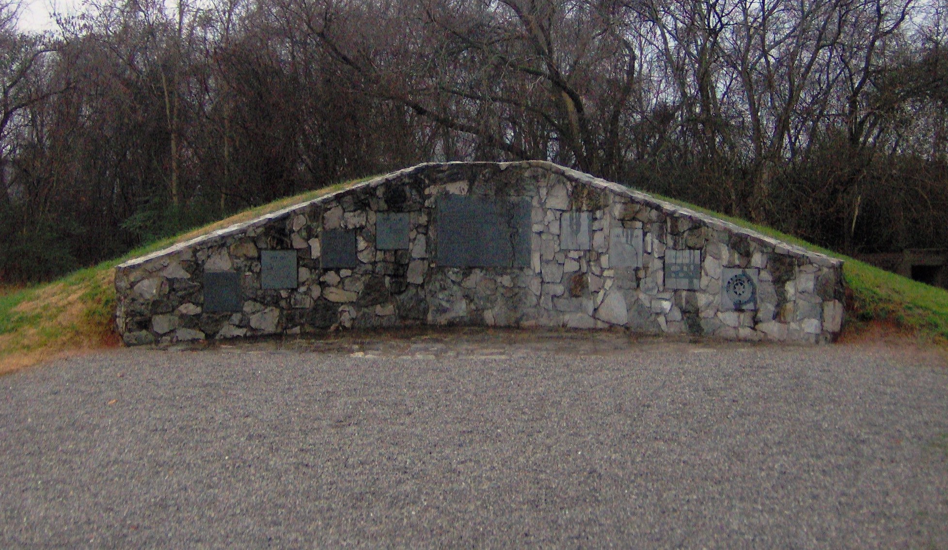
Eight stone pillars stand on a raised causeway above Tellico Lake in Monroe County, Tennessee -- seven for the Cherokee clans, one for the nation itself. Beneath the still water around them lies Chota, the place the Cherokee called their mother town. For nearly half a century, from the late 1740s until 1788, this settlement on the Little Tennessee River served as the de facto capital of the Overhill Cherokee. Leaders like Attakullakulla, Oconostota, and Nancy Ward walked its paths. Diplomats from Virginia and South Carolina traveled weeks through mountain wilderness to negotiate here. The grave of Chief Oconostota, identified during excavations by a pair of wire spectacles buried with him, rests beside the monument today.
Rising to Power on the Little Tennessee
Chota does not appear in European records until around 1745. Before that, nearby Tanasi held prominence as the seat of the Overhill Cherokee -- the towns west of the Appalachian crest in what is now East Tennessee. The Tanasi Warrior, as the English called the head man, governed both the Overhill settlements and the Middle and Valley towns in western North Carolina. But when Moytoy of Tellico, crowned 'Emperor of the Cherokee' with English backing in 1730, died in 1741, the balance of power shifted. Conocotocko, known to the English as Old Hop, was head man at Chota, and he methodically consolidated authority. By 1753, Chota had supplanted Great Tellico as the mother town of the Overhill Cherokee. The settlement sat on a flat river terrace flanked by the steep ridges of the Appalachian Ridge-and-Valley Province, with the Great Smoky Mountains rising to the southeast and the Unicoi Mountains to the southwest.
Caught Between Empires
On the eve of the French and Indian War, the Cherokee tilted toward France, alarming the English colonies. Virginia dispatched Major Andrew Lewis with sixty men to build a fort at Chota in 1756, though it was never garrisoned after the Cherokee allied with England. South Carolina sent engineer William de Brahm with three hundred men to construct Fort Loudoun on the Little Tennessee, completed in March 1757. But the alliance fractured by 1760. Cherokee warriors laid siege to Fort Loudoun, and after the garrison surrendered, the Cherokee killed many of the soldiers and carried plunder back to Chota. The British retaliated with force, and the Overhill towns eventually sued for peace. The Treaty of Long Island in 1761 ended the fighting, and Virginia sent Henry Timberlake on a friendship mission to Chota. In the townhouse, Ostenaco ceremoniously buried a hatchet while the parties smoked ritual tobacco. Timberlake mapped the town: 52 dwellings, a central townhouse, and 175 warriors -- the second-largest fighting force among the Overhill settlements.
Burned, Rebuilt, and Lost
The American Revolution brought destruction. Cherokee leaders aligned with the British, and in 1776 Dragging Canoe led an unsuccessful three-pronged attack on American frontier settlements. Virginia's Colonel William Christian marched into the Little Tennessee Valley and destroyed Great Tellico, Citico, and other towns, sparing Chota only after chiefs Attakullakulla and Oconostota negotiated a truce. The reprieve was temporary. In 1780, John Sevier, fresh from the Battle of Kings Mountain, invaded and burned Chota itself. The Cherokee rebuilt by 1784, but the town never recovered. In 1788, Old Tassel -- leader of the Overhill towns -- was murdered under a flag of truce at Chilhowee, and the Chickamauga Cherokee moved their capital south to Ustanali. By the late 1790s, when the Duke of Orleans visited, only five dwellings remained. He watched 600 Cherokee play a ritual ball game and bet six gallons of brandy on the outcome.
Unearthed Before the Flood
When the Tennessee Valley Authority announced plans in 1967 to build Tellico Dam, archaeologists from the University of Tennessee raced to excavate before the waters rose. Between 1969 and 1974, they uncovered 783 features, 31 structures, and 91 burials. The finds spanned millennia -- projectile points from the Archaic period, 8000 to 1000 B.C., and dwellings from the Early Mississippian culture around 1000 to 1300 A.D., alongside historic Cherokee structures. Two townhouses emerged: one with a diameter large enough to hold hundreds, the other slightly older, possibly the original Tanasi council house. In 1969, Burial 10 yielded the remains of Chief Oconostota, identified by a pair of wire spectacles among his grave goods. In 1986, 191 burials were reinterred at the Sequoyah Museum near Vonore. Oconostota alone was returned to Chota, buried beside the monument that now marks the townhouse site.
The Pillars Above the Water
Tellico Dam was completed in 1979, and the Little Tennessee River became Tellico Lake. Chota and Tanasi -- the town that gave Tennessee its name -- vanished beneath the surface. But before the flooding, the Chota townhouse site was deliberately raised above the reservoir's operating level and connected to the mainland by a causeway. The eight pillars of the Chota monument stand there now, managed by the Eastern Band of Cherokee Indians based in Cherokee, North Carolina. The monument is accessible from Highway 360 off Bacon Ferry Road. Each pillar bears the name of a Cherokee clan: Bird, Blue, Deer, Long Hair, Paint, Wild Potato, and Wolf. The eighth stands for the nation as a whole. Listed on the National Register of Historic Places, the site is a quiet place -- water lapping at the causeway, ridgelines pressing in from the south, the Smoky Mountains visible in the haze. Beneath the lake, the ground that once held a capital still holds its stories.
From the Air
Located at 35.56°N, 84.13°W on Tellico Lake in Monroe County, Tennessee. From altitude, the lake fills the Little Tennessee River valley below, with the causeway and Chota monument visible as a small peninsula jutting into the water opposite Bacon's Bend. The site sits in the Appalachian Ridge-and-Valley region, flanked by steep wooded ridges to the south. The Great Smoky Mountains rise to the southeast and the Unicoi Mountains to the southwest. Nearby airports include Monroe County Airport (KMMI) in Madisonville, approximately 10nm southwest, and McGhee Tyson Airport (KTYS) in Knoxville, roughly 30nm northeast. The Tellico Dam is visible downstream. Look for the distinctive elongated shape of Tellico Lake threading through narrow valley terrain.