Christchurch Gondola
From the summit of Mount Cavendish, you can see the logic of an entire landscape. To the north and west, the Canterbury Plains stretch flat and green toward the snow-capped Southern Alps. To the south and east, the volcanic remnant of Banks Peninsula drops steeply into Lyttelton Harbour, the natural port that gave Christchurch its lifeline to the sea. The city itself lies spread below, its grid streets and green parks laid out with colonial precision. The Christchurch Gondola carries visitors 445 meters above sea level to take in this panorama, covering 1,000 meters of cable between its base in Heathcote Valley and the summit station on the Port Hills. It is one of the few places where the relationship between mountain, plain, harbor, and city becomes instantly legible.
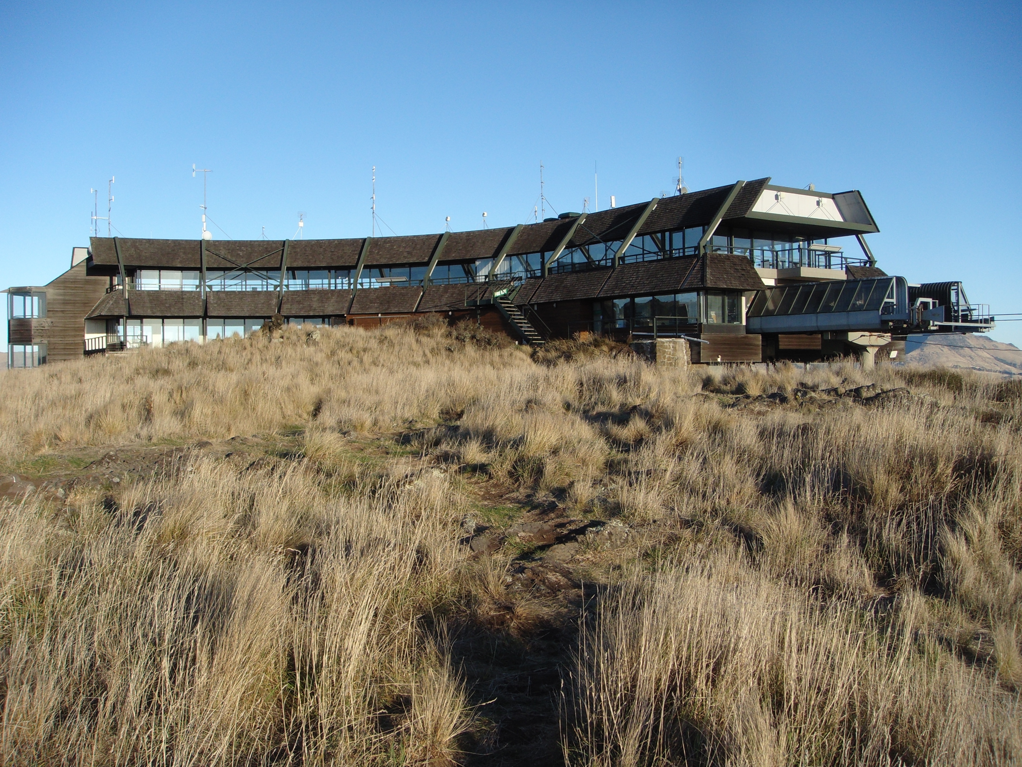
A Long Road Up the Hill
The gondola opened as the Mount Cavendish Gondola on 24 November 1992, after what was described as a long planning process. Construction cost NZ$11.5 million and involved significant landscaping afterward -- 16,000 native tussock plants were put in around the base and summit stations to restore the hillside. The system runs 19 cabins with a capacity of 812 travelers per hour, making it capable of handling substantial tourist volume. The gondola quickly became one of Christchurch's top-rated attractions, and it serves a dual purpose: tourists ride it for the views, but walkers and hikers also use it as transport to access the network of tracks on Mount Cavendish and the surrounding Port Hills. The same company, Christchurch Attractions, operates both the gondola and the heritage tramway in the city center, linking two of the city's signature experiences under one management.
Four Worlds in One View
What makes the summit remarkable is the sheer range of geography visible from a single point. The Canterbury Plains, one of New Zealand's largest flat agricultural regions, extend westward to the foothills of the Southern Alps -- the mountain chain that runs the length of the South Island. In clear weather, the Alps' snow and ice are sharp against the sky. Turning south, the view shifts dramatically: Banks Peninsula, formed by two overlapping volcanic craters, drops into the deep indentation of Lyttelton Harbour. The port town of Lyttelton, tucked into the harbor's curve, is where the first Canterbury settlers landed in 1850. Below and to the north, Christchurch spreads across the plains, its parks and rivers traceable from this height. The Port Hills themselves, the eroded rim of the Banks Peninsula volcanoes, form the boundary between these worlds -- urban flatland on one side, volcanic harbor on the other.
Stuck in the Sky
Not every chapter in the gondola's history has been scenic. In February 2016, the system broke down with passengers trapped in the cabins for two hours. No communication system existed to reach the stranded riders, and when the managing director described the incident as "no big deal," public anger was swift. Within days, the company announced it would install speaker systems in every cabin at a cost of up to NZ$50,000, allowing operators to communicate with passengers during any future stoppage. The episode was a reminder that even the most picturesque infrastructure requires the unglamorous work of maintenance and contingency planning. The gondola continues to operate daily, with shuttle services running between Cathedral Square in the city center and the Heathcote Valley base station, and public bus route 8 stopping directly outside.
The Volcanic Rim
The Port Hills are more than a backdrop. They are the geological seam where Christchurch's flat alluvial plains meet the ancient volcanic terrain of Banks Peninsula. The hills carry walking tracks, mountain bike trails, and some of the most sought-after residential real estate in the city. Mount Cavendish itself sits along this rim, offering the kind of elevated perspective that makes sense of a landscape too large to comprehend at ground level. On a clear day, the view from the gondola summit encompasses an arc of perhaps 200 kilometers, from the highest peaks of the Alps to the outermost headlands of Banks Peninsula. For visitors arriving by air into Christchurch, the gondola provides the inverse experience: instead of looking down from a plane, you stand on a volcanic ridge and look out across the same terrain you just flew over, seeing the connections between mountain, river, plain, and sea that altitude alone cannot explain.
From the Air
Located at 43.585°S, 172.708°E on the slopes of Mount Cavendish in the Port Hills, southeast of central Christchurch. The gondola line is visible as a thin cable ascending the hillside from Heathcote Valley to the 445m summit. The Port Hills ridge separates the Canterbury Plains from Lyttelton Harbour. Christchurch Airport (NZCH) is approximately 18 km to the northwest. Best viewed at 3,000-5,000 ft AGL to see the dramatic transition from plains to volcanic harbor.