Chrome Island Lighthouse
Twenty keepers in 130 years. That is the human record inscribed on Chrome Island, a small rocky outcrop off the southeast coast of Denman Island in British Columbia's Baynes Sound. The first keeper, Tom H. Piercy, lit the lamp in 1891 and watched over the waters between Deep Bay, Denman Island, and Hornby Island until 1898. The most recent, Roger Williamson, has been doing the same job since 2007. Between them stretches an unbroken chain of human presence on a rock that the Canadian Coast Guard has periodically considered automating but never quite has.
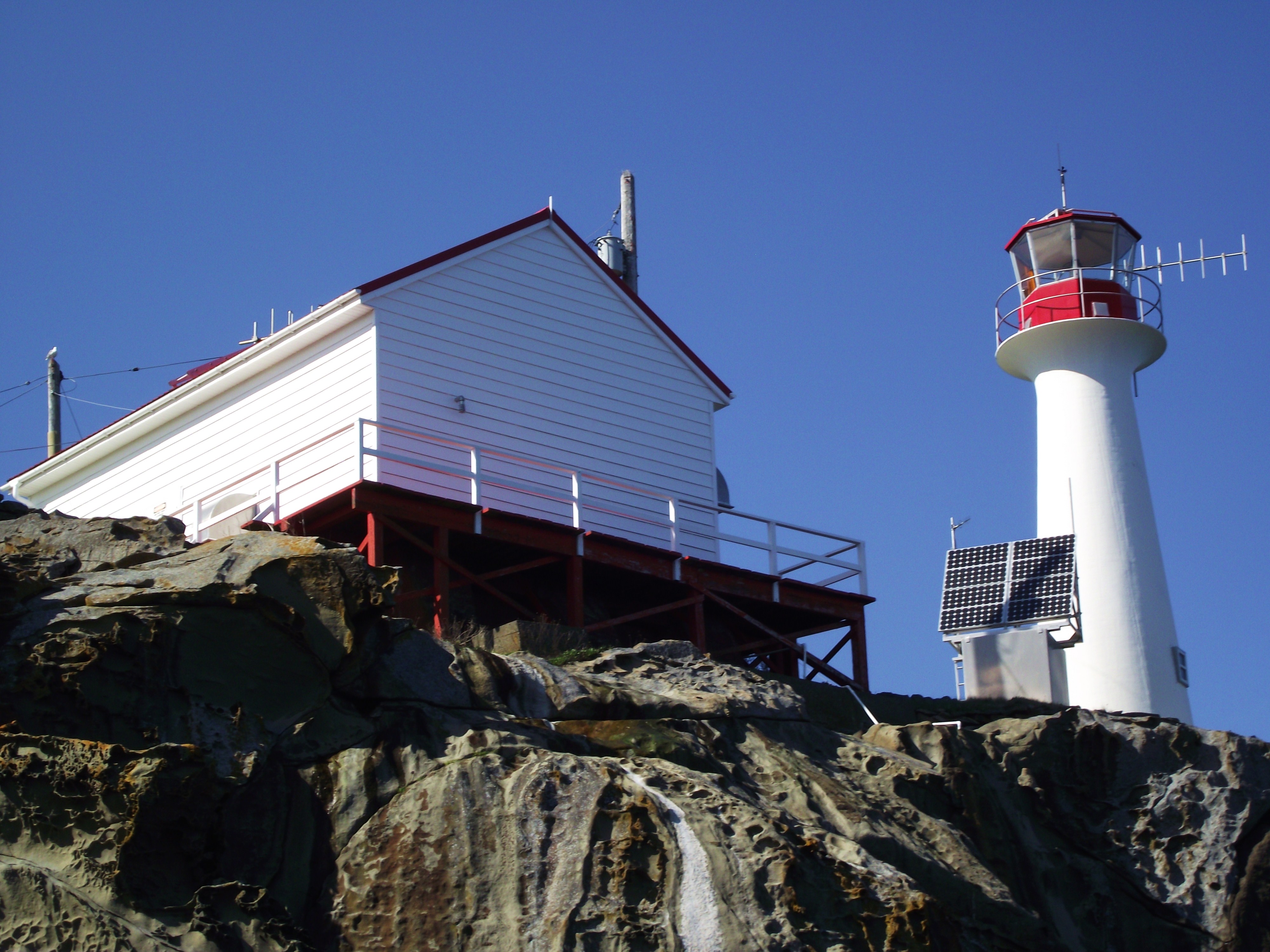
A Light Between Islands
Chrome Island sits at a crossroads of coastal traffic where ferries, fishing boats, and recreational vessels navigate the narrow passages between Vancouver Island and the Gulf Islands. The lighthouse's five-second flash rises about 21 meters above water level, depending on the tides, a modest height that nonetheless makes it a critical reference point in waters where fog, currents, and island geography can disorient even experienced mariners. The station maintains a helicopter landing deck and a rescue boat, practical necessities on an island accessible only by water or air. Electronic navigational aids have supplemented the light, but they have not replaced the keepers who monitor them.
The Sixty-Year Thermometer
Since 1961, Chrome Island has been one of 12 stations in the British Columbia Shore Station Oceanographic Program, collecting coastal water temperature and salinity measurements for the Department of Fisheries and Oceans. What began as routine data gathering has become an invaluable climate record spanning more than six decades. In an era of ocean acidification and warming seas, these long-term datasets, gathered by hand from a lighthouse on a rock, provide the kind of baseline measurements that no satellite or automated buoy can replicate with the same continuity. The keepers who take these readings may not think of themselves as scientists, but the data they produce is among the most cited in Pacific coastal oceanography.
The Keepers' Ledger
The list of Chrome Island's keepers reads like a social history of coastal British Columbia. Some served for decades: G. Allan Couldery watched the light from 1922 to 1939, and William Edward Gardiner held the post for 13 years starting in 1964. Charles Thomson served twice, from 1986 to 1997 and again from 1998 to 2007, with only Barry Shaw's single year interrupting his tenure. Others passed through quickly, like Gerald Watson, who lasted just one year from 1979 to 1980. Each keeper lived with the isolation, the weather, and the particular rhythm of a lighthouse station where the sea sets the schedule and the light must burn regardless of what happens on shore.
Why They Stay
Across Canada, lighthouse automation has proceeded steadily for decades, driven by cost savings and advances in remote monitoring technology. Chrome Island has survived each round of proposed cuts, in part because of the station's role in oceanographic monitoring, in part because of the advocacy of lighthouse preservation groups, and in part because of a simple truth that is hard to quantify in a budget: a staffed light station can respond to emergencies, report weather in real time, and notice things that sensors cannot. The light that Tom Piercy first tended in 1891 still flashes its five-second interval across Baynes Sound, watched by human eyes that have been watching, without interruption, for over a century.
From the Air
Located at 49.472N, 124.684W on Chrome Island, a small rocky islet off the southeast tip of Denman Island in Baynes Sound. The lighthouse is visible from the air as a white structure on bare rock, with Denman Island to the northwest and Hornby Island to the northeast. Nearest airport is Comox Valley Airport (CYQQ), approximately 25 km to the northwest. Recommended viewing altitude 1,500-3,000 ft AGL for best detail of the island and surrounding waterways.