Cirque de Mafate
There is no road into the Cirque de Mafate. There has never been a road, and under current national park regulations, there almost certainly never will be. This volcanic crater on the western flank of Reunion Island's extinct Piton des Neiges is home to roughly 800 people living in a handful of hamlets perched on plateaus above steep gorges, reachable only on foot or by helicopter. It is the most remote inhabited place in France, and that remoteness is precisely the point -- both for the hikers who come to walk its trails and for the people whose families have lived here for generations, ever since the crater basin became a refuge for those fleeing the world outside.
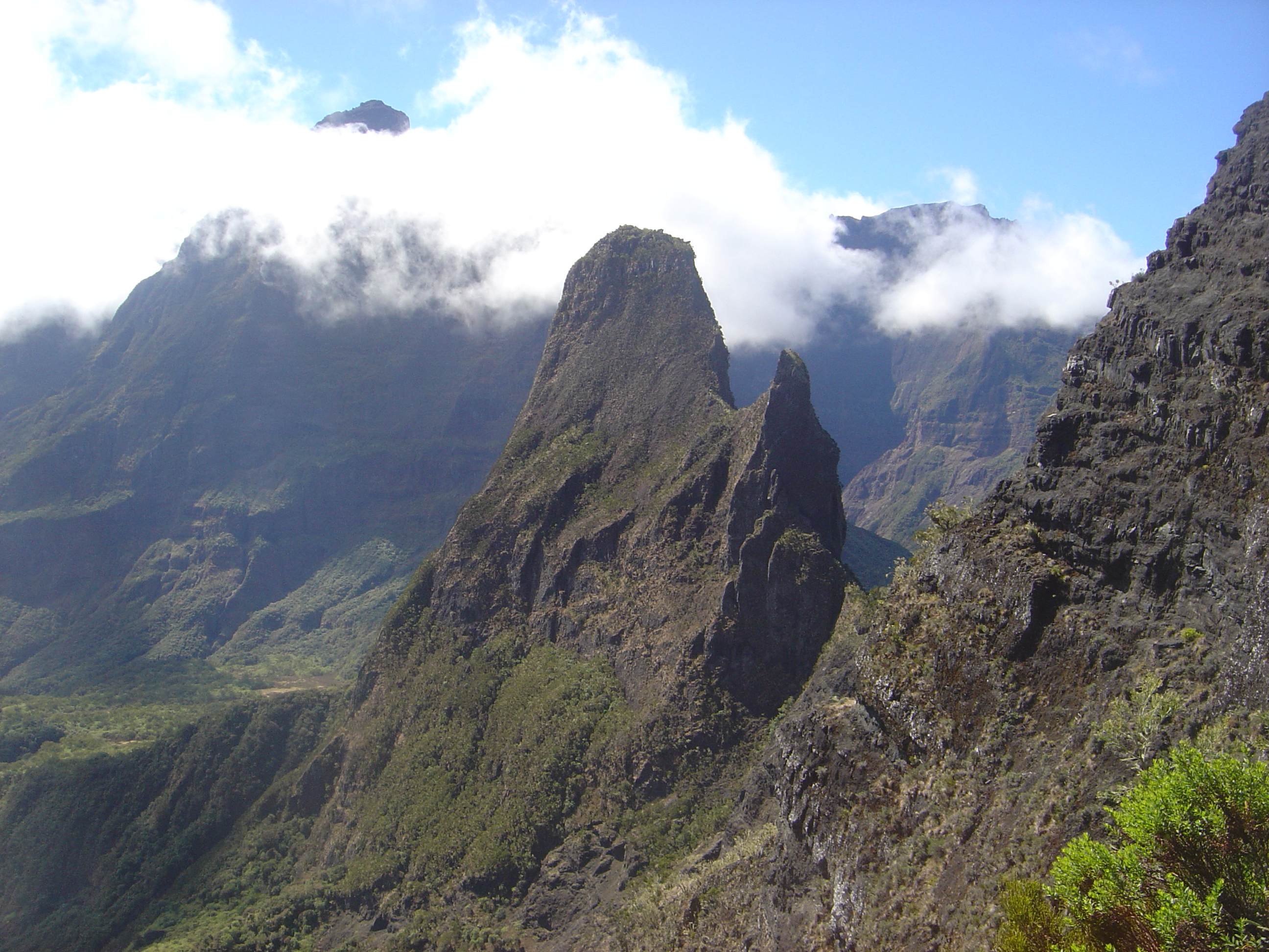
Shaped by Collapse and Rain
The cirque is a caldera formed when the magma chamber of the Piton des Neiges collapsed after one of its final eruptions. What remains is an elliptical basin stretching 14 kilometers north to south and 7 kilometers east to west, walled in by towering cliffs the Reunionnais call remparts. Gros Morne rises to 3,019 meters on the southeastern rim; Grand Benare reaches 2,898 meters to the south, standing some 1,600 meters above the basin floor. Reunion receives extraordinary rainfall -- up to 12 meters per year -- and the relentless water has carved deeply incised channels and gorges through the volcanic rock. The Riviere des Galets, the basin's sole river outlet, drains northwest through a narrow gap in the crater wall. The cirque is the driest of the three on Piton des Neiges, but even in the temperate season from May to October, afternoon showers arrive with reliable persistence.
Hamlets Above the Gorges
The settlements, called ilets, sit on flood-safe plateaus separated by ravines so steep that neighboring villages sometimes require hours of hiking to reach. La Nouvelle, at about 1,400 meters, is the largest with 137 inhabitants recorded in the 1999 census and the most modern infrastructure -- a school and a church built in 1976. Marla, the southernmost hamlet at roughly 1,600 meters, once housed several hundred people; today it has about twenty. Its name comes from the Malagasy word marolahy, meaning many people, a reminder of busier times. The entire cirque is public property managed by the national forestry service, and residents are tenants. There is no connection to the electrical grid -- inhabitants rely on solar panels and occasional diesel generators, with fuel brought in by helicopter at considerable cost. Building regulations permit only single-story wooden structures with concrete floor slabs, a concession to the cyclones that regularly batter the island.
Into the Crater
Five main routes lead into the cirque, each demanding enough to justify its reputation as premier hiking terrain. The descent from the Maido viewpoint at 2,205 meters on the western rim is the shortest entry but drops over 1,100 meters and becomes the most punishing exit. From the south, the Col du Taibit pass at 2,142 meters connects to the neighboring Cirque de Cilaos, a journey of up to five hours from the town of Cilaos. The Canalisation des Orangers path runs almost horizontally along a cliff face, following a drinking water pipe that supplies the coastal town of Saint-Paul. Inside the basin, about ten marked hiking routes crisscross the terrain, including sections of the GR R1 and GR R2 long-distance trails. The volcanic basalt becomes treacherously slippery after rain, and the humid, poorly ventilated air of the basin floor can exhaust hikers who underestimate the altitude and the tropical heat.
Silk Spiders and Dodo Beer
Hikers who brave the trails share them with palm-sized silk spiders whose webs stretch several meters across, sometimes spanning the path itself on nearly invisible anchor threads. The spiders are harmless; the rats introduced by European colonists are not -- they pose a serious threat to the nesting birds of Reunion, an island that had no land mammals besides bats before human settlement. The most common bird is the tec-tec, a species found nowhere else on Earth. Tamarind forests cover the Plaine des Tamarins plateau, and agaves send bloom stalks soaring ten meters high. At day's end, the mountain huts serve simple Creole cuisine -- rice, legume sauce, and well-seasoned meat stew -- washed down with the island beer, Dodo. Village shops carry the basics: water, chocolate, canned drinks. Anything more elaborate must be carried in on your back. Since 2010, the cirque and the surrounding inner zone of the Reunion National Park have held UNESCO World Heritage status, recognition that this crater without roads is worth more precisely because no one has paved it.
From the Air
Cirque de Mafate is located at 21.05S, 55.42E on the western side of Reunion Island. The crater basin is enclosed by ridges exceeding 3,000 m, with Gros Morne (3,019 m) on the southeastern rim. The Maido viewpoint on the western rim (2,205 m) provides the most accessible aerial perspective. Nearest airport is Roland Garros International (FMEE) in Saint-Denis, about 40 km northeast. The three cirques of Piton des Neiges -- Mafate, Cilaos, and Salazie -- form a dramatic cloverleaf pattern visible from altitude. No landing areas exist within the cirque except helicopter pads at settlements.