Cle Elum
Cross Snoqualmie Pass from Seattle, and the world changes. The dark Douglas firs give way to ponderosa pines, the drizzle to sunshine, the green slopes to something drier and more open. Cle Elum sits in this transition zone, a small town of fewer than 2,000 people that has reinvented itself multiple times: first as a railroad stop, then as a coal and lumber hub, and now as a base camp for outdoor recreation. Its neighbor Roslyn, three miles up the road, still looks enough like a frontier coal town that television producers chose it for Northern Exposure in the 1990s. But Cle Elum's real attraction lies in the terrain that surrounds it - the Alpine Lakes Wilderness to the north, the Teanaway sandstones to the east, the ski slopes and backcountry trails that draw Seattle's outdoor enthusiasts across the pass.
Where the Climate Shifts
Snoqualmie Pass marks one of the sharpest climate transitions in the American West. Seattle's annual rainfall exceeds 37 inches; Cle Elum receives barely 20. The mountains squeeze moisture from Pacific storms, leaving the eastern slopes in a rain shadow that produces blue skies even when clouds blanket the coast. This is ski country - Snoqualmie Pass resorts draw Seattle crowds on winter weekends - but it's also sunny country, with the powder snow and reliable conditions that the wetter slopes can't match. In summer, the difference is even starker: Cle Elum bakes in continental heat while Seattle shivers under marine overcast.
Into the High Country
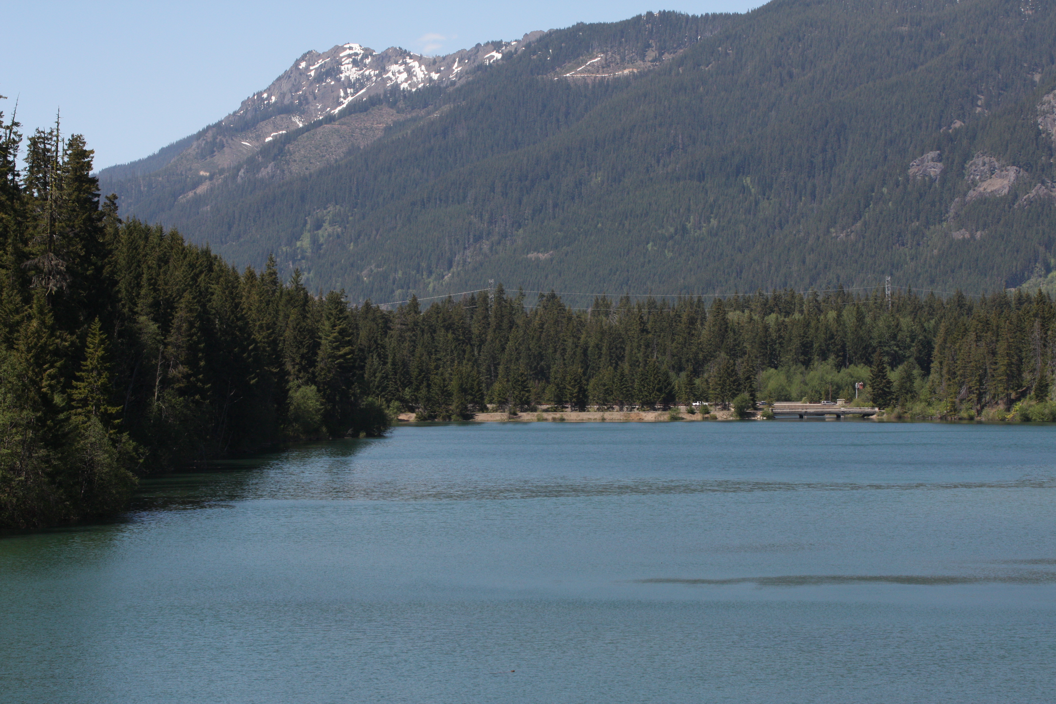
Highway 903 climbs north through Roslyn, past Cle Elum Lake, and up the Salmon La Sac River to road's end - the farthest you can drive into the Cascades from I-90 without a four-wheel-drive vehicle. From there, trails fan into the Alpine Lakes Wilderness, connecting to the Pacific Crest Trail and some of the most rugged terrain in Washington. The lake-dotted high country draws backpackers all summer; the snow lingers into July at higher elevations. Closer to town, the Teanaway River valley offers different pleasures: rolling hills of uncommon sandstone, community forests protecting the headwaters, and views of Mount Stuart rising above the northern horizon.
Three Geologies Meet
The terrain around Cle Elum is a geological puzzle box. The Teanaway Formation, dominated by sandstones rare in the volcanic Cascades, creates the rolling golden hills to the east. The Alpine Lakes region to the north features the granite peaks of the Stuart Range. And Blewett Pass, the route to Leavenworth and Wenatchee, cuts through the zone where these formations meet the Enchantments - a landscape so varied that a single day's drive traverses rock from entirely different eras and origins. For hikers, this means diversity: forested trails, exposed ridges, creek crossings, and alpine basins all within reasonable distance of town.
A Town That Adapted
Cle Elum has seen industries come and go. The railroad brought the town into existence; coal mining and logging sustained it through the early twentieth century. When those declined, Cle Elum could have faded like so many Western resource towns. Instead, it found a new purpose as a gateway. I-90 delivers weekend warriors from Seattle in less than two hours. The ski resorts need lodging; the hikers need gear and coffee; the Pacific Crest Trail thru-hikers need a resupply point. The town remains small - no public transit, not even sidewalks in some neighborhoods - but it has learned to thrive on the traffic that passes through on its way to the mountains. You need a car here. The weather changes fast. But the access is unmatched.
From the Air
Located at 47.22N, 120.96W on the eastern slope of the Cascades, approximately 10nm east of Snoqualmie Pass. The town sits at 1,920 ft elevation in the Yakima River valley. Mount Stuart (9,415 ft) is visible to the north; the Cascade crest rises to the west. Nearest airports: Cle Elum Municipal (S93, public, 2,900 ft paved, uncontrolled), Bowers Field/Ellensburg (ELN, 20nm east, 5,549 ft paved). The terrain rises sharply to the west; expect mountain wave turbulence, orographic clouds, and rapid weather changes. Winter storms can close I-90 over Snoqualmie Pass. This is drier, sunnier country than the west side - often VFR when Seattle is socked in.