Climax Mine
In 1879, a prospector named Charles Senter staked a claim on Fremont Pass during the Colorado Silver Boom, convinced the gray mineral veining the rock had to be worth something. It was not gold. It was not silver. Senter had no idea what it was. He held those claims for sixteen years, performing the required annual assessment work, before a chemist finally identified the mineral as containing molybdenum. Even then, there was virtually no market for it. Senter would wait another two decades before selling his claims for 0,000 in 1918. The mine that rose on those claims, the Climax mine, went on to become the largest molybdenum mine on Earth, supplying three quarters of the world's molybdenum and reshaping modern metallurgy from a perch high on the Continental Divide.
The Metal Nobody Wanted
Molybdenum was a solution waiting for a problem. When Senter discovered the outcropping of molybdenite veins on Bartlett Mountain in 1879, the metal had no industrial application. He settled with his Ute wife a few miles north, worked a gold placer to make a living, and kept performing assessment work on his lode claims year after year. Even after the 1895 identification, the market barely existed. The breakthrough came when steelmakers discovered that molybdenum alloys produced extraordinarily hard steel. Full production began in 1914, with the first ore shipments leaving the deposit in 1915. World War I accelerated demand dramatically when the German military began using molybdenum to strengthen tanks and weapons. But when the war ended, demand collapsed, and the Climax mine shut down in 1919. Molybdenum would later prove essential for jet engine turbines and industrial equipment resistant to heat, friction, and chemical erosion.
A Mountain Consumed
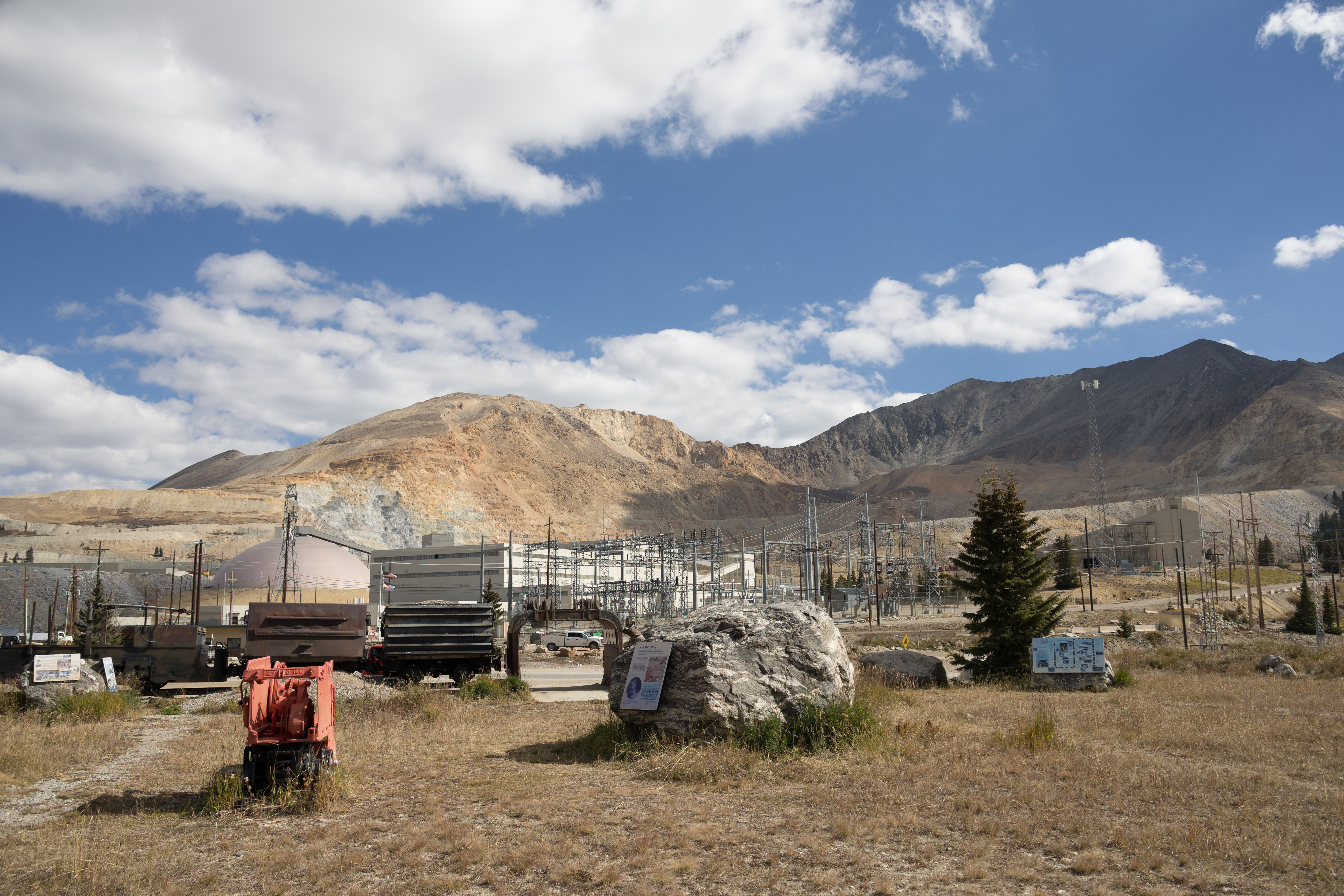
The Climax Molybdenum Company reopened the mine in 1924 and operated it nearly continuously until the 1980s. The operation encompassed approximately 14,350 acres of patented mining claims at an elevation of roughly 11,300 feet on Fremont Pass, straddling the Continental Divide in Lake and Summit counties. The main ore body sat beneath Bartlett Mountain, which was mined out during the early decades. Extraction used a technique called sub-level induced panel caving, undercutting the base of ore panels to cause controlled collapse from above. The ore was low-grade, much less than one percent molybdenum, but the deposit was enormous. Ground surface subsidence began around 1920 on Bartlett Mountain. By 2001, the subsidence area covered about 100 acres. The tailings reservoirs, visible from the highway, now cover several square miles, looking like a strange hybrid of reservoir and dammed mountain meadow.
Boom, Bust, and Rebirth
The mine shut down between 1995 and 2012 as molybdenum prices fell too low to justify extraction. Owner Freeport-McMoRan continued environmental cleanup while keeping the mine ready for a potential restart. In December 2007, the company announced a 00 million plan to reopen with modern open-pit mining and state-of-the-art milling facilities. The Climax deposit still held an estimated 500 million pounds of molybdenum at an average ore grade of 0.165 percent, and the company called it the largest, highest-grade, and lowest-cost molybdenum ore body in the world. Lower prices forced a deferral in November 2008, but the mine finally reopened on May 10, 2012. Today the open-pit operation includes a 25,000 metric ton-per-day mill capable of producing approximately 30 million pounds of molybdenum per year.
Healing the Divide
Mining on this scale leaves scars that outlast the industry. About 20 different federal and state agencies have overseen Climax operations, including the EPA, the U.S. Forest Service, and the Bureau of Land Management. In 1991, the company declared the Storke Level ore abandoned and shifted focus to reclamation. One major project tackled a highly acidic tailing pond at the head of the Eagle River drainage. Climax sold the water rights to a company from Vail and used a hydrology mining process to extract compacted tailings from bedrock, converting them to a slurry that could be piped to a neutralization pond. By 1994, the mine labor force had shrunk to 24 employees focused on water treatment, environmental quality, and reclamation. The mine also produces tin, tungsten, and pyrite as by-products, and the geology of the Climax Stock, with its alkaline felsic intrusives forming a roughly circular structure, continues to draw study as a type example of porphyry molybdenum deposits.
From the Air
Located at 39.37N, 106.19W on Fremont Pass along the Continental Divide in Lake and Summit counties, Colorado, at approximately 11,300 feet elevation. The mine is highly visible from the air as a large open-pit scar on the mountainside with extensive tailings reservoirs covering several square miles to the north. Look for the massive disturbed terrain adjacent to Highway 91 on Fremont Pass. Nearest airports: Lake County Airport (KLXV) in Leadville approximately 12nm south. Expect high density altitude operations. The Tenmile Range rises to the east and the Sawatch Range to the west.