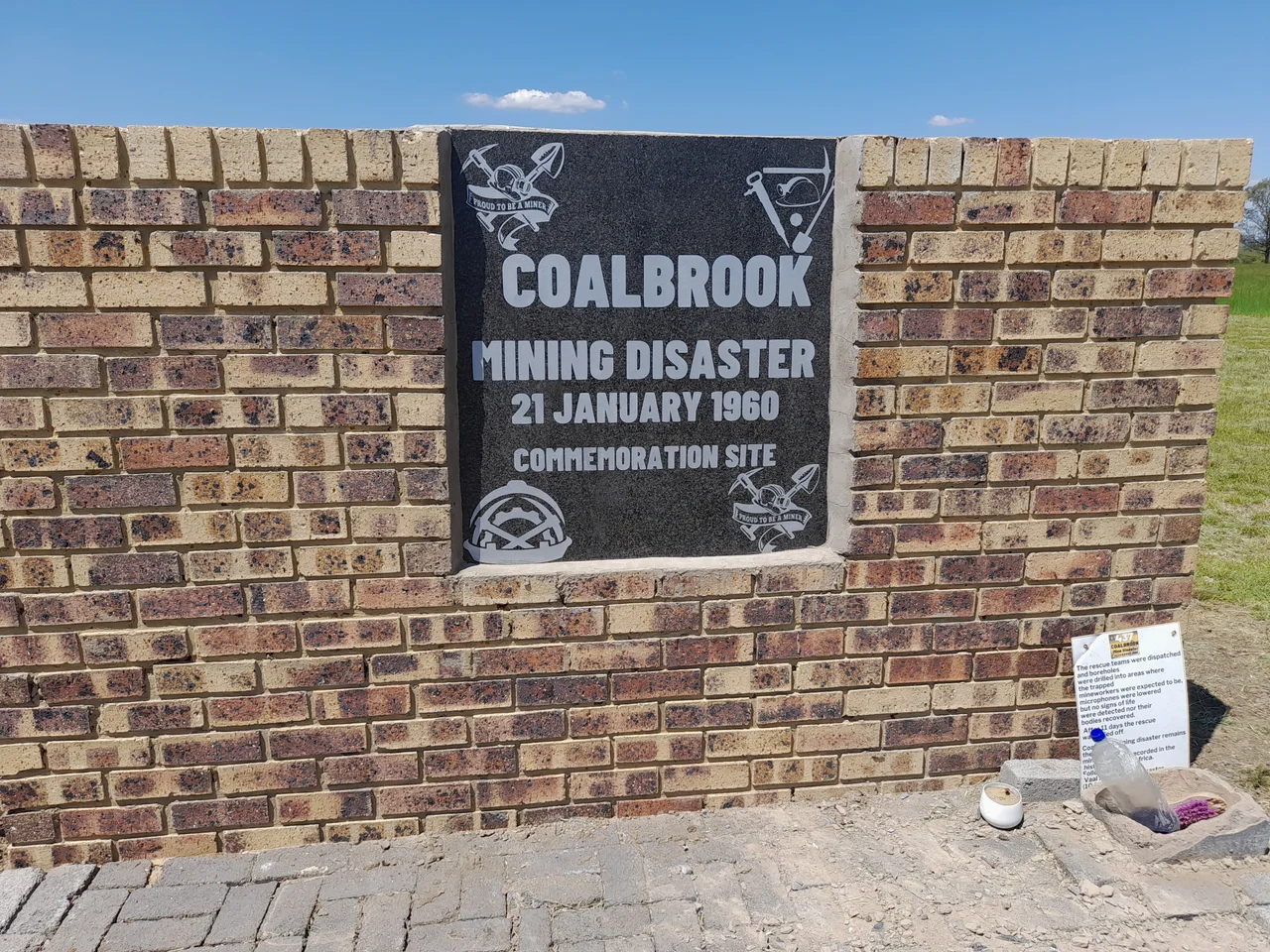

Coalbrook Mining Disaster
Twenty-four days before the catastrophe, the mine sent a warning that no one heeded. On 28 December 1959, deep inside the Coalbrook colliery in the northern Free State, six hectares of roof fell in. The collapse stopped only when it reached a row of wider, stronger pillars. The mining inspector was never told. Work went on. Then, just after seven o'clock on the evening of 21 January 1960, the warning came due. Roughly 900 support pillars failed in a chain reaction, and the roof came down across an area the size of several hundred football fields. About a thousand men were underground. Four hundred and thirty-seven of them never came up.
The Men Below
The Clydesdale Colliery at Coalbrook lay about 21 kilometres southwest of Vereeniging, sunk into the coal seams that fed apartheid-era South Africa's hunger for power. The men who worked it were, in the great majority, migrant labourers from Lesotho and Mozambique, men who had travelled hundreds of miles to earn wages underground and send them home. They were husbands, fathers and sons reduced, in the records of the day, to a count. They worked nearly 180 metres down, in tunnels held up by a grid of coal pillars, gambling, without knowing it, against the slow arithmetic of those pillars failing one by one.
A Wind, Then Silence
The men felt it before they understood it: a sudden, powerful rush of wind through the workings, the breath of an enormous space collapsing somewhere nearby. Many ran for the surface. There, in one of the cruellest details of the whole disaster, they were ordered back down or threatened with imprisonment. Only two men refused. The geologists later gave the failure a clinical name, cascading pillar collapse, in which a few overloaded pillars give way and shift their burden onto their neighbours, which then fail in turn, faster and faster, until the whole panel comes down at once. The roof fell over 324 hectares. The men were crushed by falling rock or suffocated by the methane the collapse drove out of the coal.
Eleven Days of Hope
Rescue teams converged from mines across the region. They drilled boreholes down toward where survivors might be and lowered microphones into the dark, listening. Nothing answered. A new, advanced drilling rig was brought in to reach the buried workings, but its bits wore out against a hard layer of dolerite rock. After eleven days, with no sign of life and no way through, the rescue was called off. Not one body was recovered; the dead remain entombed where they fell. The wives of the missing refused to give up. Against the certainty of the rescuers, who knew there was no hope, they kept calling for the search to go on, unwilling to surrender the men to the rock.
Remembered, Slowly
Coalbrook prompted the government to create a National Mine Disaster Fund and to fund serious research into why pillars fail, science that would make later mines safer. The same kind of borehole-and-rig approach used here helped reach the 33 Chilean miners famously rescued alive in 2010, a hopeful echo of a tragedy with no survivors. Yet for decades the dead of Coalbrook went largely unmarked. No official state commemoration was held. Only in 2017 did the Mine Health and Safety Council push for a memorial and plaque at the site, and not until January 2025 did the community of Zamdela near Sasolburg organise the first formal remembrance, with the site now being declared a heritage place. An Afrikaans band, Die Briels, had not forgotten: in 1961 they recorded a lament for the miners, keeping their memory alive in song when the country was slow to keep it in stone.
From the Air
The Coalbrook disaster site lies at approximately 26.85 degrees south, 27.88 degrees east, in the northern Free State near Sasolburg, about 21 km southwest of Vereeniging. From the air this is classic highveld coal country: flat farmland punctuated by mine workings and, to the north, the industrial sprawl of the Vaal Triangle with its power stations and the Sasol petrochemical complex. Recommended viewing altitude is 6,000 to 10,000 feet. The Vaal River runs to the north and east. The nearest airfield is Vereeniging (FAVV), a short hop northeast; OR Tambo International at Johannesburg (FAOR) is roughly 70 km north. Highveld visibility is reliably good in the dry winter, May through September, though winter mornings can bring haze and smoke over the industrial belt.
Nearby Stories
- TauTona Mine 14 km away
- Kweneng' Ruins 22 km away
- Vaal Reefs Mining Disaster 67 km away
- Secunda CTL 74 km away
- Battle of Bronkhorstspruit 83 km away
- Battle of Bothaville 87 km away
- Battle of Majuba Hill 144 km away
- Golden Gate Highlands National Park 175 km away