Cockscomb Basin Wildlife Sanctuary
In 1984, a young zoologist named Alan Rabinowitz was tracking jaguars through the forests of south-central Belize when he documented something remarkable: the Cockscomb Basin contained the highest density of jaguars ever recorded. Two years later, he and Archie Carr III convinced the Belizean government to set aside a portion of the basin as a no-hunting zone. It became the world's first protected area dedicated to the jaguar. The sanctuary has since grown to roughly 400 square kilometers of the eastern slopes of the Maya Mountains, sheltering an estimated 200 jaguars -- along with mahogany forests, Mayan ruins, and mountain streams that run clear enough to drink from.
A Ridge Like a Rooster's Comb
The sanctuary takes its name from the Cockscomb Mountain ridge, whose jagged profile resembles a rooster's comb and is easily visible from the coastal plain of the Caribbean Sea. The protected area is lozenge-shaped, stretching approximately 36 kilometers east to west and 14 kilometers north to south. It encompasses two adjacent basins. The East Basin is drained by South Stann Creek; the West Basin, more remote and densely forested, feeds the Swasey Branch, a major tributary of the Monkey River. Elevations range from 50 meters near the coast to 1,120 meters atop Victoria Peak, the second highest point in Belize. The West Basin remains largely unexplored -- its distance from trailheads and sheer forest density have kept much of it uncharted for species mapping and Mayan archaeology alike.
Twelve Thousand Years of Footprints
The Maya inhabited these foothills as early as 10,000 BCE, farming the slopes and building settlements that the jungle has long since reclaimed. The Pearce Ruin, first catalogued in a 1931 report to the British Museum, was not rediscovered until 1995, when surveys also documented two additional sites: Hun' Tul Mo' (meaning "one macaw") and Xa'a Yul Ha' ("many rivers"). The first modern explorations came in 1888 and 1889, when British expeditions paddled up South Stann Creek and attempted to summit Victoria Peak -- though they later realized they had scaled a neighboring mountain instead. By 1927, the British returned to assess timber reserves, and logging of mahogany and cedar continued until 1984, when the trees worth cutting had largely been exhausted. The timing was fortunate: just as the loggers departed, Rabinowitz arrived with his radio collars and camera traps.
The Ghost Cat's Stronghold
Jaguars are notoriously difficult to see. They are nocturnal, solitary, and wary of humans. But the Cockscomb Basin has one thing most habitats lack: enough unbroken forest, prey, and water to sustain a dense population. The West Basin wilderness, vast and nearly trackless, is where most of the sanctuary's jaguars are found. The IUCN recognized the significance in 1988, declaring the sanctuary "the major achievement in cat conservation for the triennium." That same year, Prince Philip, then president of the World Wide Fund for Nature, honored Ignacio Pop -- a local Maya man -- for his work in encouraging the reserve's creation. The sanctuary expanded in 1990, and again in 1995 when 160 square kilometers were added to connect it to the Bladen Branch Nature Reserve, creating a larger corridor of protected habitat.
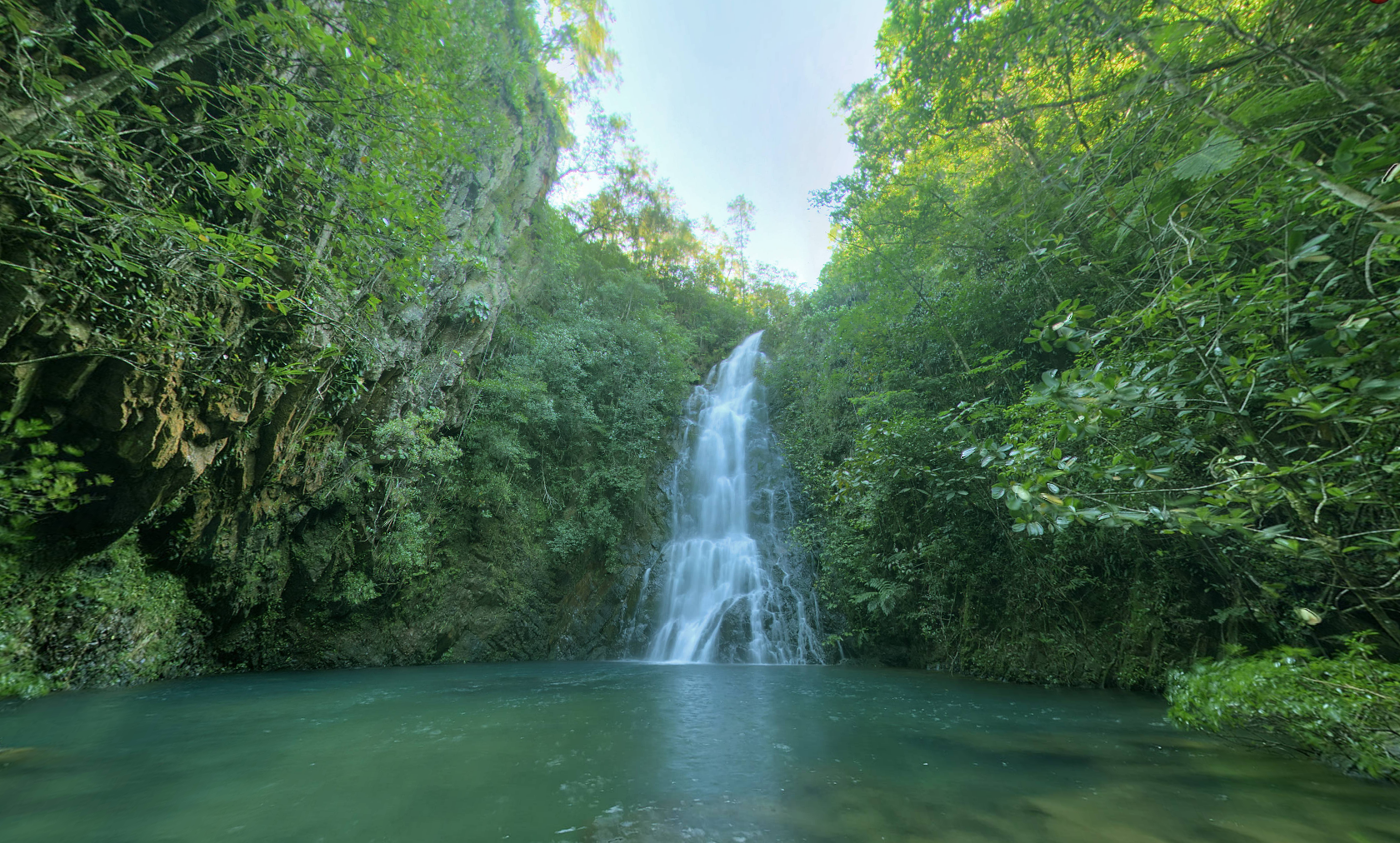
Water, Rock, and Deep Green
The Maya Mountains are among the oldest surface rock formations in Central America, their Paleozoic sediments uplifted roughly 200 million years ago during the late Carboniferous and early Permian periods. Quartzite and sandstone underlie the sanctuary's slopes. Fast-flowing mountain streams tumble over rapids and waterfalls into deep pools, their water running clear at the headwaters and growing more turbid as it reaches the valley floors. The riparian zones are lush, with broadleaf rainforest crowding the banks of both the steep mountain channels and the slow, meandering valley drainages. On the forest floor, the air stays humid even after several rainless days, fed by the density of vegetation overhead. Dominant trees include mahogany and cedar -- heavily logged through the twentieth century, but now regenerating in the sanctuary's protected interior. Pine forests, elfin scrub, and floodplain thickets round out a mosaic of habitats compressed into a single mountain basin.
Trails Through a Living Laboratory
A low-intensity trail system threads through the East Basin, making the sanctuary accessible to hikers, birdwatchers, and researchers. The West Basin remains the domain of scientists and jaguars. In 1998, the Victoria Peak National Monument was established within the sanctuary, protecting 19.59 square kilometers around Belize's highest summit. The Belize Audubon Society manages the sanctuary, maintaining trails and a small visitor infrastructure. Most visitors enter from the east, passing through secondary forest that has regrown since the logging era -- mahogany saplings rising among the stumps of their predecessors. The chances of seeing a jaguar are slim, but the tracks are everywhere: pressed into mud along stream banks, crossing trails at dawn. The cat does not need to be seen to be felt. Its presence shapes the forest and the reverence people bring to it.
From the Air
Located at 16.80N, 88.47W in the Stann Creek District of south-central Belize, on the eastern slopes of the Maya Mountains. The Cockscomb ridge is visible from the Caribbean coastal plain as a jagged ridgeline resembling a rooster's comb. Victoria Peak (1,120 m) is the second highest point in Belize. Nearest airport is Dangriga (MZDF), approximately 30 km to the northeast along the coast. The sanctuary is best viewed from an eastern approach, where the transition from coastal lowlands to forested mountain slopes is dramatic.