Coco Islands
In 1877, it took weeks for the Chief Commissioner at Port Blair to learn that a lighthouse keeper had been murdered on a tiny island 250 kilometers off the Burmese coast. That delay - the sheer, staggering remoteness of the place - convinced British administrators to hand the Coco Islands over to Burma, because nobody could govern what nobody could reach. That remoteness has defined the islands ever since. Portuguese sailors named them for their coconut palms in the sixteenth century. The East India Company folded them into its empire in the eighteenth. Japan occupied them during the Second World War. Ne Win turned Great Coco Island into a prison colony so isolated it earned the nickname "Devil's Island." And through it all, the five small islands - four clustered on the Great Coco Reef, one on the Little Coco Reef to the southwest - have remained a place where distance is the dominant fact of life, shaping everything from politics to rumor.
Coconuts, Convicts, and Empire
The Coco Islands sat on ancient trade routes between India, Burma, and Southeast Asia, visited regularly by ships long before any European arrived. Portuguese sailors gave them their name in the 1500s, after the coconut palms that covered the low-lying land. When the East India Company claimed the islands in the eighteenth century, their primary use was practical and grim: supplying coconuts to the penal colony at Port Blair on South Andaman Island, established in 1858 to hold prisoners from the Indian Rebellion of 1857.
The Jadwet family leased the islands in the 1860s and built a lighthouse on Table Island, but the archipelago resisted every attempt at development. By 1882, after the lighthouse murder scandal exposed how impossibly remote the administration was, control passed to British Burma. Commercial leases followed, but sixty years of effort produced little. The islands were too small, too distant, too difficult. When Burma became a crown colony in 1937, it kept the Cocos - a decision that would have consequences no one foresaw.
Devil's Island of the East
After Burma gained independence in 1948, the Coco Islands entered their darkest chapter. In January 1959, Ne Win's government established a penal colony on Great Coco Island for political prisoners. Following Ne Win's coup in 1962, the prison's reputation grew fearsome. Surrounded by open ocean, with no possibility of escape, the island became Burma's version of Devil's Island - a place where dissidents vanished from public life.
The prisoners did not go quietly. Three hunger strikes between 1969 and 1971 challenged conditions on the island, each one an act of defiance that cost the strikers dearly in a place where no journalist could witness and no public pressure could reach. The prison finally closed in December 1971, its facilities transferred to the Burmese Navy. The political prisoners who survived carried their stories back to the mainland, but the island itself kept its secrets - no memorials mark what happened there, and the military presence that replaced the prison ensured few civilians would visit.
The Phantom Base
For decades, the Coco Islands were the subject of one of Asia's most persistent intelligence rumors: that China had built a signals intelligence base on Great Coco Island, part of the so-called "string of pearls" strategy to encircle India with listening posts and naval facilities. Indian Defence Minister George Fernandes made the claim publicly in 1998, asserting that China had leased the islands in 1994. Journalists and academics expanded the story through the 2000s, painting a picture of sophisticated Chinese monitoring stations tracking Indian military activity across the Bay of Bengal.
The evidence never materialized. China and Burma denied the base existed. In 1998, the United States reported no significant Chinese activity. In 2005, India quietly retracted its position after inspecting the islands at Burma's invitation. By 2014, an Indian Air Marshal stated plainly that the situation was "not alarming." Satellite images from January 2023 did reveal airport upgrades - a longer 2,300-meter runway, a radar tower, two new hangars - but these appear to be Myanmar military installations with no visible Chinese presence. The phantom base remains a useful cautionary tale about how strategic geography breeds speculation.
Five Islands in the Bay
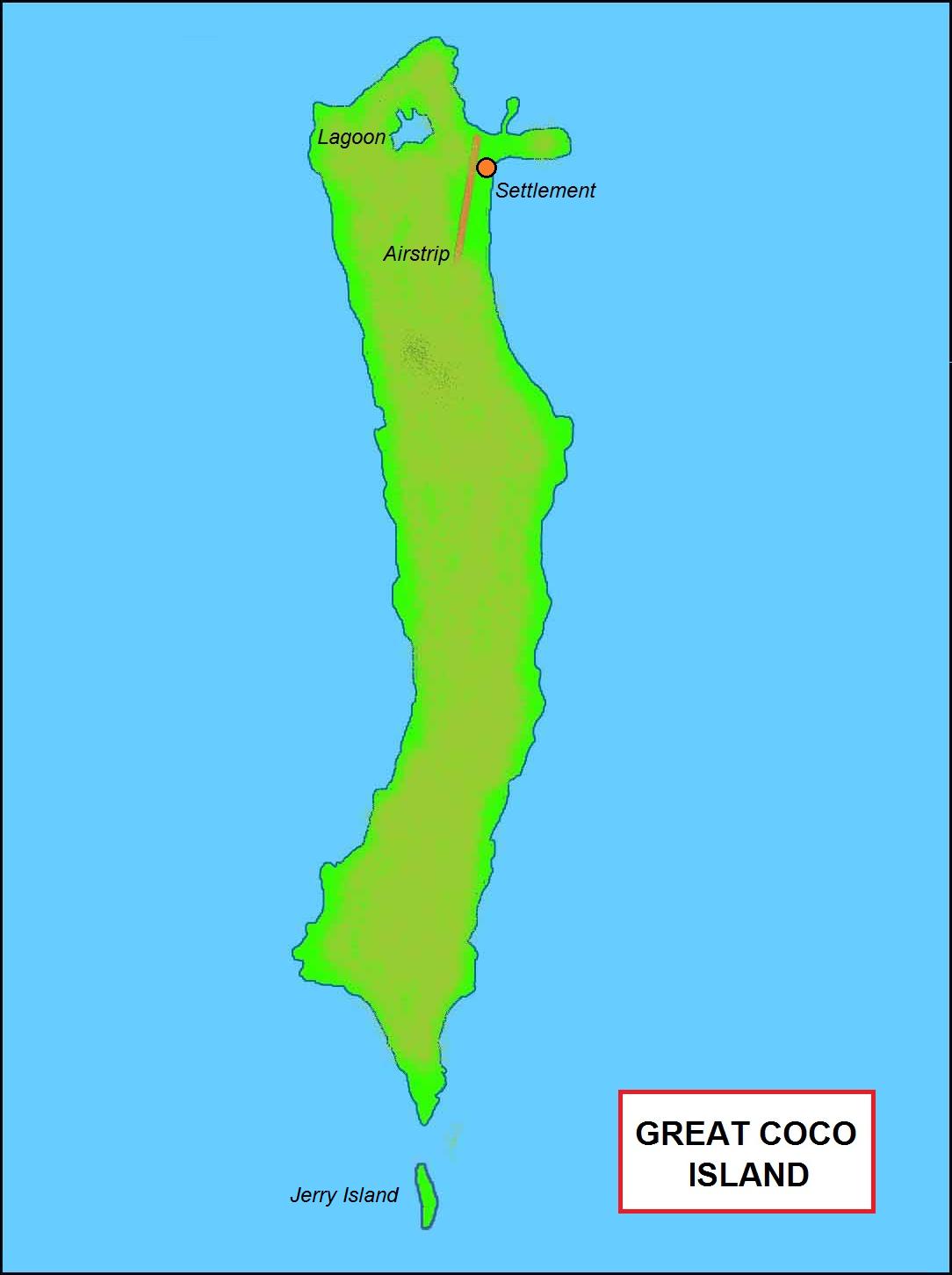
The geography of the Cocos is modest but precise. Great Coco Island anchors the group, home to roughly a thousand people living in more than 200 houses, sustained by a large water catchment reservoir. Jerry Island, just over a kilometer long, connects to Great Coco by a sandbar you can walk across at low tide. Table Island holds the old lighthouse, its lantern gallery painted in red and white horizontal bands. Tiny Slipper Island sits just 200 meters off Table Island's northwestern point. And 16 kilometers to the southwest, on its own separate reef, Little Coco Island stretches five kilometers north to south - the southernmost territory of Myanmar, separated from India's Landfall Island by the 20-kilometer-wide Coco Channel.
The Andaman Sea lies to the east, the Bay of Bengal to the west. The climate is tropical monsoon, warm year-round, with drenching rains from April through November - September can deliver over 760 millimeters in a single month. The islands host rare reptiles, birds, and mammals found nowhere else, though their biodiversity remains poorly studied. A naval base belonging to the 28th unit of the Myanmar Navy houses some 200 soldiers and their families, and the Coco Island Airport, with its recently extended runway, runs along a north-south axis near the village on Great Coco Island.
From the Air
Located at 14.12N, 93.37E in the northeastern Bay of Bengal. The Coco Islands lie approximately 250 km south of the Burmese mainland and 414 km south of Yangon. Coco Island Airport (ICAO: VYCI) on Great Coco Island features an extended 2,300 m runway oriented north-south. The archipelago is geographically part of the Andaman chain - Preparis Island lies 77 km to the north-northeast, and India's Landfall Island is just 20 km south across the Coco Channel. From cruising altitude, the cluster of five low-lying islands on the Great Coco and Little Coco reefs is visible against the deep blue of the Bay of Bengal and Andaman Sea. Approach with caution during monsoon season (April-November) when visibility drops and rain can be extreme.