Columbia Bar
Conditions can change from calm to life-threatening in five minutes. That fact, stated plainly in every mariner's guide to the Columbia Bar, is the kind of warning that sounds like exaggeration until you watch it happen. The Columbia River carries more water to the Pacific than any other river on the continent's west coast, and it arrives at the ocean without a delta -- no sprawling wetland to absorb the current, no gradual transition from fresh to salt. The river punches straight into the Pacific like a fire hose. When an outgoing tide meets incoming ocean swells driven by a North Pacific storm, the collision produces standing waves, breaking surf, and underwater currents that can flip a 47-foot motor lifeboat end over end. Approximately 2,000 large vessels have wrecked here since 1792. More than 700 people have drowned. Mariners gave this stretch of coast a name that has stuck for two centuries: the Graveyard of the Pacific.
Anatomy of a Killing Ground
The bar itself is a system of sandbars and shoals spanning the border between Oregon and Washington, roughly three miles wide and six miles long. The navigational channel starts at 2,640 feet wide on the ocean side and narrows to 600 feet between the jetties, though the jetties themselves are never closer than two miles apart. The channel is dredged to 55 feet in the northern three-quarters and 48 feet in the southern quarter; inside the bar, it shallows to 43 feet. These numbers sound generous until you consider what moves through them. A fully loaded container ship drawing 40 feet of draft has five feet of clearance in the shallow section -- and the water beneath it is heaving, surging, and breaking. Unlike other major rivers, the Columbia focuses its discharge through a narrow gap. There is no moderating delta, no gradual dispersal. The full hydraulic force of the river collides with the full energy of the open ocean in a confined space.
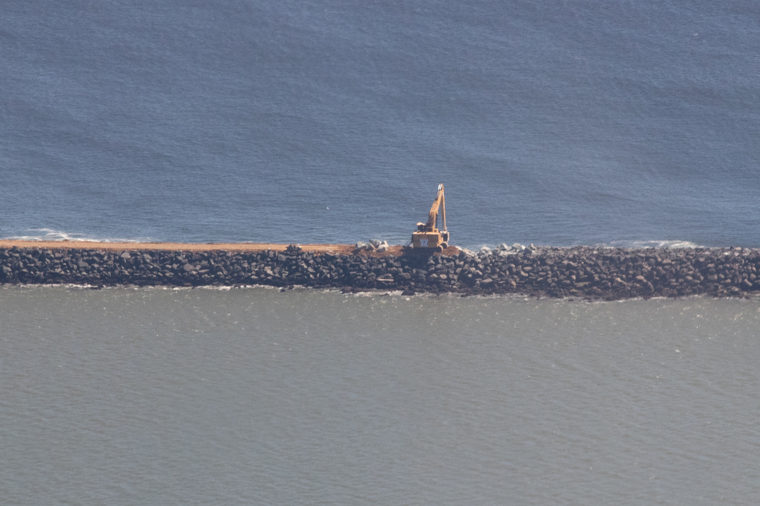
Stone Arms Against the Current
For most of the 19th century, the bar was essentially unmanaged -- a natural hazard that ships either survived or did not. After decades of wrecks, the U.S. Army Corps of Engineers built the south jetty in 1884 to stabilize the channel and keep it navigable. The north jetty followed in 1914. A third jetty was later added, and all three were repaired between 2016 and 2025, a project that underscored both their importance and the relentless power of the water they are trying to control. The jetties channel the river's flow and prevent the sandbars from shifting as freely as they once did, but they cannot eliminate the fundamental physics of the place. Ocean swells still march in from the North Pacific. The river still pushes back. During winter storms, the waves at the bar entrance reach 20 to 30 feet -- and when those waves break over a shallow bar with a six-knot current running against them, the result is water moving in every direction at once.
The Pilots Who Board by Helicopter
Approximately 16 Columbia River Bar Pilots, based in Astoria, Oregon, guide ships across the bar. They earn roughly $180,000 per year for work that requires boarding inbound vessels -- often by helicopter -- and taking the helm through the most dangerous stretch of the transit. The pilots consider "the bar" to be the area between the north and south jetties and Sand Island, a confined corridor where the margin for error shrinks with every passing swell. These are not casual mariners. Bar pilots undergo years of specialized training, learning to read the water's mood from the color of the swells, the interval between wave sets, and the direction of the wind. They know that a bar crossing safe at slack tide can become suicidal forty minutes later when the ebb strengthens. They board ships in conditions that would keep most vessels in port, because the ships waiting offshore have schedules, and the river has cargo to move.
A Graveyard with Sentinels
The Graveyard of the Pacific extends well beyond the Columbia Bar. The name encompasses the rocky, fog-bound coast from Tillamook Bay in Oregon north to the Strait of Juan de Fuca, including Cape Flattery at the tip of the Olympic Peninsula and the west coast of Vancouver Island. Thousands of shipwrecks lie scattered along this stretch. But the Columbia Bar remains the graveyard's most concentrated killing ground, the place where the most ships were lost in the smallest area. Standing watch over it is Coast Guard Station Cape Disappointment, home to the National Motor Lifeboat School -- the only school for rough-weather and surf rescue operations in the United States. From the South Jetty viewing platform at Fort Stevens State Park near Warrenton, Oregon, visitors can watch container ships navigate the channel, their decks barely visible above the swells. On a calm day it looks manageable. Five minutes later, it may not be.
From the Air
The Columbia Bar is located at approximately 46.250N, 124.033W at the mouth of the Columbia River, straddling the Oregon-Washington border. From the air, the bar is dramatically visible: the brown, sediment-laden river water meets the blue-gray Pacific in a distinct line of turbulence and breaking surf. The north and south jetties are clearly visible as stone arms extending into the ocean, with the navigational channel between them. Sand Island sits inside the bar between the jetties. Cape Disappointment and its lighthouse are visible on the Washington (north) side; Fort Stevens State Park and the South Jetty viewing platform on the Oregon (south) side. Astoria, Oregon and the Astoria-Megler Bridge are visible upriver. Nearest airports: Astoria Regional Airport (KAST) approximately 8nm southeast, Seaside Airport (not public use). Best viewed at 2,000-4,000 feet to see the full bar, jetties, and turbulence patterns. Conditions change rapidly -- expect variable weather and occasional low visibility.